The right side delivers a more consistent scenic arc across the whole flight: dramatic Front Range peaks at departure, desert mountain ranges of northern Mexico during cruise, and open basin terrain on arrival, edging out the left side which is strong mainly during the final approach.
Flown DEN to MEX? Did we get it right?
Flight Path
Denver to Mexico City is 1,450 miles (2,333 km), a flight of about 3 hours 55 minutes.
Southern Rocky Mountains and San Luis Valley in Colorado, high desert plateaus of New Mexico and Chihuahua, and the northern ranges of the Sierra Madre Oriental as the route heads toward the Mexican Altiplano
Great circle distance and headings ›


Phase by phase

Takeoff from DEN
RIGHTSouthbound departures from DEN swing over the Front Range foothills, and the right side offers a clear view of the Rocky Mountains rising abruptly from the plains as the plane climbs out.
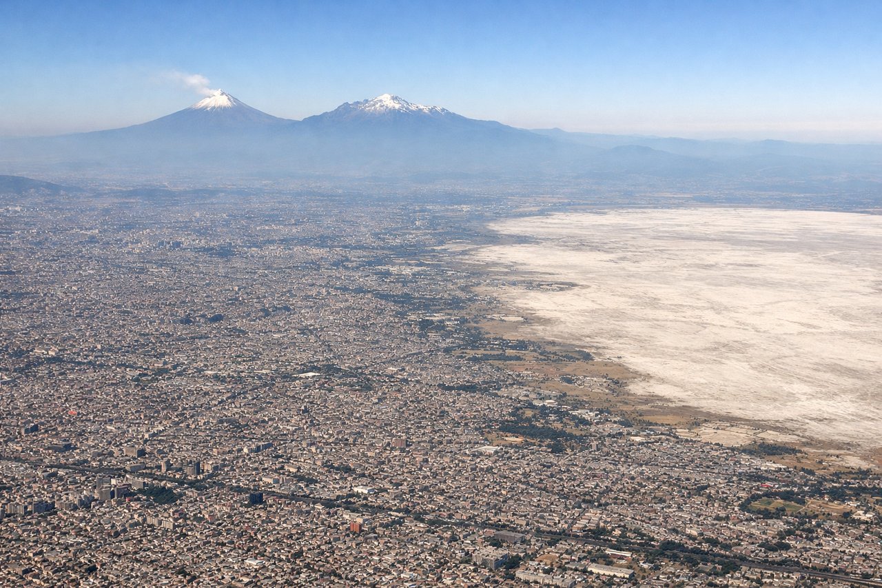
Landing at MEX
LEFTOn approach into MEX from the north, the aircraft typically banks to align with the runway, putting the snow-capped volcanoes Popocatepetl and Iztaccihuatl southeast of the city into view on the left side as the plane descends over the basin.
Will your flight be in sunlight?
Pick a date and time in the Sun Map to watch the sun move across your whole flight.
About This Route
Which side of the plane should I sit on flying from Denver International (DEN) to Licenciado Benito Juarez International (MEX)?
Sit on the Right side of the plane for the best views on flights from Denver to Mexico City. The right side delivers a more consistent scenic arc across the whole flight: dramatic Front Range peaks at departure, desert mountain ranges of northern Mexico during cruise, and open basin terrain on arrival, edging out the left side which is strong mainly during the final approach.
What can I see during takeoff from Denver International in Denver?
During takeoff from Denver International (DEN), sit on the Right side for the best views. Southbound departures from DEN swing over the Front Range foothills, and the right side offers a clear view of the Rocky Mountains rising abruptly from the plains as the plane climbs out. Notable sights include: Front Range foothills, Pikes Peak area, South Platte River valley.
What can I see when landing at Licenciado Benito Juarez International in Mexico City?
When landing at Licenciado Benito Juarez International (MEX), sit on the Left side for the best views. On approach into MEX from the north, the aircraft typically banks to align with the runway, putting the snow-capped volcanoes Popocatepetl and Iztaccihuatl southeast of the city into view on the left side as the plane descends over the basin. Notable sights include: Popocatepetl volcano, Iztaccihuatl volcano, Mexico City basin sprawl, Sierra Madre foothills.
How long is the flight from Denver to Mexico City?
The flight from Denver International (DEN) to Licenciado Benito Juarez International (MEX) takes about 3 hours 55 minutes. The shortest flight path between them is 1,450 miles (2,333 km); winds and air traffic control usually add a few percent.
What does the Denver to Mexico City flight path pass over?
Southern Rocky Mountains and San Luis Valley in Colorado, high desert plateaus of New Mexico and Chihuahua, and the northern ranges of the Sierra Madre Oriental as the route heads toward the Mexican Altiplano