While the right side wins at takeoff for the Nevado de Toluca view, the left side delivers the more sustained and dramatic scenery overall. Once the flight crosses into the US Southwest, the left side tracks the western edge of the route and picks up the Rio Grande valley, the Sangre de Cristo Mountains of New Mexico and southern Colorado, and then the full Front Range approach into Denver. The left-side Front Range panorama on descent alone makes it the better seat for the whole journey.
Flown MEX to DEN? Did we get it right?
Flight Path
Mexico City to Denver is 1,450 miles (2,333 km), a flight of about 4 hours.
The route crosses the Mexican Plateau and the Chihuahuan Desert in northern Mexico, then the Rio Grande near El Paso/Ciudad Juárez, the New Mexico basin and range terrain, the Sangre de Cristo Mountains running through northern New Mexico and southern Colorado, the San Luis Valley (a large flat high-altitude basin), and the Spanish Peaks before the Front Range descent into Denver. The terrain transitions dramatically from high desert scrubland to alpine mountain terrain in the final hour of flight.
Great circle distance and headings ›

Phase by phase
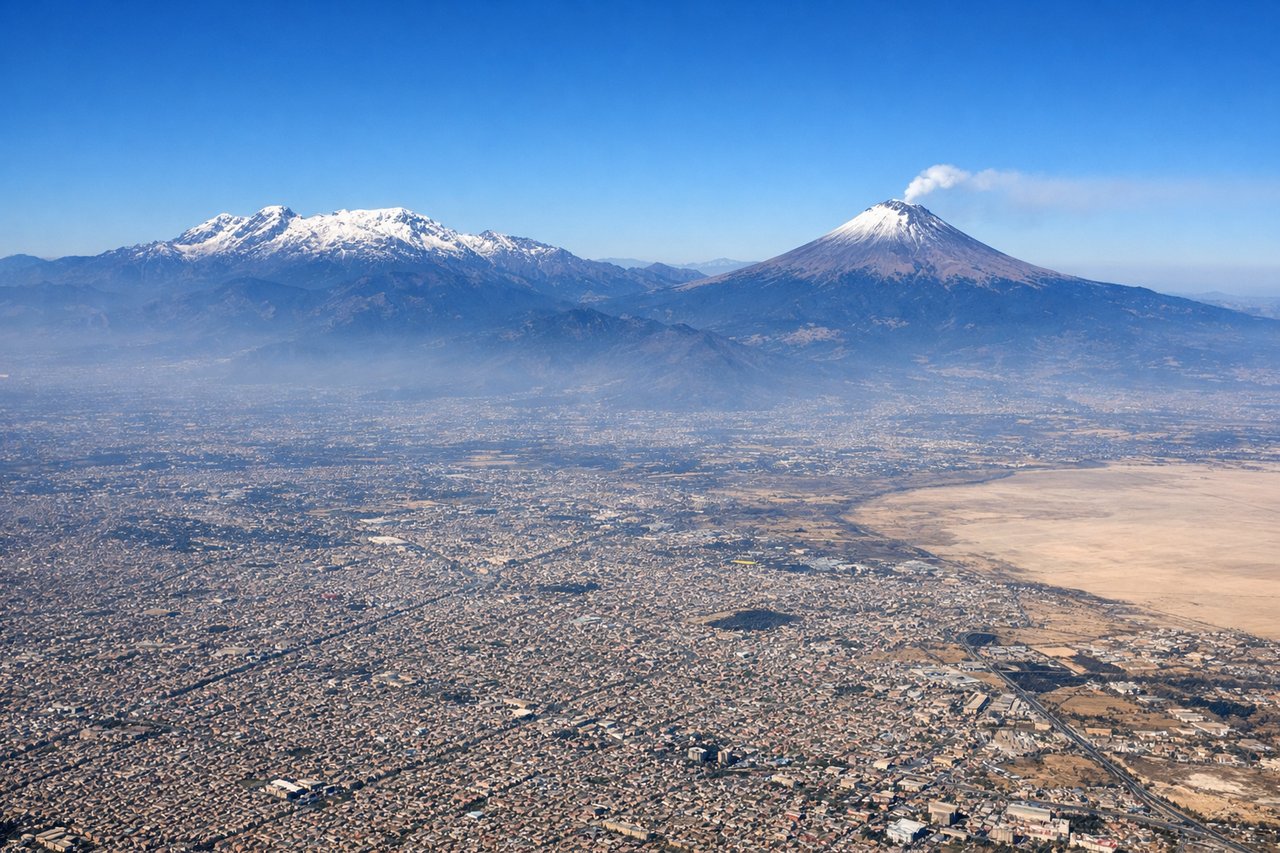
Takeoff from MEX
RIGHTMEX typically departs northward on runway 05R/23L or uses the east-west runways. On a northbound departure toward DEN, the right side gives you a clear view west toward the Sierra Nevada de Toluca volcano (Nevado de Toluca) and the broader Valle de México basin. The left side faces east toward the urban sprawl and Popocatépetl/Iztaccíhuatl, but the right side captures the dramatic western volcanic ridge more cleanly on climb-out.
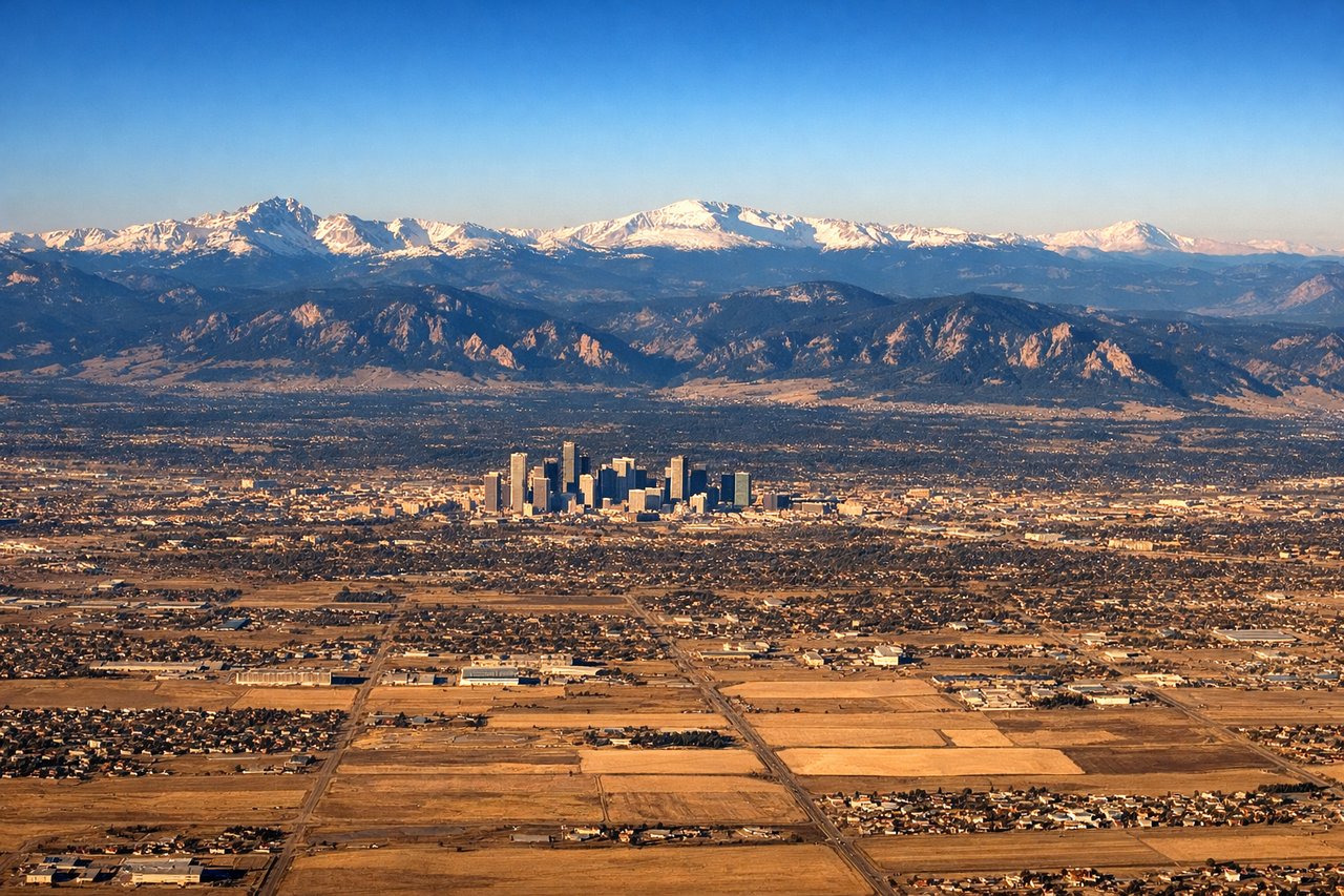
Landing at DEN
LEFTDenver International sits on the plains east of the Rockies, and aircraft typically approach from the south or southeast on runways oriented north-south. On approach from the south, the left (west-facing) side gives a prolonged and spectacular view of the entire Front Range of the Rocky Mountains — from Pikes Peak in the south to Longs Peak in the north — running parallel to the flight path for the final 100+ miles of descent.
Will your flight be in sunlight?
Pick a date and time in the Sun Map to watch the sun move across your whole flight.
About This Route
Which side of the plane should I sit on flying from Licenciado Benito Juarez International (MEX) to Denver International (DEN)?
Sit on the Left side of the plane for the best views on flights from Mexico City to Denver. While the right side wins at takeoff for the Nevado de Toluca view, the left side delivers the more sustained and dramatic scenery overall. Once the flight crosses into the US Southwest, the left side tracks the western edge of the route and picks up the Rio Grande valley, the Sangre de Cristo Mountains of New Mexico and southern Colorado, and then the full Front Range approach into Denver. The left-side Front Range panorama on descent alone makes it the better seat for the whole journey.
What can I see during takeoff from Licenciado Benito Juarez International in Mexico City?
During takeoff from Licenciado Benito Juarez International (MEX), sit on the Right side for the best views. MEX typically departs northward on runway 05R/23L or uses the east-west runways. On a northbound departure toward DEN, the right side gives you a clear view west toward the Sierra Nevada de Toluca volcano (Nevado de Toluca) and the broader Valle de México basin. The left side faces east toward the urban sprawl and Popocatépetl/Iztaccíhuatl, but the right side captures the dramatic western volcanic ridge more cleanly on climb-out. Notable sights include: Nevado de Toluca (4,680m extinct volcano to the west), Valle de México urban basin spread below, Sierra de las Cruces ridge line, Lake Texcoco remnant flats to the northeast.
What can I see when landing at Denver International in Denver?
When landing at Denver International (DEN), sit on the Left side for the best views. Denver International sits on the plains east of the Rockies, and aircraft typically approach from the south or southeast on runways oriented north-south. On approach from the south, the left (west-facing) side gives a prolonged and spectacular view of the entire Front Range of the Rocky Mountains — from Pikes Peak in the south to Longs Peak in the north — running parallel to the flight path for the final 100+ miles of descent. Notable sights include: Front Range Rocky Mountains (Pikes Peak, Mount Evans, Longs Peak), Denver city grid on the plains, Rocky Mountain foothills and hogback ridges, South Platte River corridor.
How long is the flight from Mexico City to Denver?
The flight from Licenciado Benito Juarez International (MEX) to Denver International (DEN) takes about 4 hours. The shortest flight path between them is 1,450 miles (2,333 km); winds and air traffic control usually add a few percent.
What does the Mexico City to Denver flight path pass over?
The route crosses the Mexican Plateau and the Chihuahuan Desert in northern Mexico, then the Rio Grande near El Paso/Ciudad Juárez, the New Mexico basin and range terrain, the Sangre de Cristo Mountains running through northern New Mexico and southern Colorado, the San Luis Valley (a large flat high-altitude basin), and the Spanish Peaks before the Front Range descent into Denver. The terrain transitions dramatically from high desert scrubland to alpine mountain terrain in the final hour of flight.