Detroit to London is 3,734 miles (6,009 km), a flight of about 7 hours 45 minutes.
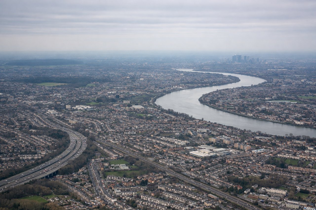
While takeoff on the right offers Great Lakes scenery, the landing approach on the left provides more dramatic and iconic views of the Thames River's meanders and London's urban landscape. The left side captures the most visually distinctive part of this transatlantic route.
Flight Path
Over the Atlantic, you'll cross the Grand Banks area southeast of Newfoundland (visible as a lighter water zone if conditions allow), then pass over open ocean with occasional cloud formations. The flight path takes you over the southern tip of Greenland's ice sheet (visible as white terrain if clear), then over the North Atlantic. As you approach Europe, you'll see the Irish coastline and Irish Sea, followed by Wales and the Welsh coast, before turning southeast toward London. The Pennines and Midlands are visible during the descent approach over central England.
Great circle distance and headings ›
.jpeg?width=600)
Phase by phase
Takeoff from DET
RIGHTRight side offers views of the Detroit River and Lake St. Clair as the aircraft climbs northeast over Michigan. You'll see the water features and the broader Great Lakes region spreading out beneath you.
Landing at LHR
LEFTLeft side provides views of the Thames River, London's urban sprawl, and the approach path over southern England. You'll see the distinctive meanders of the Thames and central London's landmarks as you descend toward Heathrow.
Landmarks on this routeAll landmarks →
Will your flight be in sunlight?
Pick a date and time in the Sun Map to watch the sun move across your whole flight.
About This Route
Which side of the plane should I sit on flying from Detroit City (DET) to Heathrow (LHR)?
Sit on the Left side of the plane for the best views on flights from Detroit to London. While takeoff on the right offers Great Lakes scenery, the landing approach on the left provides more dramatic and iconic views of the Thames River's meanders and London's urban landscape. The left side captures the most visually distinctive part of this transatlantic route.
What can I see during takeoff from Detroit City in Detroit?
During takeoff from Detroit City (DET), sit on the Right side for the best views. Right side offers views of the Detroit River and Lake St. Clair as the aircraft climbs northeast over Michigan. You'll see the water features and the broader Great Lakes region spreading out beneath you. Notable sights include: Detroit River, Lake St. Clair, Lake Huron (distant), Michigan shoreline.
What can I see when landing at Heathrow in London?
When landing at Heathrow (LHR), sit on the Left side for the best views. Left side provides views of the Thames River, London's urban sprawl, and the approach path over southern England. You'll see the distinctive meanders of the Thames and central London's landmarks as you descend toward Heathrow. Notable sights include: Thames River (multiple meanders), London urban area, Heathrow Airport runways, Windsor Castle area.
How long is the flight from Detroit to London?
The flight from Detroit City (DET) to Heathrow (LHR) takes about 7 hours 45 minutes. The shortest flight path between them is 3,734 miles (6,009 km); winds and air traffic control usually add a few percent.
What does the Detroit to London flight path pass over?
Over the Atlantic, you'll cross the Grand Banks area southeast of Newfoundland (visible as a lighter water zone if conditions allow), then pass over open ocean with occasional cloud formations. The flight path takes you over the southern tip of Greenland's ice sheet (visible as white terrain if clear), then over the North Atlantic. As you approach Europe, you'll see the Irish coastline and Irish Sea, followed by Wales and the Welsh coast, before turning southeast toward London. The Pennines and Midlands are visible during the descent approach over central England.