Dallas-Fort Worth to Del Bajio is 867 miles (1,395 km), a flight of about 2 hours 50 minutes.
The right side wins for the combination of the Fort Worth skyline at takeoff and the mountainous, visually varied terrain of the Guanajuato highlands on approach, while the left side stays flatter and less distinctive for most of the flight.
Flight Path
Chihuahuan Desert scrublands, the Rio Grande border crossing near Nuevo Laredo, and the northern reaches of the Mexican Altiplano and Sierra Madre Oriental foothills
Great circle distance and headings ›Phase by phase
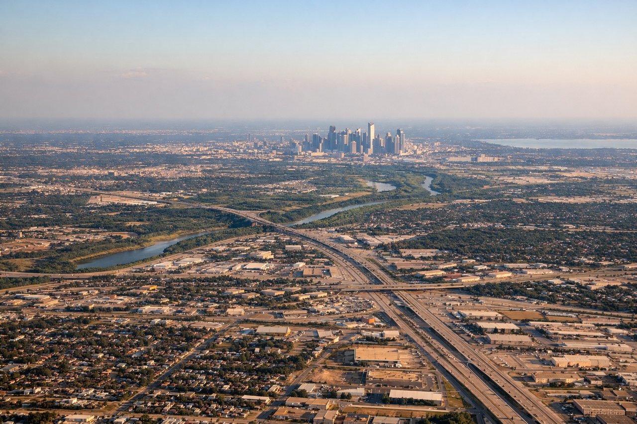
Takeoff from DFW
RIGHTDeparting DFW on the southbound runways, the right side offers a clear view of the Fort Worth skyline and the patchwork of North Texas suburbs before the plane climbs over open plains. The left side mostly shows flat farmland and Dallas's more distant skyline.
Landing at BJX
RIGHTOn approach into BJX, the surrounding Sierra de Guanajuato hills and volcanic highlands are visible to the right, with the historic mining town of Guanajuato tucked into the valleys below. The left side shows mostly the flatter agricultural Bajío plain with less topographic interest.
Will your flight be in sunlight?
Pick a date and time in the Sun Map to watch the sun move across your whole flight.
About This Route
Which side of the plane should I sit on flying from Dallas Fort Worth International (DFW) to De Guanajuato International (BJX)?
Sit on the Right side of the plane for the best views on flights from Dallas-Fort Worth to Del Bajio. The right side wins for the combination of the Fort Worth skyline at takeoff and the mountainous, visually varied terrain of the Guanajuato highlands on approach, while the left side stays flatter and less distinctive for most of the flight.
What can I see during takeoff from Dallas Fort Worth International in Dallas-Fort Worth?
During takeoff from Dallas Fort Worth International (DFW), sit on the Right side for the best views. Departing DFW on the southbound runways, the right side offers a clear view of the Fort Worth skyline and the patchwork of North Texas suburbs before the plane climbs over open plains. The left side mostly shows flat farmland and Dallas's more distant skyline. Notable sights include: Fort Worth downtown skyline, Trinity River bends, North Texas suburban grid.
What can I see when landing at De Guanajuato International in Del Bajio?
When landing at De Guanajuato International (BJX), sit on the Right side for the best views. On approach into BJX, the surrounding Sierra de Guanajuato hills and volcanic highlands are visible to the right, with the historic mining town of Guanajuato tucked into the valleys below. The left side shows mostly the flatter agricultural Bajío plain with less topographic interest. Notable sights include: Sierra de Guanajuato foothills, Bajío highland plateau, terraced agricultural valleys.
How long is the flight from Dallas-Fort Worth to Del Bajio?
The flight from Dallas Fort Worth International (DFW) to De Guanajuato International (BJX) takes about 2 hours 50 minutes. The shortest flight path between them is 867 miles (1,395 km); winds and air traffic control usually add a few percent.
What does the Dallas-Fort Worth to Del Bajio flight path pass over?
Chihuahuan Desert scrublands, the Rio Grande border crossing near Nuevo Laredo, and the northern reaches of the Mexican Altiplano and Sierra Madre Oriental foothills