The left side captures the dramatic Dallas skyline on departure and tracks the eastern side of the flight path southward. While the right side wins on landing for JSC and Galveston Bay, the left side delivers the stronger overall experience with the Dallas urban panorama at takeoff and reasonable views of the Brazos River corridor and Houston's eastern suburbs during descent.
Flown DFW to EFD? Did we get it right?
Flight Path
Dallas-Fort Worth to Houston is 253 miles (407 km), a flight of about 50 minutes.
The flight tracks roughly southeast from DFW toward Houston, crossing the Blackland Prairie and Post Oak Savanna ecological zones. The Brazos River is the most visually distinctive feature at mid-flight, a wide meandering river crossing the agricultural plains of central Texas. The Trinity River is visible early in the flight south of Dallas. The terrain is uniformly flat throughout, transitioning from dry prairie to the wetter, greener coastal plain as you approach Houston. Small towns like Corsicana and Huntsville may be visible below.
Great circle distance and headings ›Phase by phase
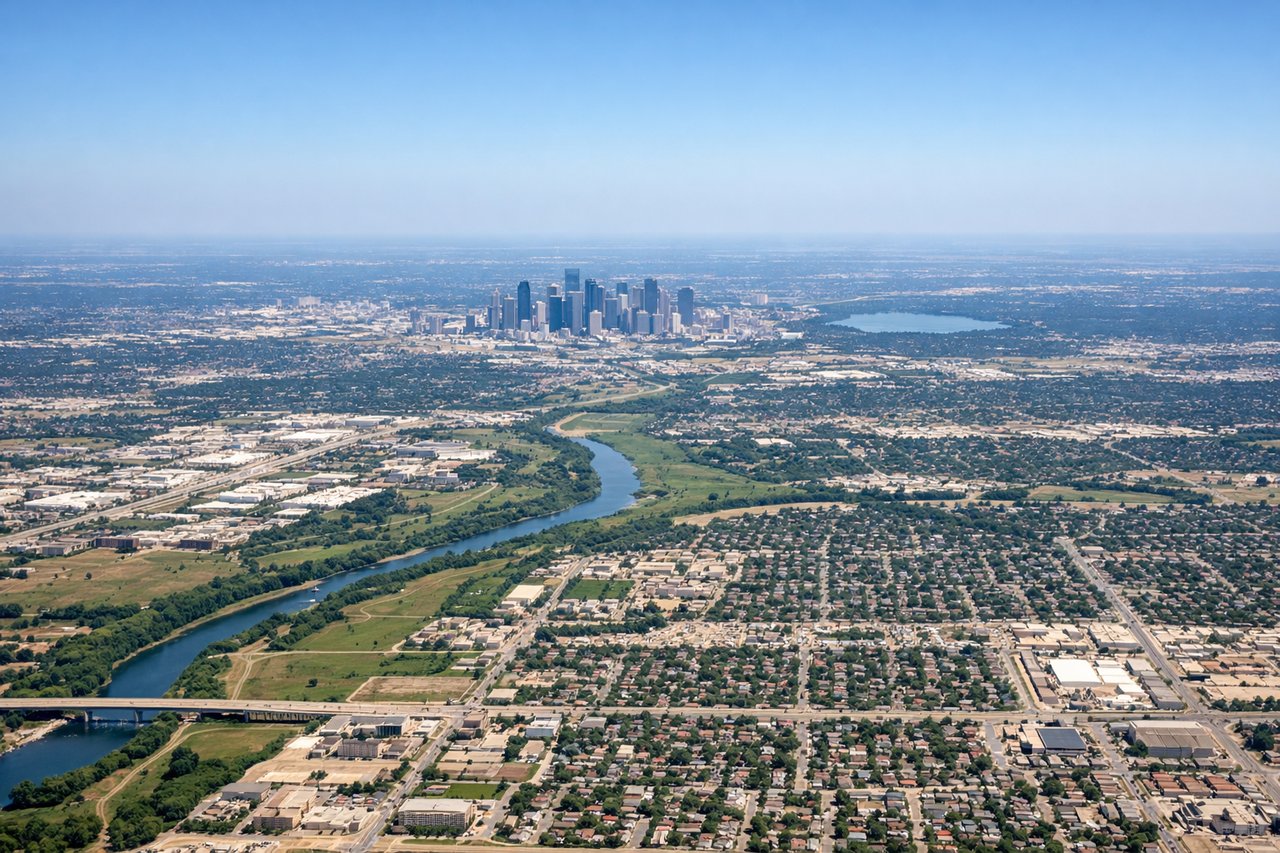
Takeoff from DFW
LEFTDFW's primary south-facing departures on runways 17L/17R/18L/18R put the left (east) side facing downtown Dallas and the urban core. You get a clear view of the Dallas skyline, White Rock Lake, and the sprawling DFW metroplex grid as you climb out heading south.
Landing at EFD
RIGHTEllington Field sits on the southeast side of Houston, and approaches typically come in from the north or northwest. The right (west) side gives you a view over central Houston, the Ship Channel industrial complex, and Clear Lake where NASA's Johnson Space Center is located — JSC is essentially adjacent to the airport.
Will your flight be in sunlight?
Pick a date and time in the Sun Map to watch the sun move across your whole flight.
About This Route
Which side of the plane should I sit on flying from Dallas Fort Worth International (DFW) to Ellington Fld (EFD)?
Sit on the Left side of the plane for the best views on flights from Dallas-Fort Worth to Houston. The left side captures the dramatic Dallas skyline on departure and tracks the eastern side of the flight path southward. While the right side wins on landing for JSC and Galveston Bay, the left side delivers the stronger overall experience with the Dallas urban panorama at takeoff and reasonable views of the Brazos River corridor and Houston's eastern suburbs during descent.
What can I see during takeoff from Dallas Fort Worth International in Dallas-Fort Worth?
During takeoff from Dallas Fort Worth International (DFW), sit on the Left side for the best views. DFW's primary south-facing departures on runways 17L/17R/18L/18R put the left (east) side facing downtown Dallas and the urban core. You get a clear view of the Dallas skyline, White Rock Lake, and the sprawling DFW metroplex grid as you climb out heading south. Notable sights include: Downtown Dallas skyline, White Rock Lake, Trinity River corridor, Texas Stadium area (Arlington).
What can I see when landing at Ellington Fld in Houston?
When landing at Ellington Fld (EFD), sit on the Right side for the best views. Ellington Field sits on the southeast side of Houston, and approaches typically come in from the north or northwest. The right (west) side gives you a view over central Houston, the Ship Channel industrial complex, and Clear Lake where NASA's Johnson Space Center is located — JSC is essentially adjacent to the airport. Notable sights include: Houston Ship Channel and refineries, Johnson Space Center campus at Clear Lake, Galveston Bay, downtown Houston skyline.
How long is the flight from Dallas-Fort Worth to Houston?
The flight from Dallas Fort Worth International (DFW) to Ellington Fld (EFD) takes about 50 minutes. The shortest flight path between them is 253 miles (407 km); winds and air traffic control usually add a few percent.
What does the Dallas-Fort Worth to Houston flight path pass over?
The flight tracks roughly southeast from DFW toward Houston, crossing the Blackland Prairie and Post Oak Savanna ecological zones. The Brazos River is the most visually distinctive feature at mid-flight, a wide meandering river crossing the agricultural plains of central Texas. The Trinity River is visible early in the flight south of Dallas. The terrain is uniformly flat throughout, transitioning from dry prairie to the wetter, greener coastal plain as you approach Houston. Small towns like Corsicana and Huntsville may be visible below.