Dallas-Fort Worth to Lawton is 140 miles (225 km), a flight of about 50 minutes.
While takeoff offers decent urban views, the landing approach into Lawton provides the more distinctive scenic payoff—the Wichita Mountains are a genuine visual highlight that rises above the surrounding plains and is clearly visible during descent. Left-side seats capture this better.
Flight Path
The flight path northwest from DFW crosses the Red River (Oklahoma border), then transitions through the Arbuckle Mountains region and across the Anadarko Basin prairie. The Arbuckles appear as low, rounded ridges in the middle distance around the 20-minute mark. The landscape gradually becomes more open grassland as you approach Lawton from the southeast.
Great circle distance and headings ›Phase by phase
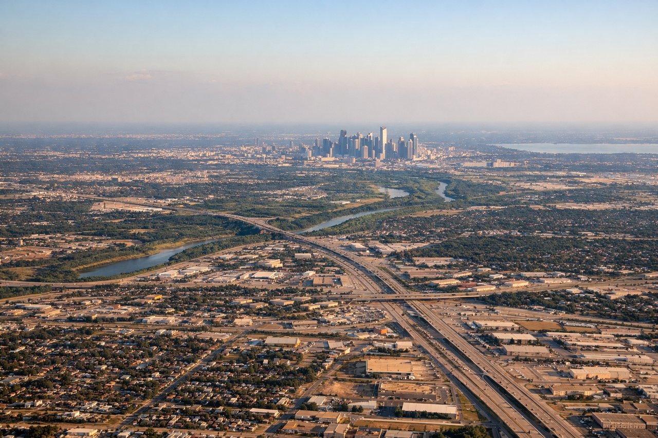
Takeoff from DFW
RIGHTRight-side seats offer views of the Trinity River valley and the Dallas-Fort Worth urban sprawl as you climb northwest. You'll see the geometric grid of the metropolis fade into prairie, with good sightlines toward the Red River basin.
Landing at LAW
LEFTLeft-side seats provide excellent views during descent into Lawton. You'll see the Wichita Mountains rising distinctly from the plains, and the approach path gives clear sightlines of Fort Sill's installation and the surrounding grassland topography.
Will your flight be in sunlight?
Pick a date and time in the Sun Map to watch the sun move across your whole flight.
About This Route
Which side of the plane should I sit on flying from Dallas Fort Worth International (DFW) to Lawton Fort Sill Regional Airport (LAW)?
Sit on the Left side of the plane for the best views on flights from Dallas-Fort Worth to Lawton. While takeoff offers decent urban views, the landing approach into Lawton provides the more distinctive scenic payoff—the Wichita Mountains are a genuine visual highlight that rises above the surrounding plains and is clearly visible during descent. Left-side seats capture this better.
What can I see during takeoff from Dallas Fort Worth International in Dallas-Fort Worth?
During takeoff from Dallas Fort Worth International (DFW), sit on the Right side for the best views. Right-side seats offer views of the Trinity River valley and the Dallas-Fort Worth urban sprawl as you climb northwest. You'll see the geometric grid of the metropolis fade into prairie, with good sightlines toward the Red River basin. Notable sights include: Trinity River valley, Dallas-Fort Worth urban grid, Lake Texoma (northern horizon), Red River floodplain.
What can I see when landing at Lawton Fort Sill Regional Airport in Lawton?
When landing at Lawton Fort Sill Regional Airport (LAW), sit on the Left side for the best views. Left-side seats provide excellent views during descent into Lawton. You'll see the Wichita Mountains rising distinctly from the plains, and the approach path gives clear sightlines of Fort Sill's installation and the surrounding grassland topography. Notable sights include: Wichita Mountains, Fort Sill military installation, Medicine Creek valley, Lawton city grid.
How long is the flight from Dallas-Fort Worth to Lawton?
The flight from Dallas Fort Worth International (DFW) to Lawton Fort Sill Regional Airport (LAW) takes about 50 minutes. The shortest flight path between them is 140 miles (225 km); winds and air traffic control usually add a few percent.
What does the Dallas-Fort Worth to Lawton flight path pass over?
The flight path northwest from DFW crosses the Red River (Oklahoma border), then transitions through the Arbuckle Mountains region and across the Anadarko Basin prairie. The Arbuckles appear as low, rounded ridges in the middle distance around the 20-minute mark. The landscape gradually becomes more open grassland as you approach Lawton from the southeast.