The left side misses the best of the DFW departure but wins decisively on arrival with the dramatic San Gabriel Mountains and Mount Baldy approach. Across the mid-flight, the left side also tracks slightly better over the Llano Estacado escarpment in west Texas and the Sacramento Mountains in New Mexico. The mountain arrival into ONT on the left is the single most visually striking moment of the flight.
Flown DFW to ONT? Did we get it right?
Flight Path
Dallas-Fort Worth to Ontario is 1,186 miles (1,908 km), a flight of about 2 hours 55 minutes.
West Texas Llano Estacado high plains and Caprock Escarpment, Guadalupe Mountains near the Texas-New Mexico border (including Guadalupe Peak at 8,749 ft), the Sacramento Mountains and Mescalero Ridge in south-central New Mexico, White Sands basin visible as a bright white patch in the Tularosa Basin, then the Mogollon Rim plateau in eastern Arizona, and the Mojave Desert transition into the San Bernardino Valley approaching Ontario
Great circle distance and headings ›

Phase by phase
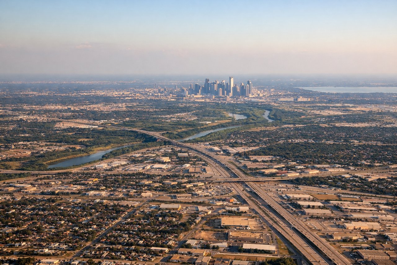
Takeoff from DFW
RIGHTDFW departures heading west on runway 17R/35L or westbound departures give the right side a clear view over the Dallas-Fort Worth metroplex sprawl, including downtown Dallas skyline to the northeast and Fort Worth to the west. The right side tracks over the suburban grid and Lake Worth as the aircraft climbs out westbound.
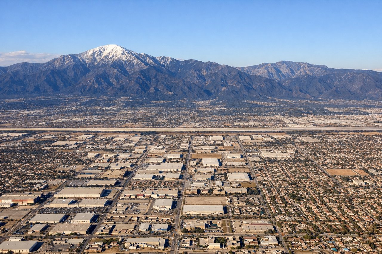
Landing at ONT
LEFTArriving into ONT from the east, aircraft typically approach from the east or southeast on runway 26L/26R heading westbound. The left side faces south and picks up the San Gabriel Mountains and Mount San Antonio (Mount Baldy) looming directly to the north, while the right side looks toward the less dramatic Chino Hills. Left side also gets the Inland Empire urban basin spread out below.
Will your flight be in sunlight?
Pick a date and time in the Sun Map to watch the sun move across your whole flight.
About This Route
Which side of the plane should I sit on flying from Dallas Fort Worth International (DFW) to Ontario International (ONT)?
Sit on the Left side of the plane for the best views on flights from Dallas-Fort Worth to Ontario. The left side misses the best of the DFW departure but wins decisively on arrival with the dramatic San Gabriel Mountains and Mount Baldy approach. Across the mid-flight, the left side also tracks slightly better over the Llano Estacado escarpment in west Texas and the Sacramento Mountains in New Mexico. The mountain arrival into ONT on the left is the single most visually striking moment of the flight.
What can I see during takeoff from Dallas Fort Worth International in Dallas-Fort Worth?
During takeoff from Dallas Fort Worth International (DFW), sit on the Right side for the best views. DFW departures heading west on runway 17R/35L or westbound departures give the right side a clear view over the Dallas-Fort Worth metroplex sprawl, including downtown Dallas skyline to the northeast and Fort Worth to the west. The right side tracks over the suburban grid and Lake Worth as the aircraft climbs out westbound. Notable sights include: Downtown Fort Worth skyline, Lake Worth, Dallas-Fort Worth suburban grid, Eagle Mountain Lake.
What can I see when landing at Ontario International in Ontario?
When landing at Ontario International (ONT), sit on the Left side for the best views. Arriving into ONT from the east, aircraft typically approach from the east or southeast on runway 26L/26R heading westbound. The left side faces south and picks up the San Gabriel Mountains and Mount San Antonio (Mount Baldy) looming directly to the north, while the right side looks toward the less dramatic Chino Hills. Left side also gets the Inland Empire urban basin spread out below. Notable sights include: Mount San Antonio (Mount Baldy), San Gabriel Mountains, Inland Empire urban basin, San Bernardino Valley.
How long is the flight from Dallas-Fort Worth to Ontario?
The flight from Dallas Fort Worth International (DFW) to Ontario International (ONT) takes about 2 hours 55 minutes. The shortest flight path between them is 1,186 miles (1,908 km); winds and air traffic control usually add a few percent.
What does the Dallas-Fort Worth to Ontario flight path pass over?
West Texas Llano Estacado high plains and Caprock Escarpment, Guadalupe Mountains near the Texas-New Mexico border (including Guadalupe Peak at 8,749 ft), the Sacramento Mountains and Mescalero Ridge in south-central New Mexico, White Sands basin visible as a bright white patch in the Tularosa Basin, then the Mogollon Rim plateau in eastern Arizona, and the Mojave Desert transition into the San Bernardino Valley approaching Ontario