The right side captures the more interesting portions of this route: the Bahamian shallows and islands during cruise, and the dramatic harbor turn into St Thomas on landing, while the left side spends most of the flight over featureless open Gulf and Atlantic water.
Flown DFW to STT? Did we get it right?
Flight Path
Dallas-Fort Worth to St. Thomas is 2,224 miles (3,579 km), a flight of about 4 hours 10 minutes.
Gulf of Mexico open water, Straits of Florida, Bahamas archipelago (Andros and the Exumas), open Caribbean Sea approaching the Virgin Islands
Great circle distance and headings ›Phase by phase
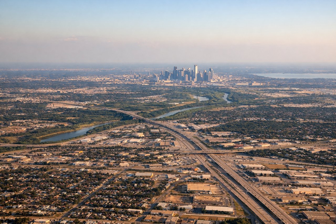
Takeoff from DFW
RIGHTDeparting DFW on the south-flowing runways, the aircraft typically banks left onto its southeast heading toward the Gulf, putting the Dallas-Fort Worth metro sprawl and its lakes (Ray Hubbard, Lavon) briefly on the right before the flat North Texas plains take over. It's not dramatic, but it's marginally more interesting than the featureless farmland on the left.
Landing at STT
RIGHTThe classic St Thomas approach curves the aircraft over Charlotte Amalie harbor before lining up on Runway 10, and this turn typically puts the harbor, Water Island, and the green hills of St Thomas on the right side of the cabin. It's one of the most dramatic short-runway island approaches in the Caribbean.
Will your flight be in sunlight?
Pick a date and time in the Sun Map to watch the sun move across your whole flight.
About This Route
Which side of the plane should I sit on flying from Dallas Fort Worth International (DFW) to Cyril E King (STT)?
Sit on the Right side of the plane for the best views on flights from Dallas-Fort Worth to St. Thomas. The right side captures the more interesting portions of this route: the Bahamian shallows and islands during cruise, and the dramatic harbor turn into St Thomas on landing, while the left side spends most of the flight over featureless open Gulf and Atlantic water.
What can I see during takeoff from Dallas Fort Worth International in Dallas-Fort Worth?
During takeoff from Dallas Fort Worth International (DFW), sit on the Right side for the best views. Departing DFW on the south-flowing runways, the aircraft typically banks left onto its southeast heading toward the Gulf, putting the Dallas-Fort Worth metro sprawl and its lakes (Ray Hubbard, Lavon) briefly on the right before the flat North Texas plains take over. It's not dramatic, but it's marginally more interesting than the featureless farmland on the left. Notable sights include: Dallas-Fort Worth skyline, Lake Ray Hubbard, flat North Texas farmland grid.
What can I see when landing at Cyril E King in St. Thomas?
When landing at Cyril E King (STT), sit on the Right side for the best views. The classic St Thomas approach curves the aircraft over Charlotte Amalie harbor before lining up on Runway 10, and this turn typically puts the harbor, Water Island, and the green hills of St Thomas on the right side of the cabin. It's one of the most dramatic short-runway island approaches in the Caribbean. Notable sights include: Charlotte Amalie harbor, Water Island, St Thomas hillsides, turquoise Caribbean shallows.
How long is the flight from Dallas-Fort Worth to St. Thomas?
The flight from Dallas Fort Worth International (DFW) to Cyril E King (STT) takes about 4 hours 10 minutes. The shortest flight path between them is 2,224 miles (3,579 km); winds and air traffic control usually add a few percent.
What does the Dallas-Fort Worth to St. Thomas flight path pass over?
Gulf of Mexico open water, Straits of Florida, Bahamas archipelago (Andros and the Exumas), open Caribbean Sea approaching the Virgin Islands