The right side captures the dramatic Dallas-Fort Worth urban departure and then tracks the southern view across East Texas pine forests and into Louisiana and Mississippi terrain. While the left side wins at landing for the bay views, the right side provides more sustained visual interest across the full flight, particularly during the climb-out phase which is the most visually engaging portion of this relatively short route.
Flown DFW to VPS? Did we get it right?
Flight Path
Dallas-Fort Worth to Valparaiso is 640 miles (1,031 km), a flight of about 1 hour 20 minutes.
The flight crosses East Texas pine and hardwood forests, the Sabine River marking the Texas-Louisiana border, the Red River bottomlands, then transitions over the longleaf pine flatlands of southern Mississippi and Alabama. The terrain is consistently flat with scattered lakes and river systems. No significant elevation changes throughout. The route passes north of the Gulf Coast, so open water is not visible until the final descent into VPS.
Great circle distance and headings ›Phase by phase
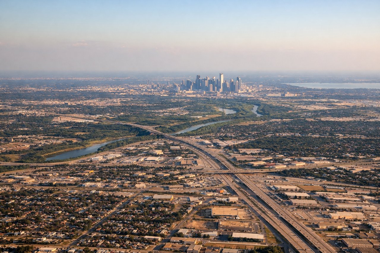
Takeoff from DFW
RIGHTDFW typically departs east or southeast on runways 17R/18R/17L, so the right side gives you a clear view south over the Dallas-Fort Worth metroplex sprawl, including downtown Dallas skyline and the Trinity River corridor. The left side faces west toward open suburban terrain with less visual interest.
Landing at VPS
LEFTVPS/Eglin AFB approaches typically come in from the west or northwest over Choctawhatchee Bay, and the left side gives you the best view of the bay's distinctive blue water and the narrow barrier island strip of Fort Walton Beach and Destin. The right side faces inland toward pine forest with little visual interest.
Will your flight be in sunlight?
Pick a date and time in the Sun Map to watch the sun move across your whole flight.
About This Route
Which side of the plane should I sit on flying from Dallas Fort Worth International (DFW) to Eglin Afb (VPS)?
Sit on the Right side of the plane for the best views on flights from Dallas-Fort Worth to Valparaiso. The right side captures the dramatic Dallas-Fort Worth urban departure and then tracks the southern view across East Texas pine forests and into Louisiana and Mississippi terrain. While the left side wins at landing for the bay views, the right side provides more sustained visual interest across the full flight, particularly during the climb-out phase which is the most visually engaging portion of this relatively short route.
What can I see during takeoff from Dallas Fort Worth International in Dallas-Fort Worth?
During takeoff from Dallas Fort Worth International (DFW), sit on the Right side for the best views. DFW typically departs east or southeast on runways 17R/18R/17L, so the right side gives you a clear view south over the Dallas-Fort Worth metroplex sprawl, including downtown Dallas skyline and the Trinity River corridor. The left side faces west toward open suburban terrain with less visual interest. Notable sights include: Downtown Dallas skyline, Trinity River floodplain, Lake Ray Hubbard to the east, Arlington stadium district.
What can I see when landing at Eglin Afb in Valparaiso?
When landing at Eglin Afb (VPS), sit on the Left side for the best views. VPS/Eglin AFB approaches typically come in from the west or northwest over Choctawhatchee Bay, and the left side gives you the best view of the bay's distinctive blue water and the narrow barrier island strip of Fort Walton Beach and Destin. The right side faces inland toward pine forest with little visual interest. Notable sights include: Choctawhatchee Bay, Destin Harbor and barrier island strip, Fort Walton Beach peninsula, Eglin AFB restricted airspace pine flatlands.
How long is the flight from Dallas-Fort Worth to Valparaiso?
The flight from Dallas Fort Worth International (DFW) to Eglin Afb (VPS) takes about 1 hour 20 minutes. The shortest flight path between them is 640 miles (1,031 km); winds and air traffic control usually add a few percent.
What does the Dallas-Fort Worth to Valparaiso flight path pass over?
The flight crosses East Texas pine and hardwood forests, the Sabine River marking the Texas-Louisiana border, the Red River bottomlands, then transitions over the longleaf pine flatlands of southern Mississippi and Alabama. The terrain is consistently flat with scattered lakes and river systems. No significant elevation changes throughout. The route passes north of the Gulf Coast, so open water is not visible until the final descent into VPS.