While takeoff on the right offers good Visayan island views, the landing approach on the left provides more dramatic and extensive scenery—Laguna de Bay is a major geographical feature, and the Sierra Madre backdrop creates a striking visual finale. The left side captures the most memorable portion of the flight.
Flown DGT to MNL? Did we get it right?
Flight Path
Dumaguete to Manila is 389 miles (627 km), a flight of about 55 minutes.
The flight path crosses the Visayan Sea northwestward, passing between Negros and Panay islands. At midpoint, you'll be over open water with occasional views of smaller islands and fishing vessels. The Sibuyan Sea lies to the northeast. As you approach Manila, the landscape transitions from island geography to the extensive lowland plains surrounding Manila Bay, with the Sierra Madre range visible along the eastern horizon throughout the descent.
Great circle distance and headings ›Phase by phase
Takeoff from DGT
RIGHTRight-side seats offer views of Bohol Strait and the Visayan islands as the aircraft climbs northwestward. You'll see the narrow channel separating Negros and Bohol islands, with Bohol's interior highlands visible in the distance.
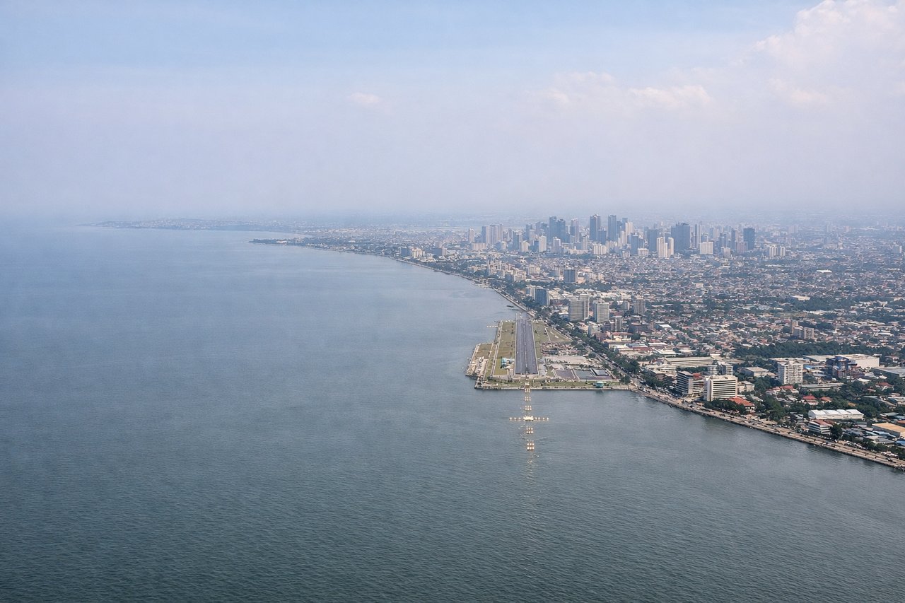
Landing at MNL
LEFTLeft-side seats provide excellent views during the descent approach into Manila. You'll see Laguna de Bay (the large freshwater lake southeast of Manila), the Calabarzon industrial region, and the Sierra Madre mountain range forming the eastern backdrop.
Will your flight be in sunlight?
Pick a date and time in the Sun Map to watch the sun move across your whole flight.
About This Route
Which side of the plane should I sit on flying from Dumaguete (DGT) to Ninoy Aquino International (MNL)?
Sit on the Left side of the plane for the best views on flights from Dumaguete to Manila. While takeoff on the right offers good Visayan island views, the landing approach on the left provides more dramatic and extensive scenery—Laguna de Bay is a major geographical feature, and the Sierra Madre backdrop creates a striking visual finale. The left side captures the most memorable portion of the flight.
What can I see during takeoff from Dumaguete in Dumaguete?
During takeoff from Dumaguete (DGT), sit on the Right side for the best views. Right-side seats offer views of Bohol Strait and the Visayan islands as the aircraft climbs northwestward. You'll see the narrow channel separating Negros and Bohol islands, with Bohol's interior highlands visible in the distance. Notable sights include: Bohol Strait, Bohol island interior highlands, Negros island coastline, Dumaguete city grid below.
What can I see when landing at Ninoy Aquino International in Manila?
When landing at Ninoy Aquino International (MNL), sit on the Left side for the best views. Left-side seats provide excellent views during the descent approach into Manila. You'll see Laguna de Bay (the large freshwater lake southeast of Manila), the Calabarzon industrial region, and the Sierra Madre mountain range forming the eastern backdrop. Notable sights include: Laguna de Bay, Sierra Madre mountain range, Calabarzon industrial plains, Manila Bay coastline.
How long is the flight from Dumaguete to Manila?
The flight from Dumaguete (DGT) to Ninoy Aquino International (MNL) takes about 55 minutes. The shortest flight path between them is 389 miles (627 km); winds and air traffic control usually add a few percent.
What does the Dumaguete to Manila flight path pass over?
The flight path crosses the Visayan Sea northwestward, passing between Negros and Panay islands. At midpoint, you'll be over open water with occasional views of smaller islands and fishing vessels. The Sibuyan Sea lies to the northeast. As you approach Manila, the landscape transitions from island geography to the extensive lowland plains surrounding Manila Bay, with the Sierra Madre range visible along the eastern horizon throughout the descent.