While takeoff favors the right, the landing view from the left is significantly more dramatic and geographically rewarding. Mount Hood and the Willamette River confluence are iconic Pacific Northwest landmarks that make the approach memorable. Left-side seats win the overall flight.
Flown DJT to PDX? Did we get it right?
Flight Path
West Palm Beach to Portland is 2,665 miles (4,290 km), a flight of about 5 hours.
The flight path crosses the Gulf of Mexico, then the Mississippi River valley near Memphis or St. Louis (depending on routing), followed by the Great Plains. The Rocky Mountains (Wyoming/Colorado border region) appear on the horizon during the western leg, with the Cascade Range and Mount Jefferson becoming visible as the aircraft descends into Oregon airspace.
Great circle distance and headings ›

Phase by phase
Takeoff from DJT
RIGHTRight-side seats capture the Atlantic coastline and Lake Worth Lagoon immediately after departure. PBI typically departs eastbound over water before turning northwest, giving right-side passengers a clear view of the barrier islands and coastal geography that defines the takeoff corridor.
Landing at PDX
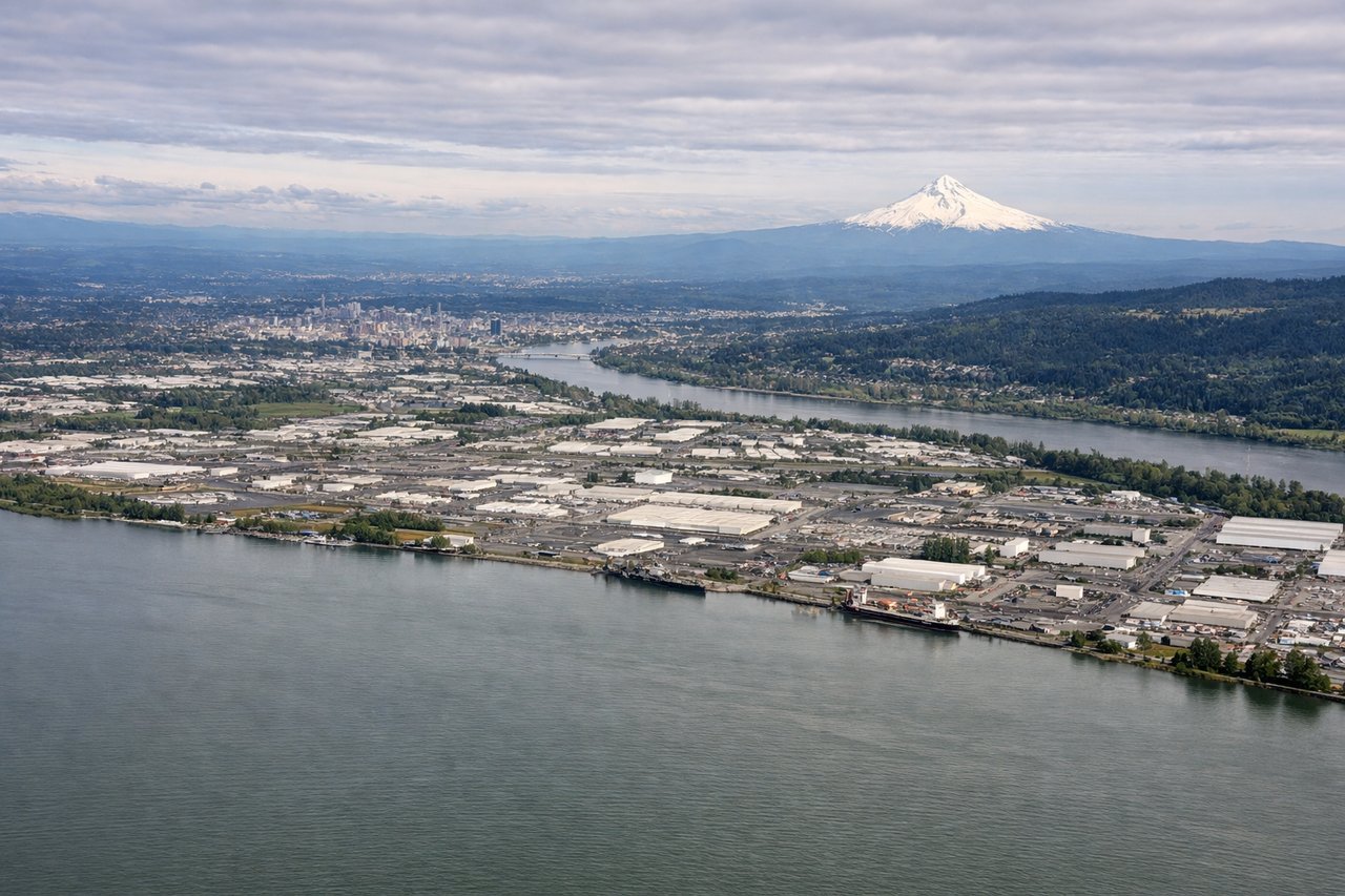
LEFTLeft-side seats offer the best view during approach to PDX. Typical landing runways are 28L/28R (westbound), which means the approach path crosses over the Willamette River valley and downtown Portland. Left-side passengers see the city center, Mount Hood to the southeast, and the confluence of the Willamette and Columbia Rivers.
Will your flight be in sunlight?
Pick a date and time in the Sun Map to watch the sun move across your whole flight.
About This Route
Which side of the plane should I sit on flying from President Donald J. Trump International Airport (DJT) to Portland International (PDX)?
Sit on the Left side of the plane for the best views on flights from West Palm Beach to Portland. While takeoff favors the right, the landing view from the left is significantly more dramatic and geographically rewarding. Mount Hood and the Willamette River confluence are iconic Pacific Northwest landmarks that make the approach memorable. Left-side seats win the overall flight.
What can I see during takeoff from President Donald J. Trump International Airport in West Palm Beach?
During takeoff from President Donald J. Trump International Airport (DJT), sit on the Right side for the best views. Right-side seats capture the Atlantic coastline and Lake Worth Lagoon immediately after departure. PBI typically departs eastbound over water before turning northwest, giving right-side passengers a clear view of the barrier islands and coastal geography that defines the takeoff corridor. Notable sights include: Lake Worth Lagoon, Atlantic barrier islands (Singer Island, Palm Beach), Port of Palm Beach container terminals, Intracoastal Waterway.
What can I see when landing at Portland International in Portland?
When landing at Portland International (PDX), sit on the Left side for the best views. Left-side seats offer the best view during approach to PDX. Typical landing runways are 28L/28R (westbound), which means the approach path crosses over the Willamette River valley and downtown Portland. Left-side passengers see the city center, Mount Hood to the southeast, and the confluence of the Willamette and Columbia Rivers. Notable sights include: Mount Hood (11,240 ft, visible 50+ miles southeast on clear days), Willamette River and downtown Portland skyline, Columbia River, Cascade Range foothills.
How long is the flight from West Palm Beach to Portland?
The flight from President Donald J. Trump International Airport (DJT) to Portland International (PDX) takes about 5 hours. The shortest flight path between them is 2,665 miles (4,290 km); winds and air traffic control usually add a few percent.
What does the West Palm Beach to Portland flight path pass over?
The flight path crosses the Gulf of Mexico, then the Mississippi River valley near Memphis or St. Louis (depending on routing), followed by the Great Plains. The Rocky Mountains (Wyoming/Colorado border region) appear on the horizon during the western leg, with the Cascade Range and Mount Jefferson becoming visible as the aircraft descends into Oregon airspace.