Both sides score equally for the cruise phase over flat Midwestern terrain with minimal dramatic features. However, the right side's approach into Detroit provides more distinctive scenery with the Great Lakes, Detroit River, and urban waterfront visible during landing. The left side's Moscow departure offers slightly more urban interest than the right side's departure, but the landing advantage on the right outweighs this, making the right side the overall winner for the complete flight experience.
Flown DME to DTW? Did we get it right?
Flight Path
Moscow to Detroit is 4,866 miles (7,832 km), a flight of about 8 hours 15 minutes.
The flight crosses the North Atlantic at high altitude with no visible landmarks during the 5+ hour oceanic phase. Over Greenland and the Canadian Arctic, only ice sheets and barren terrain are visible. The route then crosses into North American airspace over northern Quebec and Ontario, with boreal forest, lakes, and rivers visible during descent into the Great Lakes region. No major mountain ranges are crossed; the Appalachians lie south of the typical flight corridor.
Great circle distance and headings ›Phase by phase
Takeoff from DME
LEFTMoscow's urban sprawl and the Moscow River valley are visible during initial climb on the left side. The city extends visibly southward and eastward from Domodedovo, offering brief urban scenery before transitioning to flat terrain.
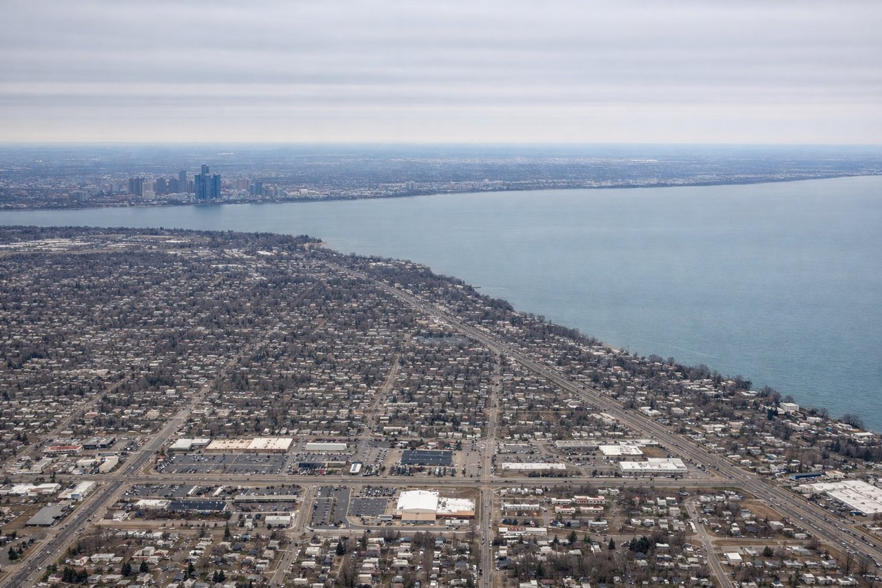
Landing at DTW
RIGHTThe right side offers views of the Great Lakes region during descent into Detroit. Lake St. Clair and the Detroit River are visible on approach, along with the urban waterfront of Detroit and Windsor, Ontario. This provides more distinctive water-based scenery than the left side's flat Midwestern farmland.
Will your flight be in sunlight?
Pick a date and time in the Sun Map to watch the sun move across your whole flight.
About This Route
Which side of the plane should I sit on flying from Domodedovo International Airport (DME) to Detroit Metro Wayne Co (DTW)?
Sit on the Right side of the plane for the best views on flights from Moscow to Detroit. Both sides score equally for the cruise phase over flat Midwestern terrain with minimal dramatic features. However, the right side's approach into Detroit provides more distinctive scenery with the Great Lakes, Detroit River, and urban waterfront visible during landing. The left side's Moscow departure offers slightly more urban interest than the right side's departure, but the landing advantage on the right outweighs this, making the right side the overall winner for the complete flight experience.
What can I see during takeoff from Domodedovo International Airport in Moscow?
During takeoff from Domodedovo International Airport (DME), sit on the Left side for the best views. Moscow's urban sprawl and the Moscow River valley are visible during initial climb on the left side. The city extends visibly southward and eastward from Domodedovo, offering brief urban scenery before transitioning to flat terrain. Notable sights include: Moscow city center and suburbs, Moscow River valley, Domodedovo industrial zone.
What can I see when landing at Detroit Metro Wayne Co in Detroit?
When landing at Detroit Metro Wayne Co (DTW), sit on the Right side for the best views. The right side offers views of the Great Lakes region during descent into Detroit. Lake St. Clair and the Detroit River are visible on approach, along with the urban waterfront of Detroit and Windsor, Ontario. This provides more distinctive water-based scenery than the left side's flat Midwestern farmland. Notable sights include: Lake St. Clair, Detroit River, Detroit city waterfront, Windsor Ontario skyline.
How long is the flight from Moscow to Detroit?
The flight from Domodedovo International Airport (DME) to Detroit Metro Wayne Co (DTW) takes about 8 hours 15 minutes. The shortest flight path between them is 4,866 miles (7,832 km); winds and air traffic control usually add a few percent.
What does the Moscow to Detroit flight path pass over?
The flight crosses the North Atlantic at high altitude with no visible landmarks during the 5+ hour oceanic phase. Over Greenland and the Canadian Arctic, only ice sheets and barren terrain are visible. The route then crosses into North American airspace over northern Quebec and Ontario, with boreal forest, lakes, and rivers visible during descent into the Great Lakes region. No major mountain ranges are crossed; the Appalachians lie south of the typical flight corridor.