The Dongola departure offers more dramatic visual contrast and geographic variety (Nile River corridor, desert transition, cataract region) compared to the Houston landing's industrial urban sprawl. While Houston's landing provides recognizable landmarks, the takeoff side's natural features and the Nile's distinctive geography create a more compelling full-flight experience. The route crosses the Atlantic and Sahara with minimal mid-flight scenery, making the departure the stronger viewing opportunity.
Flown DOG to IAH? Did we get it right?
Flight Path
Dongola to Houston is 7,484 miles (12,045 km), a flight of about 13 hours 20 minutes.
Atlantic Ocean (6+ hours of open water with minimal visual interest), Moroccan and Western Saharan coastlines during westbound crossing, Azores region (if visible at altitude), Gulf of Mexico approach with scattered oil platforms and coastal Louisiana marshlands
Great circle distance and headings ›


Phase by phase
Takeoff from DOG
LEFTLeft side captures the Nile River valley and surrounding desert terrain during climb-out from Dongola. The river's distinctive green corridor contrasts sharply with the Sahara, providing immediate visual interest. Right side faces open desert with minimal variation.
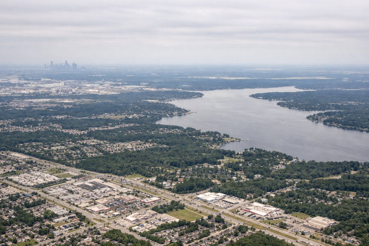
Landing at IAH
RIGHTRight side (north/northeast approach) reveals Houston's urban sprawl, the ship channel, and Galveston Bay during descent. The city's grid pattern, refineries, and water features provide strong visual landmarks. Left side shows flat coastal plains and open Gulf of Mexico with minimal distinguishing features.
Will your flight be in sunlight?
Pick a date and time in the Sun Map to watch the sun move across your whole flight.
About This Route
Which side of the plane should I sit on flying from Dongola (DOG) to George Bush Intcntl Houston (IAH)?
Sit on the Left side of the plane for the best views on flights from Dongola to Houston. The Dongola departure offers more dramatic visual contrast and geographic variety (Nile River corridor, desert transition, cataract region) compared to the Houston landing's industrial urban sprawl. While Houston's landing provides recognizable landmarks, the takeoff side's natural features and the Nile's distinctive geography create a more compelling full-flight experience. The route crosses the Atlantic and Sahara with minimal mid-flight scenery, making the departure the stronger viewing opportunity.
What can I see during takeoff from Dongola in Dongola?
During takeoff from Dongola (DOG), sit on the Left side for the best views. Left side captures the Nile River valley and surrounding desert terrain during climb-out from Dongola. The river's distinctive green corridor contrasts sharply with the Sahara, providing immediate visual interest. Right side faces open desert with minimal variation. Notable sights include: Nile River (northbound flow visible as green ribbon), Dongola town and airfield, Sahara Desert expanse, Fourth Cataract region to the south.
What can I see when landing at George Bush Intcntl Houston in Houston?
When landing at George Bush Intcntl Houston (IAH), sit on the Right side for the best views. Right side (north/northeast approach) reveals Houston's urban sprawl, the ship channel, and Galveston Bay during descent. The city's grid pattern, refineries, and water features provide strong visual landmarks. Left side shows flat coastal plains and open Gulf of Mexico with minimal distinguishing features. Notable sights include: Houston skyline and downtown towers, Houston Ship Channel (industrial waterway), Galveston Bay, refineries and petrochemical facilities along the channel.
How long is the flight from Dongola to Houston?
The flight from Dongola (DOG) to George Bush Intcntl Houston (IAH) takes about 13 hours 20 minutes. The shortest flight path between them is 7,484 miles (12,045 km); winds and air traffic control usually add a few percent.
What does the Dongola to Houston flight path pass over?
Atlantic Ocean (6+ hours of open water with minimal visual interest), Moroccan and Western Saharan coastlines during westbound crossing, Azores region (if visible at altitude), Gulf of Mexico approach with scattered oil platforms and coastal Louisiana marshlands