The left side gets the best takeoff, with Doha's skyline and coast. On the eastbound track it also faces north toward the Gulf coast of the UAE, the Hajar Mountains near Muscat, the Deccan Plateau and Bangalore area of southern India, and Sumatra's volcanic spine. The right side's Brisbane city approach is excellent, but it can't make up for the long open-ocean stretches on that side. The route is roughly 40 percent ocean, which keeps both sides below the top tier.
Flown DOH to BNE? Did we get it right?
Flight Path
Doha to Brisbane is 7,662 miles (12,330 km), a flight of about 14 hours 15 minutes.
Approximate great-circle track: the Gulf coast near Abu Dhabi, the Hajar Mountains and Gulf of Oman near Muscat, the Arabian Sea, then southern India near the Western Ghats and Bangalore. Next come the Bay of Bengal, Sumatra's Barisan Mountains near the equator, and Java's volcanic spine. The route then crosses the Timor Sea and Indian Ocean, the Northern Territory and western Queensland outback, and the Great Dividing Range before Brisbane.
Great circle distance and headings ›


Phase by phase
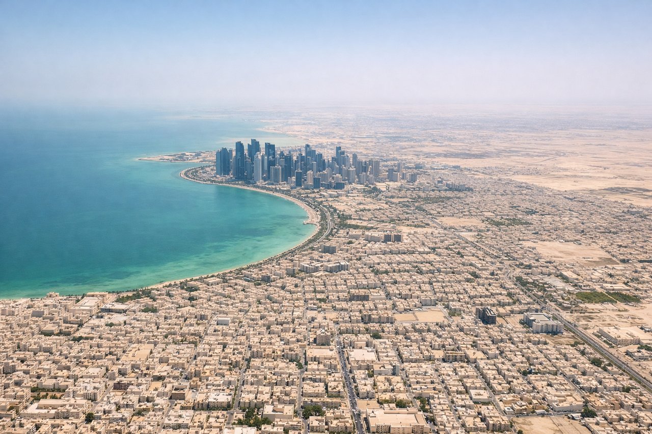
Takeoff from DOH
LEFTDeparting on the 16 runways, the aircraft turns left toward the east-southeast route, so left-side windows face north toward the Doha coast. You get the West Bay skyline, The Pearl and the Gulf shoreline as you climb. Right-side windows mostly show open Gulf water.
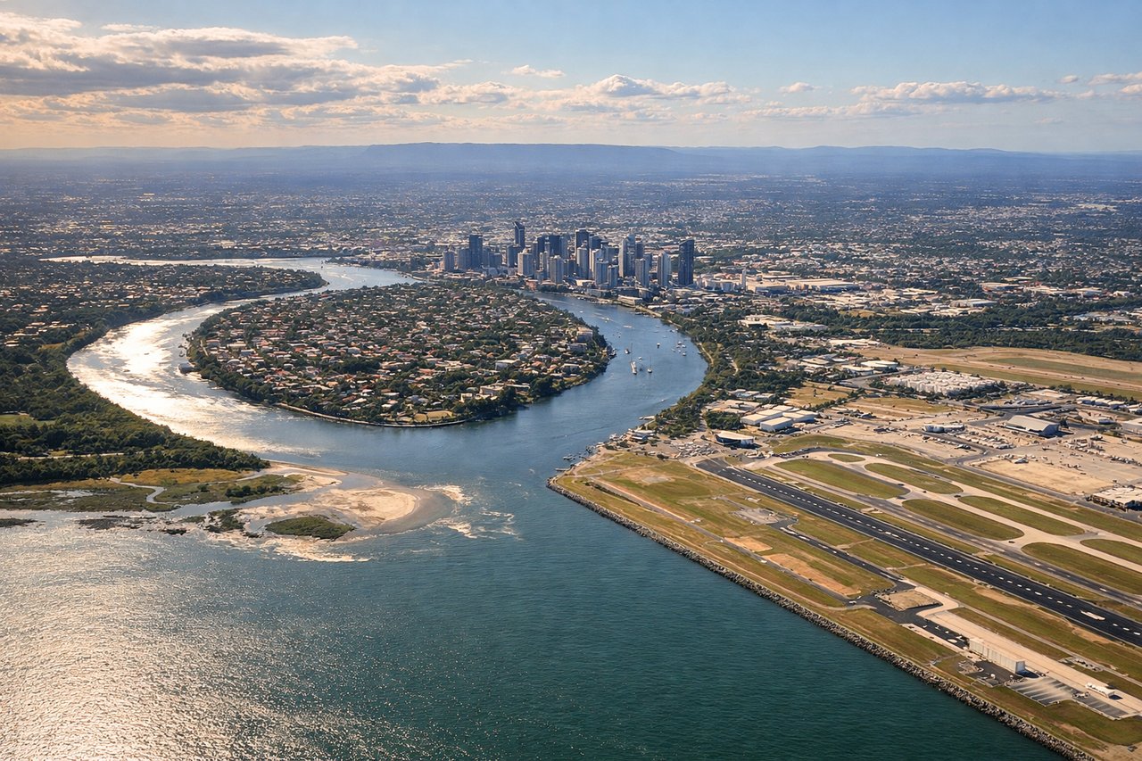
Landing at BNE
RIGHTArriving from the northwest, the aircraft usually swings out over Moreton Bay and turns right onto final for runway 19. That puts the Brisbane skyline and river on the right-hand side. The left side sees mostly the bay and its sand islands, which is pretty but flatter.
Will your flight be in sunlight?
Pick a date and time in the Sun Map to watch the sun move across your whole flight.
About This Route
Which side of the plane should I sit on flying from Hamad International Airport (DOH) to Brisbane International (BNE)?
Sit on the Left side of the plane for the best views on flights from Doha to Brisbane. The left side gets the best takeoff, with Doha's skyline and coast. On the eastbound track it also faces north toward the Gulf coast of the UAE, the Hajar Mountains near Muscat, the Deccan Plateau and Bangalore area of southern India, and Sumatra's volcanic spine. The right side's Brisbane city approach is excellent, but it can't make up for the long open-ocean stretches on that side. The route is roughly 40 percent ocean, which keeps both sides below the top tier.
What can I see during takeoff from Hamad International Airport in Doha?
During takeoff from Hamad International Airport (DOH), sit on the Left side for the best views. Departing on the 16 runways, the aircraft turns left toward the east-southeast route, so left-side windows face north toward the Doha coast. You get the West Bay skyline, The Pearl and the Gulf shoreline as you climb. Right-side windows mostly show open Gulf water. Notable sights include: West Bay skyline, The Pearl-Qatar island, Lusail coastline, Hamad airport's reclaimed shoreline.
What can I see when landing at Brisbane International in Brisbane?
When landing at Brisbane International (BNE), sit on the Right side for the best views. Arriving from the northwest, the aircraft usually swings out over Moreton Bay and turns right onto final for runway 19. That puts the Brisbane skyline and river on the right-hand side. The left side sees mostly the bay and its sand islands, which is pretty but flatter. Notable sights include: Brisbane CBD skyline, Brisbane River and Story Bridge, Port of Brisbane at the river mouth, Mount Coot-tha and the ranges beyond.
How long is the flight from Doha to Brisbane?
The flight from Hamad International Airport (DOH) to Brisbane International (BNE) takes about 14 hours 15 minutes. The shortest flight path between them is 7,662 miles (12,330 km); winds and air traffic control usually add a few percent.
What does the Doha to Brisbane flight path pass over?
Approximate great-circle track: the Gulf coast near Abu Dhabi, the Hajar Mountains and Gulf of Oman near Muscat, the Arabian Sea, then southern India near the Western Ghats and Bangalore. Next come the Bay of Bengal, Sumatra's Barisan Mountains near the equator, and Java's volcanic spine. The route then crosses the Timor Sea and Indian Ocean, the Northern Territory and western Queensland outback, and the Great Dividing Range before Brisbane.