The right side strings together the most memorable moments of the flight: Doha's skyline and Gulf coast at takeoff, a crossing of the Nile Valley and African highlands during cruise, and a mountain-backed approach into São Paulo past the Serra do Mar. The left side spends most of the flight over featureless desert interior and the open South Atlantic with little to distinguish it.
Flown DOH to GRU? Did we get it right?
Flight Path
Doha to Sao Paulo is 7,368 miles (11,858 km), a flight of about 14 hours 50 minutes.
Red Sea and Arabian coastal desert, the Nile River and Sudanese Nile Valley near Khartoum, Sahel savanna and Cameroon's interior highlands, the Gulf of Guinea coastline, a long South Atlantic Ocean crossing, and the Brazilian coast near Rio de Janeiro's Costa Verde before the final descent into São Paulo.
Great circle distance and headings ›


Phase by phase

Takeoff from DOH
RIGHTDeparting DOH to the southwest, the right side faces back toward Doha's coastline as the aircraft climbs, giving a brief but clear view of the West Bay skyscraper cluster, The Pearl-Qatar island, and the turquoise Gulf shoreline before the city gives way to flat desert. The left side only shows the empty interior of the Qatar peninsula.
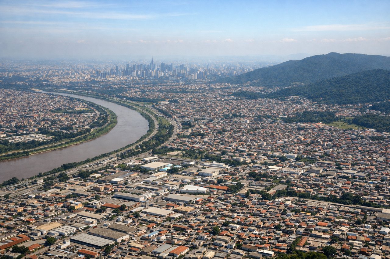
Landing at GRU
RIGHTOn the final approach into GRU from the northeast, the right side faces north toward greater São Paulo's dense urban sprawl and the forested ridges of the Serra da Cantareira, with the higher Serra do Mar coastal range visible further back toward Rio de Janeiro's Costa Verde. The left side mostly shows the flatter, less distinctive interior toward the ABC industrial suburbs.
Will your flight be in sunlight?
Pick a date and time in the Sun Map to watch the sun move across your whole flight.
About This Route
Which side of the plane should I sit on flying from Hamad International Airport (DOH) to Guarulhos (GRU)?
Sit on the Right side of the plane for the best views on flights from Doha to Sao Paulo. The right side strings together the most memorable moments of the flight: Doha's skyline and Gulf coast at takeoff, a crossing of the Nile Valley and African highlands during cruise, and a mountain-backed approach into São Paulo past the Serra do Mar. The left side spends most of the flight over featureless desert interior and the open South Atlantic with little to distinguish it.
What can I see during takeoff from Hamad International Airport in Doha?
During takeoff from Hamad International Airport (DOH), sit on the Right side for the best views. Departing DOH to the southwest, the right side faces back toward Doha's coastline as the aircraft climbs, giving a brief but clear view of the West Bay skyscraper cluster, The Pearl-Qatar island, and the turquoise Gulf shoreline before the city gives way to flat desert. The left side only shows the empty interior of the Qatar peninsula. Notable sights include: West Bay skyline, The Pearl-Qatar artificial island, Persian Gulf coastline, Qatar's flat desert interior.
What can I see when landing at Guarulhos in Sao Paulo?
When landing at Guarulhos (GRU), sit on the Right side for the best views. On the final approach into GRU from the northeast, the right side faces north toward greater São Paulo's dense urban sprawl and the forested ridges of the Serra da Cantareira, with the higher Serra do Mar coastal range visible further back toward Rio de Janeiro's Costa Verde. The left side mostly shows the flatter, less distinctive interior toward the ABC industrial suburbs. Notable sights include: São Paulo urban sprawl, Serra da Cantareira forested hills, Serra do Mar coastal mountains in the distance, Tietê River valley.
How long is the flight from Doha to Sao Paulo?
The flight from Hamad International Airport (DOH) to Guarulhos (GRU) takes about 14 hours 50 minutes. The shortest flight path between them is 7,368 miles (11,858 km); winds and air traffic control usually add a few percent.
What does the Doha to Sao Paulo flight path pass over?
Red Sea and Arabian coastal desert, the Nile River and Sudanese Nile Valley near Khartoum, Sahel savanna and Cameroon's interior highlands, the Gulf of Guinea coastline, a long South Atlantic Ocean crossing, and the Brazilian coast near Rio de Janeiro's Costa Verde before the final descent into São Paulo.