Right-side seats capture the dramatic volcanic scenery of Bali during departure, which is the most visually distinctive segment of this route. The landing approach over the MacDonnell Ranges is notable but less dramatic than Bali's volcanic peaks.
Flown DPS to ASP? Did we get it right?
Flight Path
Denpasar to Alice Springs is 1,617 miles (2,602 km), a flight of about 3 hours 45 minutes.
The flight path crosses the Timor Sea (featureless open water for most of the crossing), passes near or over Timor island's northern coast (mountainous terrain visible if the route tracks close enough), then transitions to the Australian mainland with the Tanami Desert and scattered rocky outcrops becoming visible as the aircraft approaches the MacDonnell Ranges system near Alice Springs. The Arafura Sea and Timor Sea dominate the central portion of the flight with minimal visual landmarks.
Great circle distance and headings ›

Phase by phase
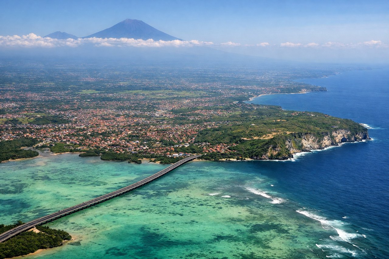
Takeoff from DPS
RIGHTRight-side seats offer views of Bali's volcanic peaks and the island's interior as the aircraft climbs northeastward. The left side faces the Indian Ocean with minimal visual interest during departure.
Landing at ASP
LEFTLeft-side seats provide views of the MacDonnell Ranges and the West MacDonnell Ranges as the aircraft descends toward Alice Springs from the north. The right side faces the relatively featureless red desert with fewer distinctive landmarks.
Will your flight be in sunlight?
Pick a date and time in the Sun Map to watch the sun move across your whole flight.
About This Route
Which side of the plane should I sit on flying from Denpasar I Gusti Ngurah Rai International Airport (DPS) to Alice Springs (ASP)?
Sit on the Right side of the plane for the best views on flights from Denpasar to Alice Springs. Right-side seats capture the dramatic volcanic scenery of Bali during departure, which is the most visually distinctive segment of this route. The landing approach over the MacDonnell Ranges is notable but less dramatic than Bali's volcanic peaks.
What can I see during takeoff from Denpasar I Gusti Ngurah Rai International Airport in Denpasar?
During takeoff from Denpasar I Gusti Ngurah Rai International Airport (DPS), sit on the Right side for the best views. Right-side seats offer views of Bali's volcanic peaks and the island's interior as the aircraft climbs northeastward. The left side faces the Indian Ocean with minimal visual interest during departure. Notable sights include: Mount Agung (3,142 m, visible as a prominent cone on the eastern horizon), Mount Batur (1,717 m, closer and slightly west of Agung), Bali's terraced agricultural landscape in the central highlands, Lombok Strait separating Bali from Lombok island to the east.
What can I see when landing at Alice Springs in Alice Springs?
When landing at Alice Springs (ASP), sit on the Left side for the best views. Left-side seats provide views of the MacDonnell Ranges and the West MacDonnell Ranges as the aircraft descends toward Alice Springs from the north. The right side faces the relatively featureless red desert with fewer distinctive landmarks. Notable sights include: West MacDonnell Ranges (a series of parallel ridges running east-west, visible as dark linear features against red earth), Finke River valley (a major drainage line cutting through the ranges), Alice Springs township (visible as a developed area in the valley floor), the red desert plains of central Australia stretching toward the southern horizon.
How long is the flight from Denpasar to Alice Springs?
The flight from Denpasar I Gusti Ngurah Rai International Airport (DPS) to Alice Springs (ASP) takes about 3 hours 45 minutes. The shortest flight path between them is 1,617 miles (2,602 km); winds and air traffic control usually add a few percent.
What does the Denpasar to Alice Springs flight path pass over?
The flight path crosses the Timor Sea (featureless open water for most of the crossing), passes near or over Timor island's northern coast (mountainous terrain visible if the route tracks close enough), then transitions to the Australian mainland with the Tanami Desert and scattered rocky outcrops becoming visible as the aircraft approaches the MacDonnell Ranges system near Alice Springs. The Arafura Sea and Timor Sea dominate the central portion of the flight with minimal visual landmarks.