Right side scores marginally higher due to superior takeoff scenery (immediate ocean and coastline views from the more commonly used Runway 09 departure). Landing views are roughly equal between sides, but the takeoff advantage—occurring during the most engaging phase of flight when passengers are most attentive—tips the overall recommendation to the right side.
Flown DPS to BDO? Did we get it right?
Flight Path
Denpasar to Bandung is 535 miles (861 km), a flight of about 1 hour 15 minutes.
The flight path crosses central Java at cruise altitude (approximately 25,000-30,000 feet). Passengers may observe the volcanic highlands of central Java, including the Dieng Plateau region and scattered volcanic peaks. The terrain transitions from Bali's tropical island landscape to Java's broader highland plateau. Cloud cover is common in this region, but on clear days the volcanic ridgelines and highland terrain create visible topographic variation. The flight passes roughly over or near the Slamet-Sundoro volcanic complex before descending toward Bandung.
Great circle distance and headings ›


Phase by phase
Takeoff from DPS
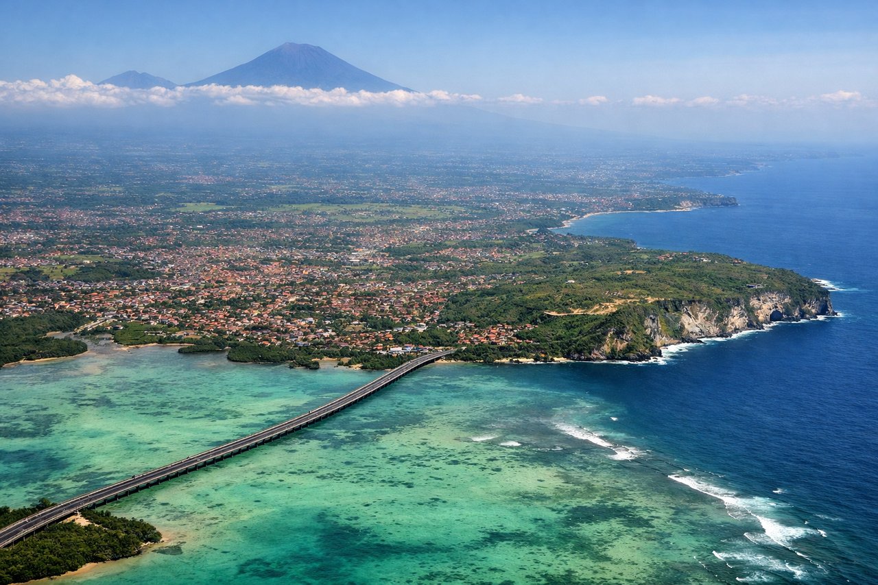
RIGHTRunway 09 departures (the more common direction) climb eastward over the Indian Ocean and Bali's southern coastline, offering immediate water and coastal views. Runway 27 departures head inland over flat terrain with less visual interest during the critical initial climb phase.
Landing at BDO
LEFTApproach to Bandung typically descends from the north over the Bandung Basin and surrounding highlands. Left-side passengers see the city's urban sprawl, the basin terrain, and the volcanic highlands that frame the approach. Right-side views are primarily of open terrain and distant mountains with less urban definition.
Will your flight be in sunlight?
Pick a date and time in the Sun Map to watch the sun move across your whole flight.
About This Route
Which side of the plane should I sit on flying from Denpasar I Gusti Ngurah Rai International Airport (DPS) to Husein Sastranegara International Airport (BDO)?
Sit on the Right side of the plane for the best views on flights from Denpasar to Bandung. Right side scores marginally higher due to superior takeoff scenery (immediate ocean and coastline views from the more commonly used Runway 09 departure). Landing views are roughly equal between sides, but the takeoff advantage—occurring during the most engaging phase of flight when passengers are most attentive—tips the overall recommendation to the right side.
What can I see during takeoff from Denpasar I Gusti Ngurah Rai International Airport in Denpasar?
During takeoff from Denpasar I Gusti Ngurah Rai International Airport (DPS), sit on the Right side for the best views. Runway 09 departures (the more common direction) climb eastward over the Indian Ocean and Bali's southern coastline, offering immediate water and coastal views. Runway 27 departures head inland over flat terrain with less visual interest during the critical initial climb phase. Notable sights include: Indian Ocean (immediate departure), Bali's southern coastline, Benoa Harbor area, Mount Agung volcanic peak (visible on clear days to the north during climb).
What can I see when landing at Husein Sastranegara International Airport in Bandung?
When landing at Husein Sastranegara International Airport (BDO), sit on the Left side for the best views. Approach to Bandung typically descends from the north over the Bandung Basin and surrounding highlands. Left-side passengers see the city's urban sprawl, the basin terrain, and the volcanic highlands that frame the approach. Right-side views are primarily of open terrain and distant mountains with less urban definition. Notable sights include: Bandung city sprawl and urban grid, Bandung Basin terrain, Tangkuban Perahu volcanic complex (north of city), surrounding tea plantations and highland ridges.
How long is the flight from Denpasar to Bandung?
The flight from Denpasar I Gusti Ngurah Rai International Airport (DPS) to Husein Sastranegara International Airport (BDO) takes about 1 hour 15 minutes. The shortest flight path between them is 535 miles (861 km); winds and air traffic control usually add a few percent.
What does the Denpasar to Bandung flight path pass over?
The flight path crosses central Java at cruise altitude (approximately 25,000-30,000 feet). Passengers may observe the volcanic highlands of central Java, including the Dieng Plateau region and scattered volcanic peaks. The terrain transitions from Bali's tropical island landscape to Java's broader highland plateau. Cloud cover is common in this region, but on clear days the volcanic ridgelines and highland terrain create visible topographic variation. The flight passes roughly over or near the Slamet-Sundoro volcanic complex before descending toward Bandung.