The takeoff volcanic scenery from Bali is more visually striking and geographically concentrated than the landing approach. While Phang Nga Bay is scenic, the Bali peaks offer clearer, more dramatic landmarks during the initial climb phase.
Flown DPS to HKT? Did we get it right?
Flight Path
Denpasar to Phuket is 1,644 miles (2,646 km), a flight of about 3 hours 50 minutes.
The flight path crosses the Andaman Sea northwestward. Notable midpoint geography includes the Strait of Malacca region, with views of the Andaman Islands (Indian territory) visible to the left around the 1-hour mark if flying at lower cruise altitude. The Java Sea transitions to open Andaman waters. No major mountain ranges are visible during cruise, but the coastlines of Sumatra (distant left) and the Thai peninsula (distant right) frame the route at altitude.
Great circle distance and headings ›


Phase by phase
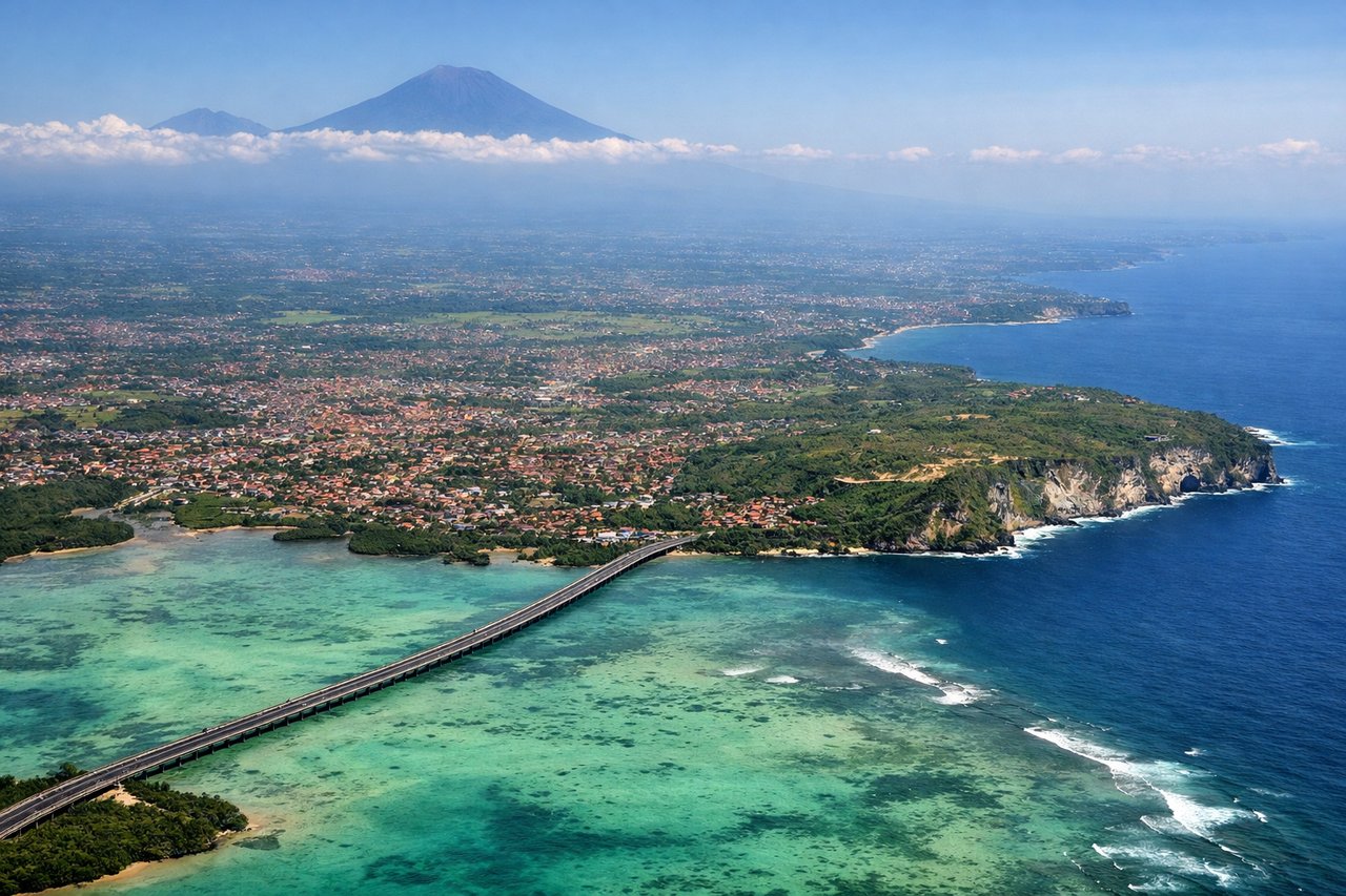
Takeoff from DPS
RIGHTRight-side seats capture the volcanic peaks of eastern Bali during northwestward climb-out. Mount Agung and Mount Batur dominate the immediate landscape, with the Bali Strait visible to the west.
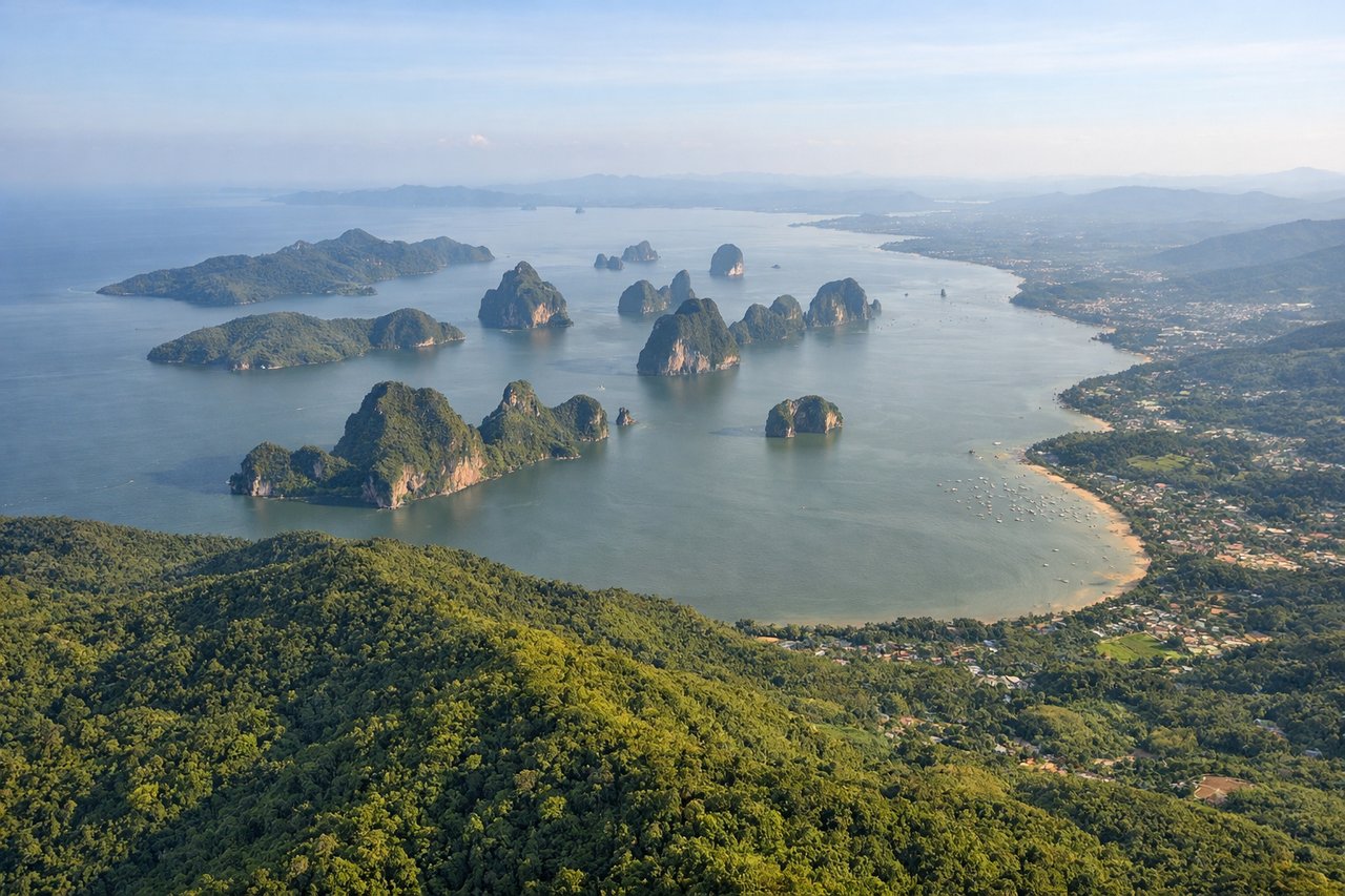
Landing at HKT
LEFTLeft-side seats offer views of Phang Nga Bay's distinctive limestone karsts and the Andaman Sea during the southeastern approach to Phuket. The dramatic geology of the bay is unmistakable and photogenic.
Will your flight be in sunlight?
Pick a date and time in the Sun Map to watch the sun move across your whole flight.
About This Route
Which side of the plane should I sit on flying from Denpasar I Gusti Ngurah Rai International Airport (DPS) to Phuket International (HKT)?
Sit on the Right side of the plane for the best views on flights from Denpasar to Phuket. The takeoff volcanic scenery from Bali is more visually striking and geographically concentrated than the landing approach. While Phang Nga Bay is scenic, the Bali peaks offer clearer, more dramatic landmarks during the initial climb phase.
What can I see during takeoff from Denpasar I Gusti Ngurah Rai International Airport in Denpasar?
During takeoff from Denpasar I Gusti Ngurah Rai International Airport (DPS), sit on the Right side for the best views. Right-side seats capture the volcanic peaks of eastern Bali during northwestward climb-out. Mount Agung and Mount Batur dominate the immediate landscape, with the Bali Strait visible to the west. Notable sights include: Mount Agung (3,142m), Mount Batur (1,717m), Bali Strait, Lombok Strait.
What can I see when landing at Phuket International in Phuket?
When landing at Phuket International (HKT), sit on the Left side for the best views. Left-side seats offer views of Phang Nga Bay's distinctive limestone karsts and the Andaman Sea during the southeastern approach to Phuket. The dramatic geology of the bay is unmistakable and photogenic. Notable sights include: Phang Nga Bay limestone formations, Andaman Sea, Phuket Island, Phang Nga Province coastline.
How long is the flight from Denpasar to Phuket?
The flight from Denpasar I Gusti Ngurah Rai International Airport (DPS) to Phuket International (HKT) takes about 3 hours 50 minutes. The shortest flight path between them is 1,644 miles (2,646 km); winds and air traffic control usually add a few percent.
What does the Denpasar to Phuket flight path pass over?
The flight path crosses the Andaman Sea northwestward. Notable midpoint geography includes the Strait of Malacca region, with views of the Andaman Islands (Indian territory) visible to the left around the 1-hour mark if flying at lower cruise altitude. The Java Sea transitions to open Andaman waters. No major mountain ranges are visible during cruise, but the coastlines of Sumatra (distant left) and the Thai peninsula (distant right) frame the route at altitude.