Right-side seats capture the most dramatic scenery: Mount Agung and Bali's volcanic landscape during takeoff, then the Timor Sea crossing, and finally the Gold Coast's hinterland ranges during descent. Left seats offer good landing views but miss the striking volcanic terrain at departure.
Flown DPS to OOL? Did we get it right?
Flight Path
Denpasar to Coolangatta is 2,830 miles (4,554 km), a flight of about 5 hours 55 minutes.
Timor Sea crossing (open water with minimal landmarks for approximately 2 hours of flight); the flight path passes east of the Sunda Strait and crosses the Java Sea before heading toward the Australian coast. No major islands are typically visible in the midpoint of this route at cruise altitude. The descent begins over the Coral Sea, with the Australian continental shelf becoming visible approximately 1 hour before landing. The Great Dividing Range becomes visible as a distant ridge on the horizon during the final approach phase.
Great circle distance and headings ›


Phase by phase
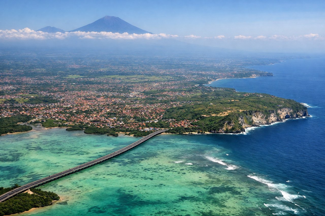
Takeoff from DPS
RIGHTRight-side seats offer views of Mount Agung and the volcanic ridgeline of eastern Bali as the aircraft climbs southeastward. The mountain's distinctive cone and surrounding terrain are clearly visible during the initial climb-out phase.
Landing at OOL
LEFTLeft-side seats provide excellent views of the Gold Coast's beachfront and hinterland during the descent approach from the northwest. The city's distinctive linear beach development, the Nerang River, and the forested ranges inland are all visible on the left side as the aircraft turns toward runway alignment.
Will your flight be in sunlight?
Pick a date and time in the Sun Map to watch the sun move across your whole flight.
About This Route
Which side of the plane should I sit on flying from Denpasar I Gusti Ngurah Rai International Airport (DPS) to Gold Coast Coolangatta (OOL)?
Sit on the Right side of the plane for the best views on flights from Denpasar to Coolangatta. Right-side seats capture the most dramatic scenery: Mount Agung and Bali's volcanic landscape during takeoff, then the Timor Sea crossing, and finally the Gold Coast's hinterland ranges during descent. Left seats offer good landing views but miss the striking volcanic terrain at departure.
What can I see during takeoff from Denpasar I Gusti Ngurah Rai International Airport in Denpasar?
During takeoff from Denpasar I Gusti Ngurah Rai International Airport (DPS), sit on the Right side for the best views. Right-side seats offer views of Mount Agung and the volcanic ridgeline of eastern Bali as the aircraft climbs southeastward. The mountain's distinctive cone and surrounding terrain are clearly visible during the initial climb-out phase. Notable sights include: Mount Agung (3,142 m active volcano), Bali's eastern volcanic ridge, Lombok Strait, Lombok island in the distance.
What can I see when landing at Gold Coast Coolangatta in Coolangatta?
When landing at Gold Coast Coolangatta (OOL), sit on the Left side for the best views. Left-side seats provide excellent views of the Gold Coast's beachfront and hinterland during the descent approach from the northwest. The city's distinctive linear beach development, the Nerang River, and the forested ranges inland are all visible on the left side as the aircraft turns toward runway alignment. Notable sights include: Gold Coast beachfront (Surfers Paradise to Coolangatta), Nerang River estuary, Lamington National Park ranges, Tallebudgera Valley.
How long is the flight from Denpasar to Coolangatta?
The flight from Denpasar I Gusti Ngurah Rai International Airport (DPS) to Gold Coast Coolangatta (OOL) takes about 5 hours 55 minutes. The shortest flight path between them is 2,830 miles (4,554 km); winds and air traffic control usually add a few percent.
What does the Denpasar to Coolangatta flight path pass over?
Timor Sea crossing (open water with minimal landmarks for approximately 2 hours of flight); the flight path passes east of the Sunda Strait and crosses the Java Sea before heading toward the Australian coast. No major islands are typically visible in the midpoint of this route at cruise altitude. The descent begins over the Coral Sea, with the Australian continental shelf becoming visible approximately 1 hour before landing. The Great Dividing Range becomes visible as a distant ridge on the horizon during the final approach phase.