While takeoff favors the right with Bali's volcanoes, the left side delivers the more prolonged and dramatic scenery during descent, with the Bromo-Tengger-Semeru massif being one of Java's most striking landscapes visible from altitude.
Flown DPS to SUB? Did we get it right?
Flight Path
Denpasar to Surabaya is 188 miles (303 km), a flight of about 50 minutes.
Bali Strait, Java Sea, and the volcanic highlands of East Java including the Bromo-Tengger-Semeru complex south of the flight path
Great circle distance and headings ›Phase by phase
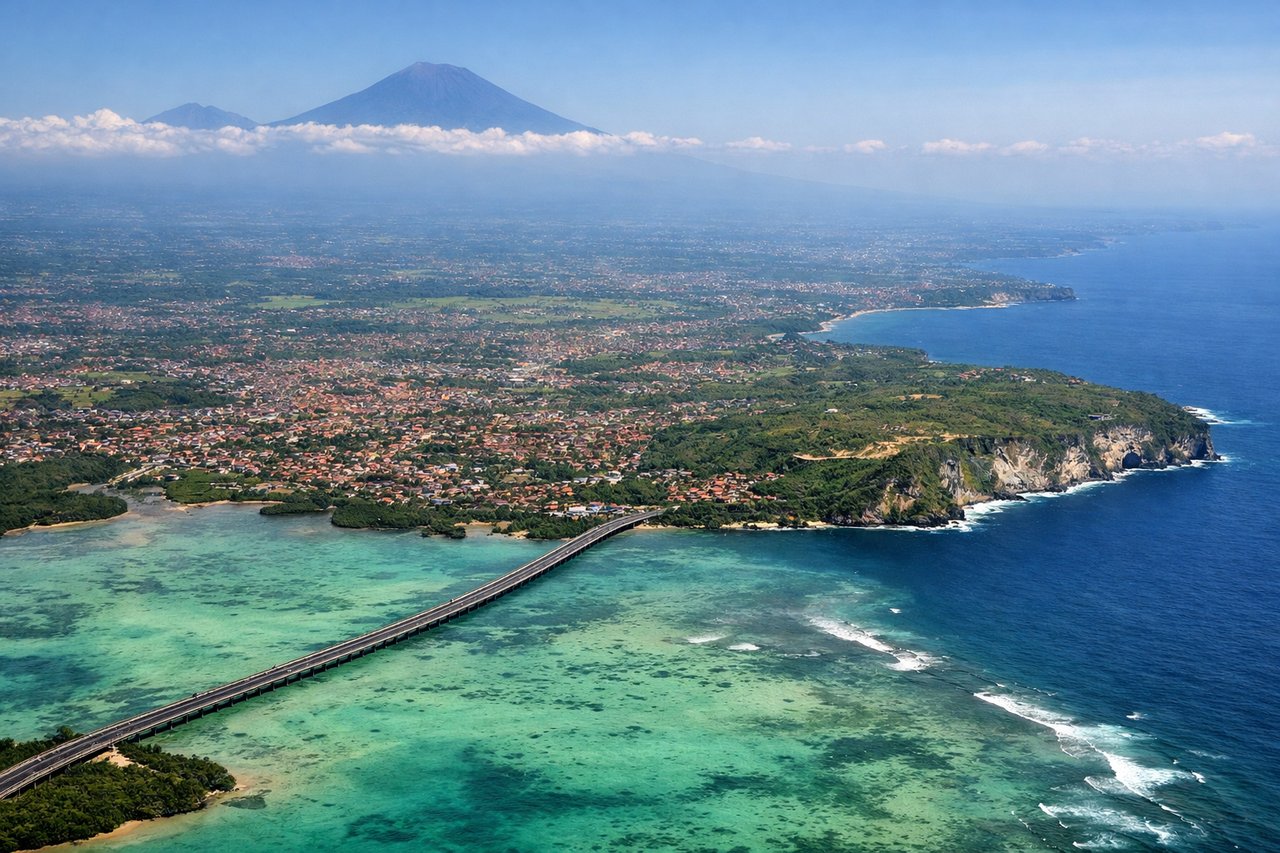
Takeoff from DPS
RIGHTDeparting DPS toward the west-northwest, Bali's volcanic spine sits to the north of the flight path. Passengers on the right get a good look at Mount Agung and Mount Batur rising over the island's interior as the aircraft climbs away from the southern coast.
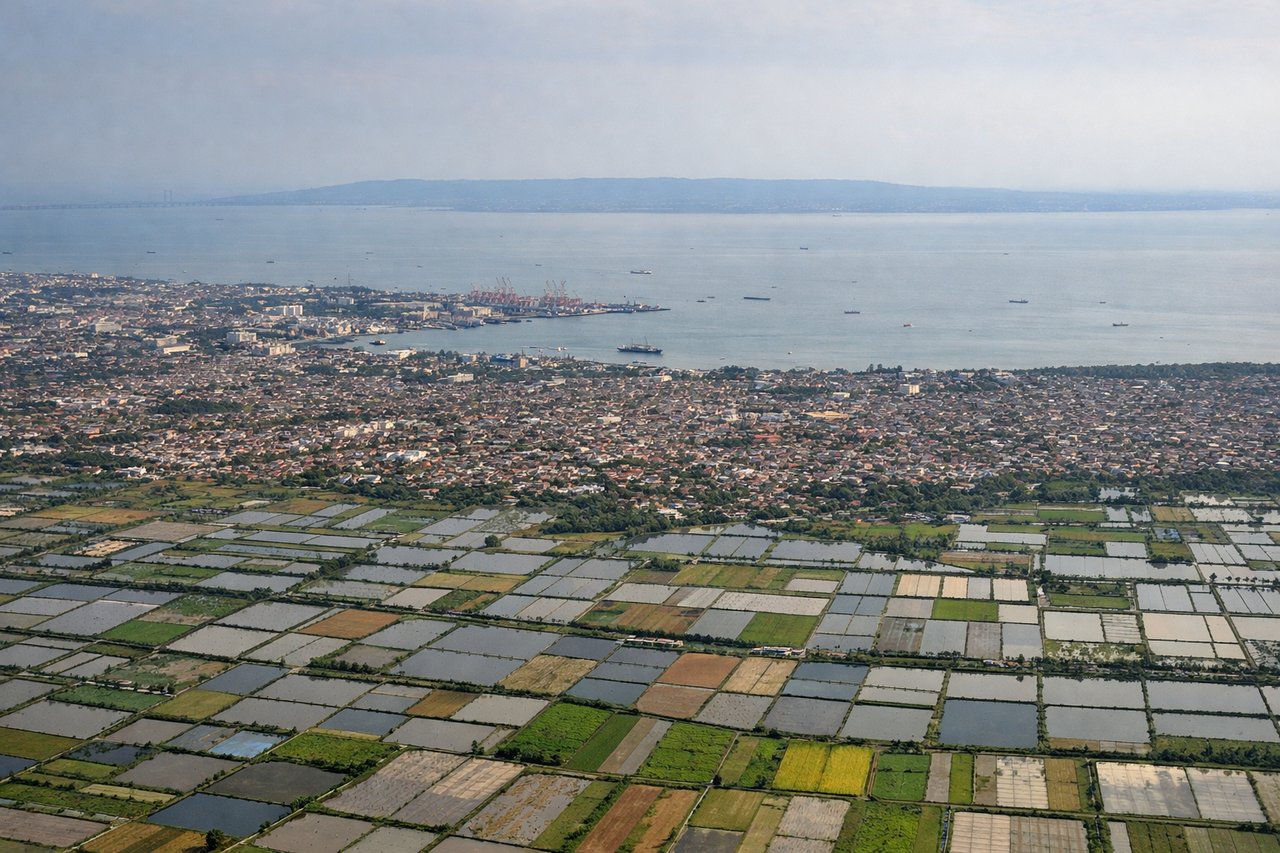
Landing at SUB
LEFTOn approach into Surabaya from the east, the descent path passes just north of the Bromo-Tengger-Semeru volcanic complex, Java's most dramatic highland scenery. Passengers on the left see the massive Semeru cone and the Tengger caldera before the aircraft levels out over the flat Brantas delta near Surabaya.
Will your flight be in sunlight?
Pick a date and time in the Sun Map to watch the sun move across your whole flight.
About This Route
Which side of the plane should I sit on flying from Denpasar I Gusti Ngurah Rai International Airport (DPS) to Juanda International Airport (SUB)?
Sit on the Left side of the plane for the best views on flights from Denpasar to Surabaya. While takeoff favors the right with Bali's volcanoes, the left side delivers the more prolonged and dramatic scenery during descent, with the Bromo-Tengger-Semeru massif being one of Java's most striking landscapes visible from altitude.
What can I see during takeoff from Denpasar I Gusti Ngurah Rai International Airport in Denpasar?
During takeoff from Denpasar I Gusti Ngurah Rai International Airport (DPS), sit on the Right side for the best views. Departing DPS toward the west-northwest, Bali's volcanic spine sits to the north of the flight path. Passengers on the right get a good look at Mount Agung and Mount Batur rising over the island's interior as the aircraft climbs away from the southern coast. Notable sights include: Mount Agung, Mount Batur, Bali's southern coastline and reef flats, Benoa Harbor.
What can I see when landing at Juanda International Airport in Surabaya?
When landing at Juanda International Airport (SUB), sit on the Left side for the best views. On approach into Surabaya from the east, the descent path passes just north of the Bromo-Tengger-Semeru volcanic complex, Java's most dramatic highland scenery. Passengers on the left see the massive Semeru cone and the Tengger caldera before the aircraft levels out over the flat Brantas delta near Surabaya. Notable sights include: Mount Semeru, Mount Bromo and the Tengger caldera, Java's north coastal plain, Surabaya's harbor and city grid.
How long is the flight from Denpasar to Surabaya?
The flight from Denpasar I Gusti Ngurah Rai International Airport (DPS) to Juanda International Airport (SUB) takes about 50 minutes. The shortest flight path between them is 188 miles (303 km); winds and air traffic control usually add a few percent.
What does the Denpasar to Surabaya flight path pass over?
Bali Strait, Java Sea, and the volcanic highlands of East Java including the Bromo-Tengger-Semeru complex south of the flight path