While the takeoff offers Mount Agung's drama, the landing approach provides more sustained and visually striking views of the Merapi-Merbabu volcanic pair during a longer descent window. Right seats capture this iconic landscape during the most photogenic phase of the flight.
Flown DPS to YIA? Did we get it right?
Flight Path
Denpasar to Yogyakarta is 354 miles (570 km), a flight of about 1 hour 10 minutes.
The flight crosses the Flores Sea (Laut Flores) between Bali and Java. At cruise altitude, you'll see the narrow Lombok Strait separating Bali from Lombok island to the east (visible on departure), then open water for most of the crossing. As you approach Java, the northern coast of central Java becomes visible with its coastal plains, river deltas, and the beginning of the volcanic arc. The Sunda Strait region lies to the west but is not on this direct route.
Great circle distance and headings ›

Phase by phase
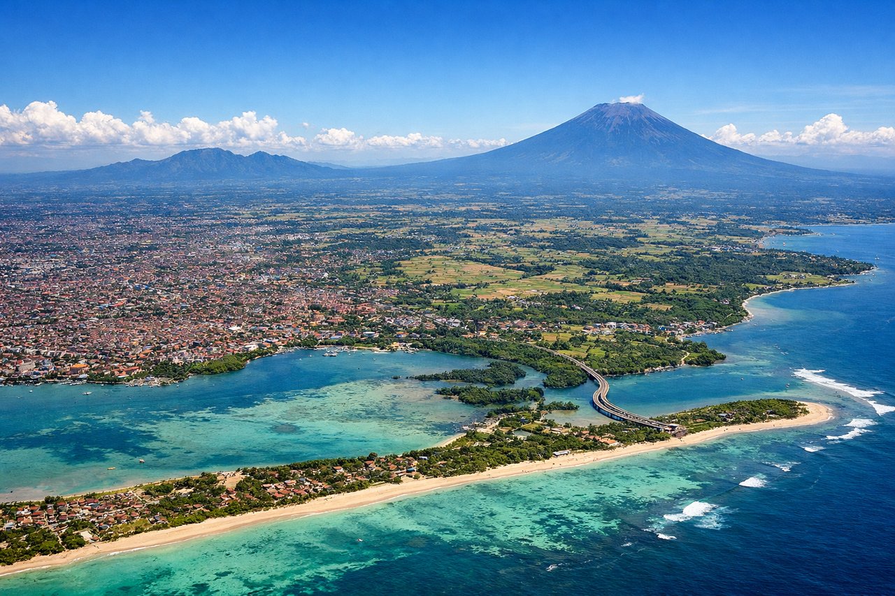
Takeoff from DPS
LEFTLeft seats offer views of Mount Agung and the volcanic ridge system dominating central Bali as you climb westward. The mountain rises dramatically from the terrain immediately after departure and remains visible for several minutes during the initial climb-out phase.
Landing at YIA
RIGHTRight seats provide excellent views of the Merapi-Merbabu volcanic complex and the Progo River valley during descent into Yogyakarta. These mountains form the dramatic western approach to the airport and are clearly visible from 8,000–12,000 feet on final approach.
Will your flight be in sunlight?
Pick a date and time in the Sun Map to watch the sun move across your whole flight.
About This Route
Which side of the plane should I sit on flying from Denpasar I Gusti Ngurah Rai International Airport (DPS) to Yogyakarta International Airport (YIA)?
Sit on the Right side of the plane for the best views on flights from Denpasar to Yogyakarta. While the takeoff offers Mount Agung's drama, the landing approach provides more sustained and visually striking views of the Merapi-Merbabu volcanic pair during a longer descent window. Right seats capture this iconic landscape during the most photogenic phase of the flight.
What can I see during takeoff from Denpasar I Gusti Ngurah Rai International Airport in Denpasar?
During takeoff from Denpasar I Gusti Ngurah Rai International Airport (DPS), sit on the Left side for the best views. Left seats offer views of Mount Agung and the volcanic ridge system dominating central Bali as you climb westward. The mountain rises dramatically from the terrain immediately after departure and remains visible for several minutes during the initial climb-out phase. Notable sights include: Mount Agung (3,142 m), Bali's highest volcano; the Batur caldera complex to the northwest; the Indian Ocean coastline to the south; terraced rice paddies of central Bali.
What can I see when landing at Yogyakarta International Airport in Yogyakarta?
When landing at Yogyakarta International Airport (YIA), sit on the Right side for the best views. Right seats provide excellent views of the Merapi-Merbabu volcanic complex and the Progo River valley during descent into Yogyakarta. These mountains form the dramatic western approach to the airport and are clearly visible from 8,000–12,000 feet on final approach. Notable sights include: Mount Merapi (2,968 m) and Mount Merbabu (3,145 m) volcanic pair; the Progo River valley cutting through lowlands; Yogyakarta city sprawl on the plains; agricultural terraces of the Sleman Regency.
How long is the flight from Denpasar to Yogyakarta?
The flight from Denpasar I Gusti Ngurah Rai International Airport (DPS) to Yogyakarta International Airport (YIA) takes about 1 hour 10 minutes. The shortest flight path between them is 354 miles (570 km); winds and air traffic control usually add a few percent.
What does the Denpasar to Yogyakarta flight path pass over?
The flight crosses the Flores Sea (Laut Flores) between Bali and Java. At cruise altitude, you'll see the narrow Lombok Strait separating Bali from Lombok island to the east (visible on departure), then open water for most of the crossing. As you approach Java, the northern coast of central Java becomes visible with its coastal plains, river deltas, and the beginning of the volcanic arc. The Sunda Strait region lies to the west but is not on this direct route.