Right-side seats offer the most consistent scenic value: excellent views during Des Moines departure over the Missouri River valley and Iowa landscape, and reasonable views during Phoenix descent over the desert terrain and city approach. Left seats favor the landing sequence but miss the scenic departure.
Flown DSM to PHX? Did we get it right?
Flight Path
Des Moines to Phoenix is 1,148 miles (1,847 km), a flight of about 3 hours 30 minutes.
The flight path crosses central Kansas and the Oklahoma Panhandle. Notable features include the Arkansas River valley (visible as a linear green corridor in western Kansas), the High Plains terrain (flat, semi-arid landscape with sparse vegetation), and the transition from agricultural land to shortgrass prairie. The Cimarron River (tributary of the Arkansas) may be visible in the Oklahoma Panhandle as a thin line through the landscape. As the aircraft approaches Arizona, the terrain becomes increasingly arid with visible buttes and mesas near the New Mexico-Arizona border. The Colorado Plateau's southern edge creates subtle topographic changes visible from altitude.
Great circle distance and headings ›

Phase by phase
Takeoff from DSM
RIGHTDes Moines typically departs to the south or southwest. Right-side seats face toward the Missouri River valley and the rolling terrain south of the airport, offering views of the Des Moines metro area receding below and the agricultural landscape that dominates central Iowa.
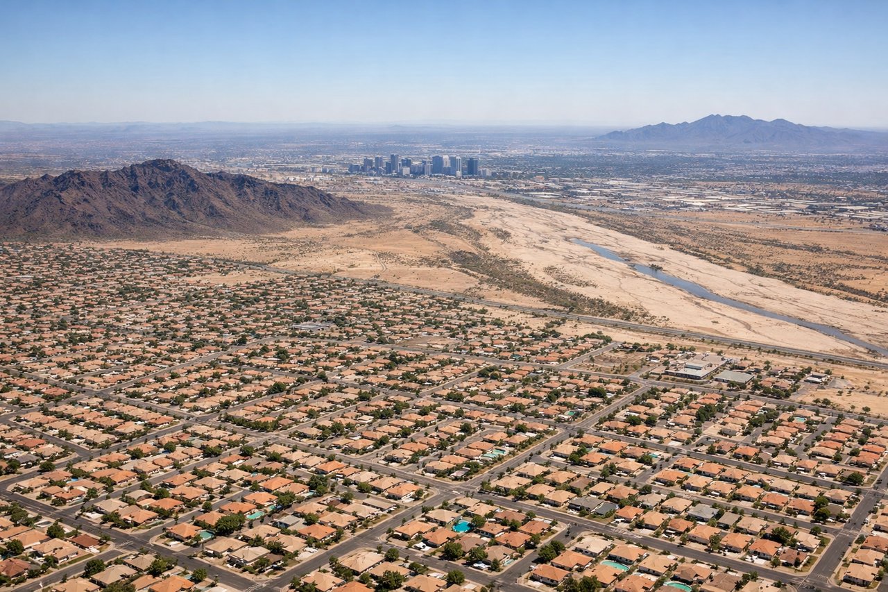
Landing at PHX
LEFTPhoenix Sky Harbor typically lands from the north or northeast. Left-side seats provide views of the Phoenix metropolitan area, the Salt River valley, and the surrounding desert terrain as the aircraft descends toward the airport. The city sprawl and nearby mountain ranges are more prominent on the left approach.
Will your flight be in sunlight?
Pick a date and time in the Sun Map to watch the sun move across your whole flight.
About This Route
Which side of the plane should I sit on flying from Des Moines International (DSM) to Phoenix Sky Harbor International (PHX)?
Sit on the Right side of the plane for the best views on flights from Des Moines to Phoenix. Right-side seats offer the most consistent scenic value: excellent views during Des Moines departure over the Missouri River valley and Iowa landscape, and reasonable views during Phoenix descent over the desert terrain and city approach. Left seats favor the landing sequence but miss the scenic departure.
What can I see during takeoff from Des Moines International in Des Moines?
During takeoff from Des Moines International (DSM), sit on the Right side for the best views. Des Moines typically departs to the south or southwest. Right-side seats face toward the Missouri River valley and the rolling terrain south of the airport, offering views of the Des Moines metro area receding below and the agricultural landscape that dominates central Iowa. Notable sights include: Des Moines downtown skyline, Missouri River (visible as a meandering line south of the airport), Saylorville Lake (reservoir northeast, visible as a bright water body), rolling Iowa farmland in geometric grid patterns.
What can I see when landing at Phoenix Sky Harbor International in Phoenix?
When landing at Phoenix Sky Harbor International (PHX), sit on the Left side for the best views. Phoenix Sky Harbor typically lands from the north or northeast. Left-side seats provide views of the Phoenix metropolitan area, the Salt River valley, and the surrounding desert terrain as the aircraft descends toward the airport. The city sprawl and nearby mountain ranges are more prominent on the left approach. Notable sights include: Phoenix metropolitan area (sprawling urban grid), Salt River valley (low-lying terrain), South Mountain Park (dark ridge visible south of downtown), Sierra Estrella Mountains (distant western range).
How long is the flight from Des Moines to Phoenix?
The flight from Des Moines International (DSM) to Phoenix Sky Harbor International (PHX) takes about 3 hours 30 minutes. The shortest flight path between them is 1,148 miles (1,847 km); winds and air traffic control usually add a few percent.
What does the Des Moines to Phoenix flight path pass over?
The flight path crosses central Kansas and the Oklahoma Panhandle. Notable features include the Arkansas River valley (visible as a linear green corridor in western Kansas), the High Plains terrain (flat, semi-arid landscape with sparse vegetation), and the transition from agricultural land to shortgrass prairie. The Cimarron River (tributary of the Arkansas) may be visible in the Oklahoma Panhandle as a thin line through the landscape. As the aircraft approaches Arizona, the terrain becomes increasingly arid with visible buttes and mesas near the New Mexico-Arizona border. The Colorado Plateau's southern edge creates subtle topographic changes visible from altitude.