While takeoff favors the right, the landing view from the left is more dramatic and geographically significant. Narragansett Bay and Providence's waterfront setting are more visually distinctive than Detroit's river system, and the left side captures this better during approach.
Flown DTW to PVD? Did we get it right?
Flight Path
Detroit to Providence is 613 miles (987 km), a flight of about 2 hours 15 minutes.
The flight path crosses Lake Erie's northern shore (visible if departing eastbound), then passes over Ohio and Pennsylvania. Notable midpoint features include the southern shore of Lake Erie near Cleveland, the Appalachian foothills of eastern Ohio and western Pennsylvania, and the Hudson River valley as you approach New England. The flight generally follows a great-circle route heading east-northeast, crossing from the Midwest's glacial lakes into the Appalachian region before descending into southern New England.
Great circle distance and headings ›

Phase by phase
Takeoff from DTW
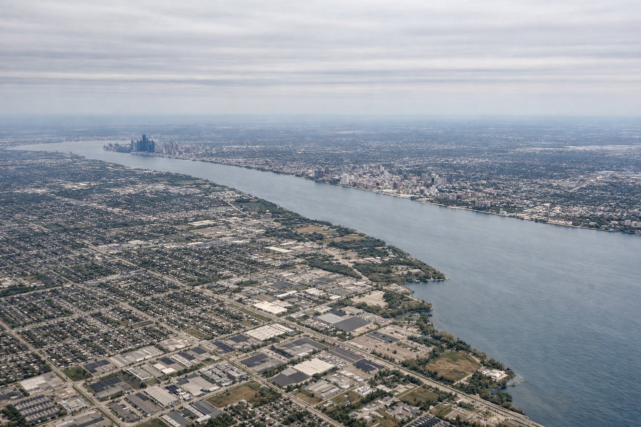
RIGHTRight-side seats capture the Detroit River and Lake St. Clair during initial climb. DTW typically departs runways 3L/3R or 22L/22R; eastbound departures on 3R offer the best water views as you climb over the river system separating Detroit from Windsor, Ontario.
Landing at PVD
LEFTLeft-side seats offer views of Narragansett Bay and Providence's downtown during descent. PVD typically lands on runways 5 or 23; westbound approaches on runway 5 descend over the bay, giving left-side passengers clear views of the water, islands, and the city's location on the bay's northern shore.
Will your flight be in sunlight?
Pick a date and time in the Sun Map to watch the sun move across your whole flight.
About This Route
Which side of the plane should I sit on flying from Detroit Metro Wayne Co (DTW) to Theodore Francis Green State (PVD)?
Sit on the Left side of the plane for the best views on flights from Detroit to Providence. While takeoff favors the right, the landing view from the left is more dramatic and geographically significant. Narragansett Bay and Providence's waterfront setting are more visually distinctive than Detroit's river system, and the left side captures this better during approach.
What can I see during takeoff from Detroit Metro Wayne Co in Detroit?
During takeoff from Detroit Metro Wayne Co (DTW), sit on the Right side for the best views. Right-side seats capture the Detroit River and Lake St. Clair during initial climb. DTW typically departs runways 3L/3R or 22L/22R; eastbound departures on 3R offer the best water views as you climb over the river system separating Detroit from Windsor, Ontario. Notable sights include: Detroit River, Lake St. Clair, Windsor Ontario skyline, Belle Isle.
What can I see when landing at Theodore Francis Green State in Providence?
When landing at Theodore Francis Green State (PVD), sit on the Left side for the best views. Left-side seats offer views of Narragansett Bay and Providence's downtown during descent. PVD typically lands on runways 5 or 23; westbound approaches on runway 5 descend over the bay, giving left-side passengers clear views of the water, islands, and the city's location on the bay's northern shore. Notable sights include: Narragansett Bay, Providence downtown, Conanicut Island, Mount Hope Bridge.
How long is the flight from Detroit to Providence?
The flight from Detroit Metro Wayne Co (DTW) to Theodore Francis Green State (PVD) takes about 2 hours 15 minutes. The shortest flight path between them is 613 miles (987 km); winds and air traffic control usually add a few percent.
What does the Detroit to Providence flight path pass over?
The flight path crosses Lake Erie's northern shore (visible if departing eastbound), then passes over Ohio and Pennsylvania. Notable midpoint features include the southern shore of Lake Erie near Cleveland, the Appalachian foothills of eastern Ohio and western Pennsylvania, and the Hudson River valley as you approach New England. The flight generally follows a great-circle route heading east-northeast, crossing from the Midwest's glacial lakes into the Appalachian region before descending into southern New England.