Detroit to Atlanta is 595 miles (958 km), a flight of about 1 hour 55 minutes.
The left side edges ahead thanks to the Detroit River/Lake Erie views on departure and glimpses of the Appalachian foothills and Cumberland Plateau relief to the east during cruise, giving slightly more topographic variety than the flatter, plains-dominated right side, even though the right side wins the Atlanta skyline approach.
Flight Path
Ohio River valley farmland, Kentucky Bluegrass region, and the low ridgelines of the Cumberland Plateau/Appalachian foothills near the Tennessee-Georgia border, with the Tennessee River valley around Chattanooga visible in the distance to the west.
Great circle distance and headings ›Phase by phase
Takeoff from DTW
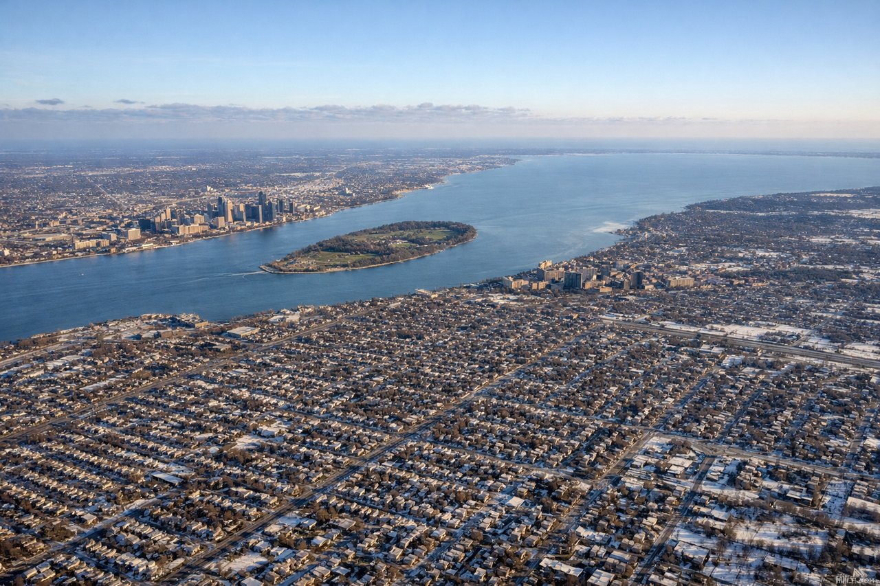
LEFTDeparting DTW under typical northerly-wind operations (runway 22), the aircraft climbs southwest then turns south, putting the Detroit River, western Lake Erie shoreline, and the distant Detroit skyline on the left side before the plane settles onto its southbound track over Ohio farmland.

Landing at ATL
RIGHTArriving at ATL from the north under normal west-flow operations, the aircraft flies south past the city before turning onto a westbound final approach, putting the Atlanta skyline and Buckhead high-rises on the right side of the cabin during the descent.
Landmarks on this routeAll landmarks →
Will your flight be in sunlight?
Pick a date and time in the Sun Map to watch the sun move across your whole flight.
About This Route
Which side of the plane should I sit on flying from Detroit Metro Wayne Co (DTW) to The William B Hartsfield Atlanta International (ATL)?
Sit on the Left side of the plane for the best views on flights from Detroit to Atlanta. The left side edges ahead thanks to the Detroit River/Lake Erie views on departure and glimpses of the Appalachian foothills and Cumberland Plateau relief to the east during cruise, giving slightly more topographic variety than the flatter, plains-dominated right side, even though the right side wins the Atlanta skyline approach.
What can I see during takeoff from Detroit Metro Wayne Co in Detroit?
During takeoff from Detroit Metro Wayne Co (DTW), sit on the Left side for the best views. Departing DTW under typical northerly-wind operations (runway 22), the aircraft climbs southwest then turns south, putting the Detroit River, western Lake Erie shoreline, and the distant Detroit skyline on the left side before the plane settles onto its southbound track over Ohio farmland. Notable sights include: Detroit River, western Lake Erie/Toledo shoreline, distant Detroit downtown skyline, Ohio River-basin farmland patchwork.
What can I see when landing at The William B Hartsfield Atlanta International in Atlanta?
When landing at The William B Hartsfield Atlanta International (ATL), sit on the Right side for the best views. Arriving at ATL from the north under normal west-flow operations, the aircraft flies south past the city before turning onto a westbound final approach, putting the Atlanta skyline and Buckhead high-rises on the right side of the cabin during the descent. Notable sights include: Downtown Atlanta skyline, Buckhead/Midtown high-rise cluster, Chattahoochee River, Piedmont foothills on the horizon.
How long is the flight from Detroit to Atlanta?
The flight from Detroit Metro Wayne Co (DTW) to The William B Hartsfield Atlanta International (ATL) takes about 1 hour 55 minutes. The shortest flight path between them is 595 miles (958 km); winds and air traffic control usually add a few percent.
What does the Detroit to Atlanta flight path pass over?
Ohio River valley farmland, Kentucky Bluegrass region, and the low ridgelines of the Cumberland Plateau/Appalachian foothills near the Tennessee-Georgia border, with the Tennessee River valley around Chattanooga visible in the distance to the west.