The takeoff from Davao offers more visually distinctive features (gulf, islands, mountain backdrop) than the landing approach to Doha, which is primarily flat coastal development and desert.
Flown DVO to DOH? Did we get it right?
Flight Path
Davao to Doha is 5,013 miles (8,068 km), a flight of about 9 hours 55 minutes.
The flight path crosses the Sulu Sea and Celebes Sea, passing over or near Brunei and the northern coast of Borneo (Sabah region). The aircraft then crosses the South China Sea heading northwest toward the Strait of Malacca region before continuing over the Indian Ocean and Arabian Sea toward the Persian Gulf. Notable midpoint landmarks include the Brunei coastline, the mountainous spine of Borneo visible on clear days, and the transition from tropical seas to arid Arabian geography as the aircraft approaches Qatar.
Great circle distance and headings ›


Phase by phase
Takeoff from DVO
RIGHTRight side offers views of Davao Gulf and the Samal Island strait as the aircraft climbs northwest. Left side faces inland terrain with less distinctive visual features during the initial climb-out.
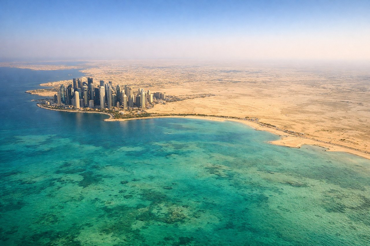
Landing at DOH
LEFTLeft side provides views of Qatar's coastal approach, including the Persian Gulf shoreline and Doha's urban sprawl along the coast. Right side faces inland desert with minimal visual interest during descent.
Will your flight be in sunlight?
Pick a date and time in the Sun Map to watch the sun move across your whole flight.
About This Route
Which side of the plane should I sit on flying from Francisco Bangoy International Airport (DVO) to Hamad International Airport (DOH)?
Sit on the Right side of the plane for the best views on flights from Davao to Doha. The takeoff from Davao offers more visually distinctive features (gulf, islands, mountain backdrop) than the landing approach to Doha, which is primarily flat coastal development and desert.
What can I see during takeoff from Francisco Bangoy International Airport in Davao?
During takeoff from Francisco Bangoy International Airport (DVO), sit on the Right side for the best views. Right side offers views of Davao Gulf and the Samal Island strait as the aircraft climbs northwest. Left side faces inland terrain with less distinctive visual features during the initial climb-out. Notable sights include: Davao Gulf, Samal Island, Mount Apo (visible as a distant peak to the southwest on clear days), Mindanao coastline.
What can I see when landing at Hamad International Airport in Doha?
When landing at Hamad International Airport (DOH), sit on the Left side for the best views. Left side provides views of Qatar's coastal approach, including the Persian Gulf shoreline and Doha's urban sprawl along the coast. Right side faces inland desert with minimal visual interest during descent. Notable sights include: Persian Gulf, Doha waterfront and Corniche district, Qatar's coastal development, The Pearl-Qatar artificial islands (visible as geometric patterns in shallow water).
How long is the flight from Davao to Doha?
The flight from Francisco Bangoy International Airport (DVO) to Hamad International Airport (DOH) takes about 9 hours 55 minutes. The shortest flight path between them is 5,013 miles (8,068 km); winds and air traffic control usually add a few percent.
What does the Davao to Doha flight path pass over?
The flight path crosses the Sulu Sea and Celebes Sea, passing over or near Brunei and the northern coast of Borneo (Sabah region). The aircraft then crosses the South China Sea heading northwest toward the Strait of Malacca region before continuing over the Indian Ocean and Arabian Sea toward the Persian Gulf. Notable midpoint landmarks include the Brunei coastline, the mountainous spine of Borneo visible on clear days, and the transition from tropical seas to arid Arabian geography as the aircraft approaches Qatar.