Right-side seats capture the most visually distinctive scenery: the dramatic Zhangjiajie karst peaks during takeoff are the flight's most striking natural feature. While the landing approach into Beijing is less dramatic, the right side still offers better views of the terrain transition from the Yangtze River basin toward the North China Plain.
Flown DYG to PEK? Did we get it right?
Flight Path
Zhangjiajie to Beijing is 834 miles (1,343 km), a flight of about 2 hours 15 minutes.
The flight path northward crosses the Yangtze River watershed boundary, transitioning from the mountainous terrain of central Hunan Province through Hubei Province's rolling hills and river valleys (including the Han River system), then into the flatter agricultural regions of Henan Province before reaching the North China Plain. The Dabie Mountains appear on the eastern horizon during the mid-flight segment. Major cities visible along the route include Yichang and Wuhan in the middle section of the flight.
Great circle distance and headings ›


Phase by phase
Takeoff from DYG
RIGHTRight-side seats offer immediate views of the Zhangjiajie sandstone peaks as the aircraft climbs northward. The distinctive karst formations of Zhangjiajie National Forest Park dominate the landscape directly beneath and to the right during initial climb-out.
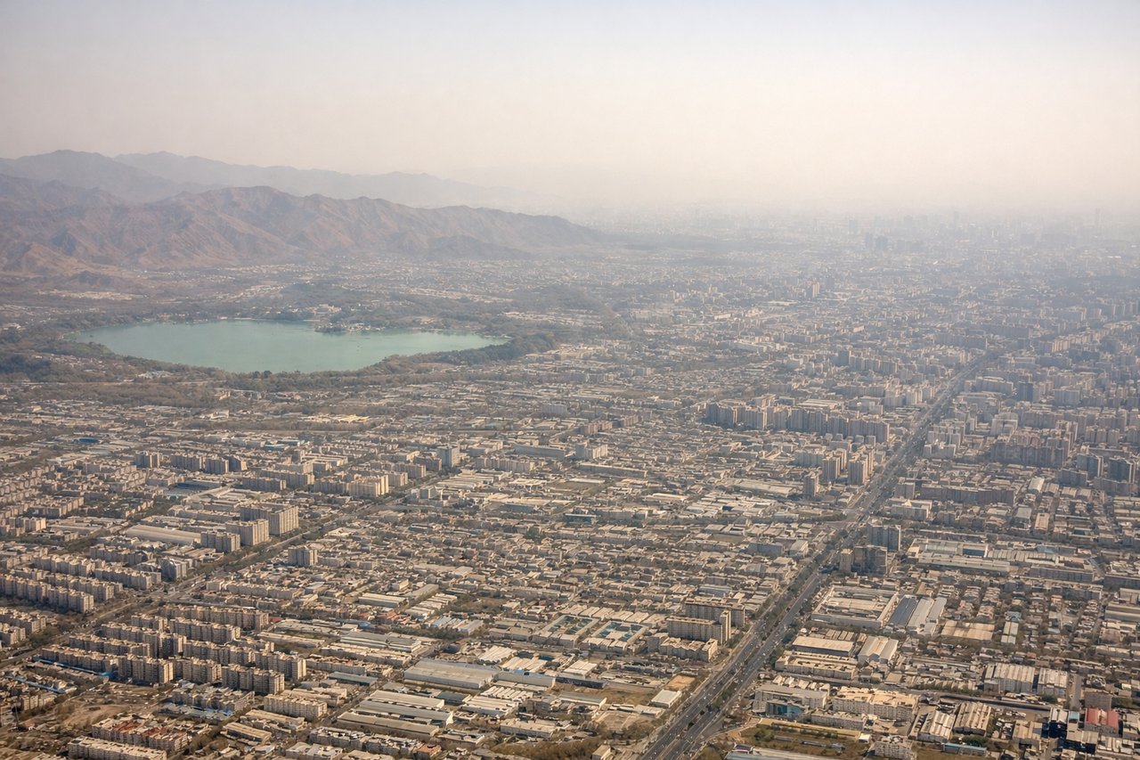
Landing at PEK
LEFTLeft-side seats provide excellent views during the descent approach into Beijing Capital International Airport. The North China Plain becomes visible with the urban sprawl of Beijing's outer districts, and on clear days the Western Hills (Yanshan Mountains) appear on the left horizon as the aircraft descends toward the airport northeast of the city.
Will your flight be in sunlight?
Pick a date and time in the Sun Map to watch the sun move across your whole flight.
About This Route
Which side of the plane should I sit on flying from Zhangjiajie Hehua International Airport (DYG) to Capital (PEK)?
Sit on the Right side of the plane for the best views on flights from Zhangjiajie to Beijing. Right-side seats capture the most visually distinctive scenery: the dramatic Zhangjiajie karst peaks during takeoff are the flight's most striking natural feature. While the landing approach into Beijing is less dramatic, the right side still offers better views of the terrain transition from the Yangtze River basin toward the North China Plain.
What can I see during takeoff from Zhangjiajie Hehua International Airport in Zhangjiajie?
During takeoff from Zhangjiajie Hehua International Airport (DYG), sit on the Right side for the best views. Right-side seats offer immediate views of the Zhangjiajie sandstone peaks as the aircraft climbs northward. The distinctive karst formations of Zhangjiajie National Forest Park dominate the landscape directly beneath and to the right during initial climb-out. Notable sights include: Zhangjiajie National Forest Park (sandstone pillars), Lishui River valley, Yongding District urban area, surrounding forested hills.
What can I see when landing at Capital in Beijing?
When landing at Capital (PEK), sit on the Left side for the best views. Left-side seats provide excellent views during the descent approach into Beijing Capital International Airport. The North China Plain becomes visible with the urban sprawl of Beijing's outer districts, and on clear days the Western Hills (Yanshan Mountains) appear on the left horizon as the aircraft descends toward the airport northeast of the city. Notable sights include: Beijing urban sprawl and ring roads, Yanshan Mountains (western horizon), North China Plain agricultural grid, Chaoyangdistrict and airport approach corridor.
How long is the flight from Zhangjiajie to Beijing?
The flight from Zhangjiajie Hehua International Airport (DYG) to Capital (PEK) takes about 2 hours 15 minutes. The shortest flight path between them is 834 miles (1,343 km); winds and air traffic control usually add a few percent.
What does the Zhangjiajie to Beijing flight path pass over?
The flight path northward crosses the Yangtze River watershed boundary, transitioning from the mountainous terrain of central Hunan Province through Hubei Province's rolling hills and river valleys (including the Han River system), then into the flatter agricultural regions of Henan Province before reaching the North China Plain. The Dabie Mountains appear on the eastern horizon during the mid-flight segment. Major cities visible along the route include Yichang and Wuhan in the middle section of the flight.