Right side scores higher due to the dramatic Andean mountain approach during landing, which provides exceptional visual variety and terrain drama. While both sides offer modest takeoff scenery from Panama City Beach, the right side's arrival sequence over the Colombian highlands and Bogotá's high-altitude setting creates a more memorable and geographically distinctive flight experience. The left side remains relatively flat and featureless throughout most of the journey.
Flown ECP to BOG? Did we get it right?
Flight Path
Panama City Beach to Bogota is 1,928 miles (3,103 km), a flight of about 5 hours 15 minutes.
Caribbean coast of Central America (Honduras/Nicaragua border region), Yucatán Peninsula to the south, transition from Caribbean lowlands to Central American highlands, then descent into Colombian Pacific coastal plains before final climb to Andean plateau
Great circle distance and headings ›Phase by phase
Takeoff from ECP
RIGHTRight side captures Panama City Beach's coastal development and the Gulf of Mexico shoreline during initial climb. Left side faces inland toward flat pine forests with minimal visual interest during departure.
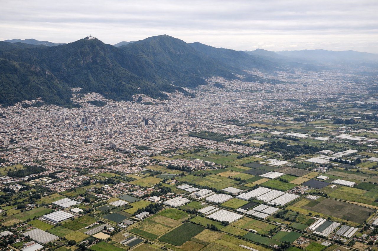
Landing at BOG
RIGHTRight side offers the dramatic Andean approach to Bogotá. The eastern cordillera rises steeply from the savanna, with the city nestled in the high plateau at 2,640 meters elevation. Left side shows only the western approaches over flat terrain with minimal topographic interest.
Will your flight be in sunlight?
Pick a date and time in the Sun Map to watch the sun move across your whole flight.
About This Route
Which side of the plane should I sit on flying from Northwest Florida Beaches International Airport (ECP) to Eldorado International (BOG)?
Sit on the Right side of the plane for the best views on flights from Panama City Beach to Bogota. Right side scores higher due to the dramatic Andean mountain approach during landing, which provides exceptional visual variety and terrain drama. While both sides offer modest takeoff scenery from Panama City Beach, the right side's arrival sequence over the Colombian highlands and Bogotá's high-altitude setting creates a more memorable and geographically distinctive flight experience. The left side remains relatively flat and featureless throughout most of the journey.
What can I see during takeoff from Northwest Florida Beaches International Airport in Panama City Beach?
During takeoff from Northwest Florida Beaches International Airport (ECP), sit on the Right side for the best views. Right side captures Panama City Beach's coastal development and the Gulf of Mexico shoreline during initial climb. Left side faces inland toward flat pine forests with minimal visual interest during departure. Notable sights include: Panama City Beach waterfront and harbor, Gulf of Mexico coastline, St. Andrew Bay.
What can I see when landing at Eldorado International in Bogota?
When landing at Eldorado International (BOG), sit on the Right side for the best views. Right side offers the dramatic Andean approach to Bogotá. The eastern cordillera rises steeply from the savanna, with the city nestled in the high plateau at 2,640 meters elevation. Left side shows only the western approaches over flat terrain with minimal topographic interest. Notable sights include: Eastern Cordillera of the Colombian Andes, Bogotá high plateau (Altiplano Cundiboyacense), city sprawl of Bogotá, surrounding mountain ridges.
How long is the flight from Panama City Beach to Bogota?
The flight from Northwest Florida Beaches International Airport (ECP) to Eldorado International (BOG) takes about 5 hours 15 minutes. The shortest flight path between them is 1,928 miles (3,103 km); winds and air traffic control usually add a few percent.
What does the Panama City Beach to Bogota flight path pass over?
Caribbean coast of Central America (Honduras/Nicaragua border region), Yucatán Peninsula to the south, transition from Caribbean lowlands to Central American highlands, then descent into Colombian Pacific coastal plains before final climb to Andean plateau