Anchorage to Phoenix is 2,546 miles (4,097 km), a flight of about 5 hours 45 minutes.
The left side delivers the more dramatic scenery overall. The Chugach Mountains on departure are genuinely spectacular, and through the flight the left side tracks closer to the Alaska Range remnants, the Canadian Rockies in British Columbia, and eventually the Sierra Nevada and Mojave terrain. The Phoenix arrival on the right is good but relatively brief.
Flight Path
The route crosses the Alaska Range foothills south of Anchorage, then tracks southeast over the Coast Mountains of British Columbia, the interior of Washington and Oregon with the Cascade volcanoes visible including Mount Rainier and Mount Hood, then into Nevada desert basin-and-range terrain, and finally the Mojave Desert before descending into the Phoenix basin.
Great circle distance and headings ›

.jpeg?width=600)
Phase by phase
Takeoff from EDF
LEFTElmendorf typically departs south on runway 06/24 or uses runway 34, and a southbound departure puts the left side facing east toward the Chugach Mountains and the Knik Arm of Cook Inlet. The left seat gets a direct view of the Chugach Range rising dramatically behind Anchorage and the sprawling mudflats of Turnagain Arm.
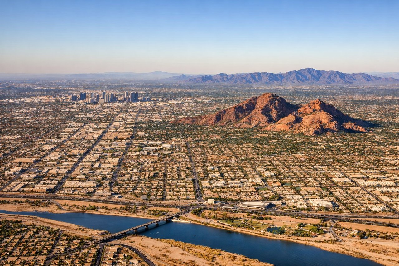
Landing at PHX
RIGHTPhoenix Sky Harbor primarily uses runways 8/26 and 7R/25L, with arrivals typically from the west or east. On a flight arriving from the north, aircraft generally approach from the northeast on runway 26, putting the right side facing south and west over the Salt River valley, South Mountain Park, and the Phoenix metro grid. The right seat also catches Camelback Mountain and the distinctive desert basin topography.
Landmarks on this routeAll landmarks →
Will your flight be in sunlight?
Pick a date and time in the Sun Map to watch the sun move across your whole flight.
About This Route
Which side of the plane should I sit on flying from Elmendorf Afb (EDF) to Phoenix Sky Harbor International (PHX)?
Sit on the Left side of the plane for the best views on flights from Anchorage to Phoenix. The left side delivers the more dramatic scenery overall. The Chugach Mountains on departure are genuinely spectacular, and through the flight the left side tracks closer to the Alaska Range remnants, the Canadian Rockies in British Columbia, and eventually the Sierra Nevada and Mojave terrain. The Phoenix arrival on the right is good but relatively brief.
What can I see during takeoff from Elmendorf Afb in Anchorage?
During takeoff from Elmendorf Afb (EDF), sit on the Left side for the best views. Elmendorf typically departs south on runway 06/24 or uses runway 34, and a southbound departure puts the left side facing east toward the Chugach Mountains and the Knik Arm of Cook Inlet. The left seat gets a direct view of the Chugach Range rising dramatically behind Anchorage and the sprawling mudflats of Turnagain Arm. Notable sights include: Chugach Mountains, Knik Arm mudflats, downtown Anchorage grid, Turnagain Arm.
What can I see when landing at Phoenix Sky Harbor International in Phoenix?
When landing at Phoenix Sky Harbor International (PHX), sit on the Right side for the best views. Phoenix Sky Harbor primarily uses runways 8/26 and 7R/25L, with arrivals typically from the west or east. On a flight arriving from the north, aircraft generally approach from the northeast on runway 26, putting the right side facing south and west over the Salt River valley, South Mountain Park, and the Phoenix metro grid. The right seat also catches Camelback Mountain and the distinctive desert basin topography. Notable sights include: South Mountain Park, Camelback Mountain, Salt River bed, Phoenix metro grid.
How long is the flight from Anchorage to Phoenix?
The flight from Elmendorf Afb (EDF) to Phoenix Sky Harbor International (PHX) takes about 5 hours 45 minutes. The shortest flight path between them is 2,546 miles (4,097 km); winds and air traffic control usually add a few percent.
What does the Anchorage to Phoenix flight path pass over?
The route crosses the Alaska Range foothills south of Anchorage, then tracks southeast over the Coast Mountains of British Columbia, the interior of Washington and Oregon with the Cascade volcanoes visible including Mount Rainier and Mount Hood, then into Nevada desert basin-and-range terrain, and finally the Mojave Desert before descending into the Phoenix basin.