Phoenix to Anchorage is 2,546 miles (4,097 km), a flight of about 4 hours 45 minutes.
While the Phoenix departure offers desert scenery, the Anchorage arrival on the right side provides more dramatic and distinctive views of the Chugach Mountains and Alaska's coastal geography, which are more visually striking than the relatively flat desert climb-out.
Flight Path
The flight path northwestward crosses the Colorado Plateau (visible as elevated terrain with subtle color variations), then transitions into the Great Basin. Over Nevada and Oregon, the landscape becomes increasingly sparse with isolated mountain ranges and vast open terrain. As the aircraft approaches the Pacific Northwest, the Cascade Range becomes visible on the left (west) side. The flight then crosses into Alaska airspace, with the Alaska Range visible in the distance before descending toward Anchorage. The entire route offers views of progressively more remote and mountainous terrain, with the most dramatic scenery occurring in the final descent phase over the Chugach Mountains.
Great circle distance and headings ›.jpeg?width=600)


Phase by phase
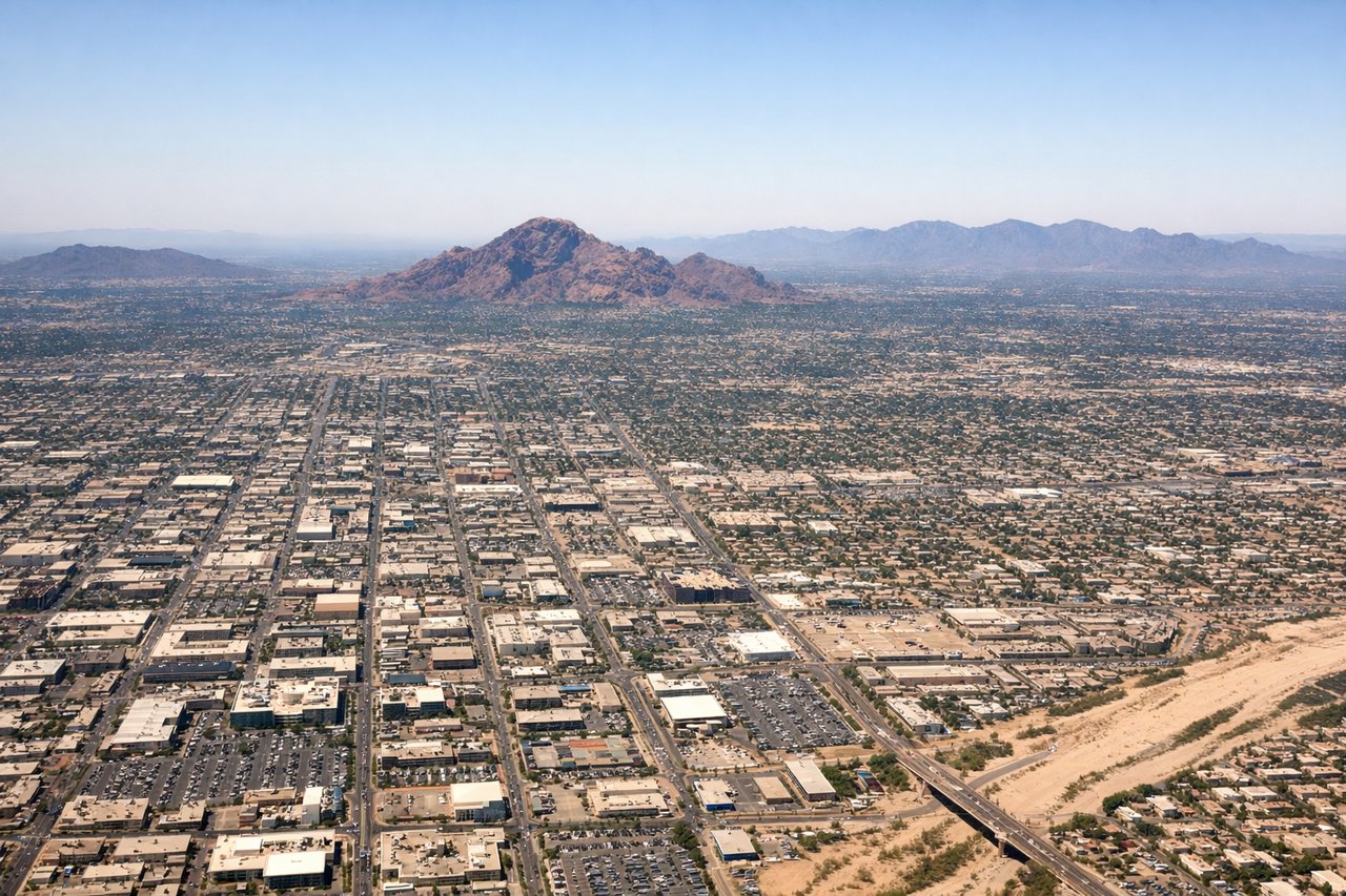
Takeoff from PHX
LEFTLeft side offers views of the Salt River Mountains and the Phoenix metropolitan area spreading eastward. The climb-out path northbound provides excellent perspective of the Sonoran Desert terrain and the city grid below.
Landing at EDF
RIGHTRight side captures the approach over the Chugach Mountains and Knik Arm as the aircraft descends into Anchorage. This provides dramatic views of Alaska's coastal geography and the transition from mountains to the urban area.
Landmarks on this routeAll landmarks →
Will your flight be in sunlight?
Pick a date and time in the Sun Map to watch the sun move across your whole flight.
About This Route
Which side of the plane should I sit on flying from Phoenix Sky Harbor International (PHX) to Elmendorf Afb (EDF)?
Sit on the Right side of the plane for the best views on flights from Phoenix to Anchorage. While the Phoenix departure offers desert scenery, the Anchorage arrival on the right side provides more dramatic and distinctive views of the Chugach Mountains and Alaska's coastal geography, which are more visually striking than the relatively flat desert climb-out.
What can I see during takeoff from Phoenix Sky Harbor International in Phoenix?
During takeoff from Phoenix Sky Harbor International (PHX), sit on the Left side for the best views. Left side offers views of the Salt River Mountains and the Phoenix metropolitan area spreading eastward. The climb-out path northbound provides excellent perspective of the Sonoran Desert terrain and the city grid below. Notable sights include: Salt River Mountains, Phoenix downtown skyline, Sonoran Desert scrubland, Lake Pleasant (visible on clear days to the northeast).
What can I see when landing at Elmendorf Afb in Anchorage?
When landing at Elmendorf Afb (EDF), sit on the Right side for the best views. Right side captures the approach over the Chugach Mountains and Knik Arm as the aircraft descends into Anchorage. This provides dramatic views of Alaska's coastal geography and the transition from mountains to the urban area. Notable sights include: Chugach Mountains, Knik Arm (tidal inlet), Cook Inlet, Anchorage downtown and port facilities.
How long is the flight from Phoenix to Anchorage?
The flight from Phoenix Sky Harbor International (PHX) to Elmendorf Afb (EDF) takes about 4 hours 45 minutes. The shortest flight path between them is 2,546 miles (4,097 km); winds and air traffic control usually add a few percent.
What does the Phoenix to Anchorage flight path pass over?
The flight path northwestward crosses the Colorado Plateau (visible as elevated terrain with subtle color variations), then transitions into the Great Basin. Over Nevada and Oregon, the landscape becomes increasingly sparse with isolated mountain ranges and vast open terrain. As the aircraft approaches the Pacific Northwest, the Cascade Range becomes visible on the left (west) side. The flight then crosses into Alaska airspace, with the Alaska Range visible in the distance before descending toward Anchorage. The entire route offers views of progressively more remote and mountainous terrain, with the most dramatic scenery occurring in the final descent phase over the Chugach Mountains.