While takeoff favors the right for Dordogne valley scenery, the landing view from the left—featuring the Thames, Isle of Dogs, and London's iconic skyline—is more memorable and visually distinctive for most passengers.
Flight Path
The flight path crosses the English Channel roughly between Normandy and Sussex. At cruise altitude (around 15,000-25,000 feet), the Channel itself is visible as a wide body of water with shipping lanes. The Normandy coast (cliffs near Étretat or Honfleur) may be visible on the left during climb-out if flying a northern routing. The Sussex and Kent coastlines appear as the aircraft descends toward London, with the South Downs visible inland as a ridge of higher terrain running east-west.
Great circle distance and headings ›Phase by phase
Takeoff from EGC
RIGHTBergerac typically departs to the north or northeast. Right-side seats offer views of the Dordogne River valley and the rolling hills of Périgord as you climb out, with the river's distinctive meanders visible below.
Landing at LCY
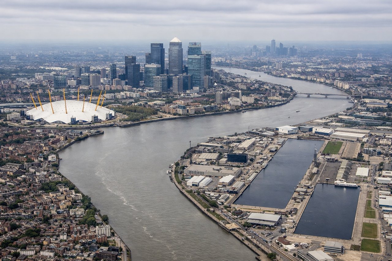
LEFTCity Airport uses the Thames for approach alignment. Left-side seats provide excellent views of the Thames estuary, the Isle of Dogs, and central London's skyline during descent into LCY, especially on easterly approaches.
Landmarks on this routeAll landmarks →
Will your flight be in sunlight?
See exactly which side of the plane gets sun and shade at your departure time.
About This Route
Which side of the plane should I sit on flying from Roumaniere (EGC) to City (LCY)?
Sit on the Left side of the plane for the best views on flights from Bergerac to London. While takeoff favors the right for Dordogne valley scenery, the landing view from the left—featuring the Thames, Isle of Dogs, and London's iconic skyline—is more memorable and visually distinctive for most passengers.
What can I see during takeoff from Roumaniere in Bergerac?
During takeoff from Roumaniere (EGC), sit on the Right side for the best views. Bergerac typically departs to the north or northeast. Right-side seats offer views of the Dordogne River valley and the rolling hills of Périgord as you climb out, with the river's distinctive meanders visible below. Notable sights include: Dordogne River (winding through agricultural valleys), Périgord limestone plateaus, Bergerac town and surrounding vineyards, forested hills to the east.
What can I see when landing at City in London?
When landing at City (LCY), sit on the Left side for the best views. City Airport uses the Thames for approach alignment. Left-side seats provide excellent views of the Thames estuary, the Isle of Dogs, and central London's skyline during descent into LCY, especially on easterly approaches. Notable sights include: River Thames (wide and tidal in this section), Isle of Dogs peninsula, Canary Wharf towers, central London skyline with St. Paul's Cathedral visible on clear days.
How long is the flight from Bergerac to London?
The flight from Roumaniere (EGC) to City (LCY) takes Approximately 2 hours 15 minutes.
What does the Bergerac to London flight path pass over?
The flight path crosses the English Channel roughly between Normandy and Sussex. At cruise altitude (around 15,000-25,000 feet), the Channel itself is visible as a wide body of water with shipping lanes. The Normandy coast (cliffs near Étretat or Honfleur) may be visible on the left during climb-out if flying a northern routing. The Sussex and Kent coastlines appear as the aircraft descends toward London, with the South Downs visible inland as a ridge of higher terrain running east-west.