El Paso to Denver is 564 miles (908 km), a flight of about 1 hour 55 minutes.
Left side wins both ends of the flight. During the cruise over New Mexico and southern Colorado, the left side also tracks closer to the Sangre de Cristo Mountains and the San Luis Valley, giving you a better view of the high terrain throughout the flight.
Flight Path
The flight tracks north-northeast over the Tularosa Basin and White Sands area of New Mexico, then over the Rio Grande valley near Truth or Consequences, the Jemez Mountains and Taos Plateau volcanic field, the San Luis Valley — a broad flat graben flanked by the Sangre de Cristo Mountains to the east and San Juan Mountains to the west — and finally the southern Colorado high plains before descending into Denver
Great circle distance and headings ›Phase by phase
Takeoff from ELP
LEFTEl Paso typically departs northeast on runway 04, so the left (west/northwest) side gives you the Franklin Mountains rising directly above the city, plus the Rio Grande valley and Ciudad Juárez spreading out below. The contrast between the urban sprawl and the sharp desert ridgeline is striking.
Landing at DEN
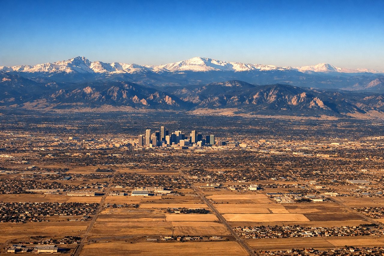
LEFTDenver typically lands from the north or east on runways oriented northeast-southwest, with final approach from the northeast. The left side gives a clear view of the entire Front Range — from Pikes Peak in the south to Longs Peak in the north — as the aircraft descends over the plains toward DEN. The Rocky Mountain wall is dramatically laid out along the western horizon.
Landmarks on this routeAll landmarks →
Will your flight be in sunlight?
Pick a date and time in the Sun Map to watch the sun move across your whole flight.
About This Route
Which side of the plane should I sit on flying from El Paso International (ELP) to Denver International (DEN)?
Sit on the Left side of the plane for the best views on flights from El Paso to Denver. Left side wins both ends of the flight. During the cruise over New Mexico and southern Colorado, the left side also tracks closer to the Sangre de Cristo Mountains and the San Luis Valley, giving you a better view of the high terrain throughout the flight.
What can I see during takeoff from El Paso International in El Paso?
During takeoff from El Paso International (ELP), sit on the Left side for the best views. El Paso typically departs northeast on runway 04, so the left (west/northwest) side gives you the Franklin Mountains rising directly above the city, plus the Rio Grande valley and Ciudad Juárez spreading out below. The contrast between the urban sprawl and the sharp desert ridgeline is striking. Notable sights include: Franklin Mountains State Park ridgeline, Rio Grande corridor and Ciudad Juárez, El Paso urban grid, Hueco Tanks area to the east visible from left rear.
What can I see when landing at Denver International in Denver?
When landing at Denver International (DEN), sit on the Left side for the best views. Denver typically lands from the north or east on runways oriented northeast-southwest, with final approach from the northeast. The left side gives a clear view of the entire Front Range — from Pikes Peak in the south to Longs Peak in the north — as the aircraft descends over the plains toward DEN. The Rocky Mountain wall is dramatically laid out along the western horizon. Notable sights include: Front Range including Pikes Peak, Mount Evans, and Longs Peak, Denver city skyline, Denver International Airport's white tent roof structure, South Platte River corridor.
How long is the flight from El Paso to Denver?
The flight from El Paso International (ELP) to Denver International (DEN) takes about 1 hour 55 minutes. The shortest flight path between them is 564 miles (908 km); winds and air traffic control usually add a few percent.
What does the El Paso to Denver flight path pass over?
The flight tracks north-northeast over the Tularosa Basin and White Sands area of New Mexico, then over the Rio Grande valley near Truth or Consequences, the Jemez Mountains and Taos Plateau volcanic field, the San Luis Valley — a broad flat graben flanked by the Sangre de Cristo Mountains to the east and San Juan Mountains to the west — and finally the southern Colorado high plains before descending into Denver