El Paso to Seattle is 1,368 miles (2,201 km), a flight of about 3 hours 30 minutes.
The left side wins both ends of this flight. Departing El Paso you get the Rio Grande border crossing and Franklin Mountains, and arriving into Seattle you get Mount Rainier, Lake Washington, and the downtown skyline. During the cruise over Nevada and Oregon the left side also tends to face the Cascade and Sierra Nevada ranges as the route tracks northwest.
Flight Path
The route typically tracks northwest over southern New Mexico, then across central Arizona or Nevada, passing near the Great Basin desert. Over Nevada you may see the Ruby Mountains or Humboldt Range. Crossing into Oregon, the high desert gives way to the Cascade Range with peaks like Crater Lake area, Mount Jefferson, and Mount Hood visible depending on exact routing. The Columbia River Gorge may be visible before entering Washington state.
Great circle distance and headings ›.jpg?width=600)

.jpg?width=600)


Phase by phase
Takeoff from ELP
LEFTEl Paso typically departs northwest on Runway 26L/R, putting the left side facing south toward the Franklin Mountains and the Rio Grande valley. You get a clear look at downtown El Paso and Ciudad Juárez sprawling across the border, with the Rio Grande snaking between them.
Landing at SEA
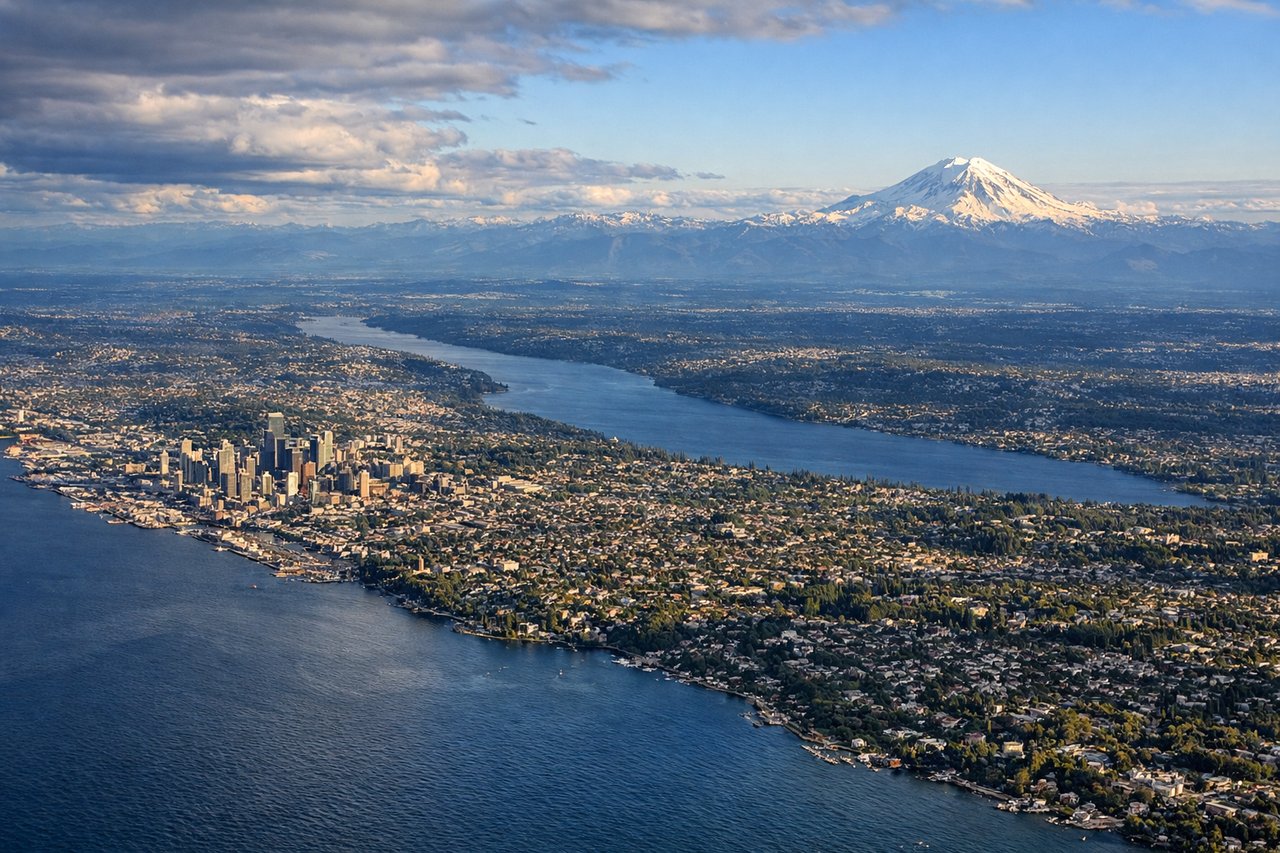
LEFTSeaTac primarily uses runways oriented north-south (16L/R, 34L/R). On a southerly approach from the north, the left side faces east toward Mount Rainier, which dominates the horizon on clear days. The left side also captures Puget Sound, the Seattle skyline, and the Cascade foothills as you descend.
Landmarks on this routeAll landmarks →
Will your flight be in sunlight?
Pick a date and time in the Sun Map to watch the sun move across your whole flight.
About This Route
Which side of the plane should I sit on flying from El Paso International (ELP) to Seattle Tacoma International (SEA)?
Sit on the Left side of the plane for the best views on flights from El Paso to Seattle. The left side wins both ends of this flight. Departing El Paso you get the Rio Grande border crossing and Franklin Mountains, and arriving into Seattle you get Mount Rainier, Lake Washington, and the downtown skyline. During the cruise over Nevada and Oregon the left side also tends to face the Cascade and Sierra Nevada ranges as the route tracks northwest.
What can I see during takeoff from El Paso International in El Paso?
During takeoff from El Paso International (ELP), sit on the Left side for the best views. El Paso typically departs northwest on Runway 26L/R, putting the left side facing south toward the Franklin Mountains and the Rio Grande valley. You get a clear look at downtown El Paso and Ciudad Juárez sprawling across the border, with the Rio Grande snaking between them. Notable sights include: Franklin Mountains State Park, Rio Grande/US-Mexico border, Ciudad Juárez urban grid, Hueco Tanks rock formations to the east.
What can I see when landing at Seattle Tacoma International in Seattle?
When landing at Seattle Tacoma International (SEA), sit on the Left side for the best views. SeaTac primarily uses runways oriented north-south (16L/R, 34L/R). On a southerly approach from the north, the left side faces east toward Mount Rainier, which dominates the horizon on clear days. The left side also captures Puget Sound, the Seattle skyline, and the Cascade foothills as you descend. Notable sights include: Mount Rainier (14,411 ft), Seattle downtown skyline, Puget Sound, Lake Washington.
How long is the flight from El Paso to Seattle?
The flight from El Paso International (ELP) to Seattle Tacoma International (SEA) takes about 3 hours 30 minutes. The shortest flight path between them is 1,368 miles (2,201 km); winds and air traffic control usually add a few percent.
What does the El Paso to Seattle flight path pass over?
The route typically tracks northwest over southern New Mexico, then across central Arizona or Nevada, passing near the Great Basin desert. Over Nevada you may see the Ruby Mountains or Humboldt Range. Crossing into Oregon, the high desert gives way to the Cascade Range with peaks like Crater Lake area, Mount Jefferson, and Mount Hood visible depending on exact routing. The Columbia River Gorge may be visible before entering Washington state.