Seattle to El Paso is 1,368 miles (2,201 km), a flight of about 2 hours 55 minutes.
Left side wins at both ends of the flight. During the cruise south-southeast through Oregon, Nevada, and into the Chihuahuan Desert, the left side also faces east toward the High Cascades, the Great Basin ranges, and eventually the Sacramento Mountains of New Mexico — consistently more dramatic terrain than the flatter western views on the right side.
Flight Path
The flight tracks south-southeast over the Oregon Cascades including the Three Sisters volcanic peaks, then crosses the high desert of the Great Basin in southern Oregon and northern Nevada, passes over the Snake River Plain region, transitions into the Basin and Range terrain of southern Idaho and Nevada, crosses into Arizona or New Mexico airspace over the Sonoran and Chihuahuan Desert transition zone, with the Sacramento Mountains and Guadalupe Mountains visible on the left side before descent into El Paso.
Great circle distance and headings ›

.jpg?width=600)

.jpg?width=600)
Phase by phase
Takeoff from SEA
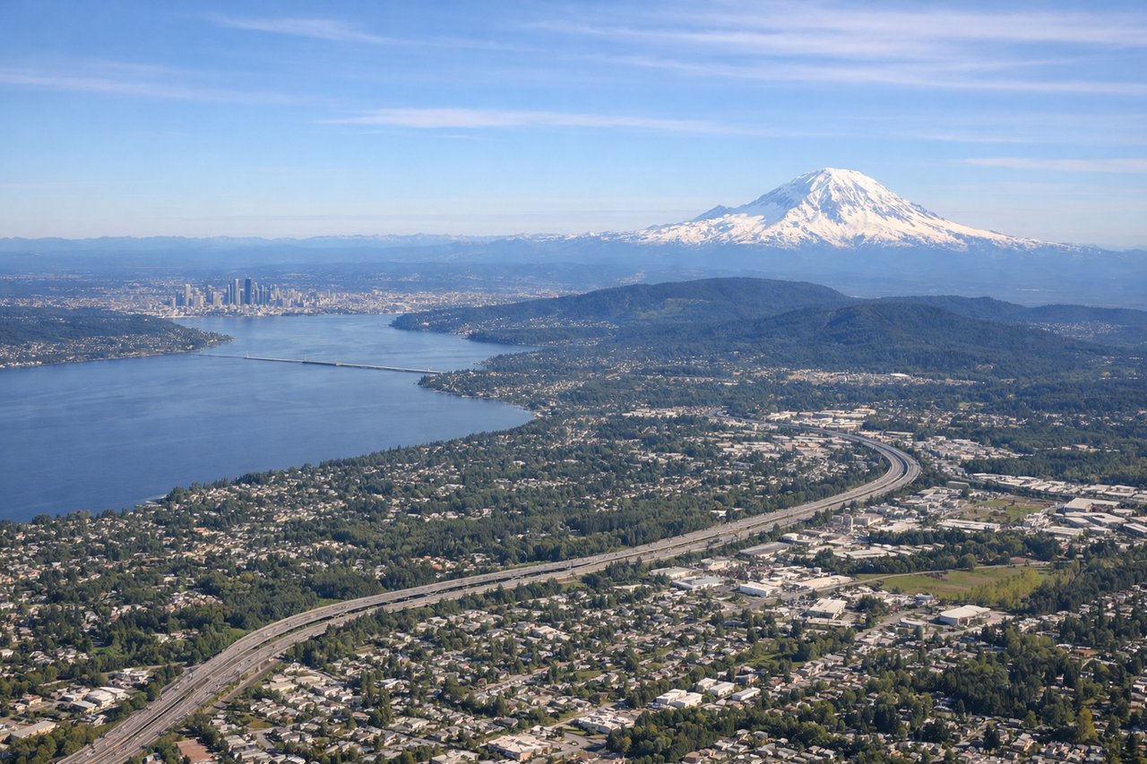
LEFTSEA's primary departure runway 16L/16R sends aircraft southbound, and a left-side seat faces east toward the Cascade Range. You get a clear view of Mount Rainier dominating the skyline, with the Seattle metro and Lake Washington visible during the initial climb.
Landing at ELP
LEFTEl Paso typically uses runway 04/22 or 08/26. On approach from the northwest, a left-side seat faces south toward the Franklin Mountains and the Rio Grande valley, with Ciudad Juárez spread across the Mexican side of the border directly visible. The contrast between the desert basin and the mountain spine is striking on final approach.
Landmarks on this routeAll landmarks →
Will your flight be in sunlight?
Pick a date and time in the Sun Map to watch the sun move across your whole flight.
About This Route
Which side of the plane should I sit on flying from Seattle Tacoma International (SEA) to El Paso International (ELP)?
Sit on the Left side of the plane for the best views on flights from Seattle to El Paso. Left side wins at both ends of the flight. During the cruise south-southeast through Oregon, Nevada, and into the Chihuahuan Desert, the left side also faces east toward the High Cascades, the Great Basin ranges, and eventually the Sacramento Mountains of New Mexico — consistently more dramatic terrain than the flatter western views on the right side.
What can I see during takeoff from Seattle Tacoma International in Seattle?
During takeoff from Seattle Tacoma International (SEA), sit on the Left side for the best views. SEA's primary departure runway 16L/16R sends aircraft southbound, and a left-side seat faces east toward the Cascade Range. You get a clear view of Mount Rainier dominating the skyline, with the Seattle metro and Lake Washington visible during the initial climb. Notable sights include: Mount Rainier, Lake Washington, Seattle city skyline, Cascade Range foothills.
What can I see when landing at El Paso International in El Paso?
When landing at El Paso International (ELP), sit on the Left side for the best views. El Paso typically uses runway 04/22 or 08/26. On approach from the northwest, a left-side seat faces south toward the Franklin Mountains and the Rio Grande valley, with Ciudad Juárez spread across the Mexican side of the border directly visible. The contrast between the desert basin and the mountain spine is striking on final approach. Notable sights include: Franklin Mountains, Rio Grande, Ciudad Juárez, Chihuahuan Desert basin.
How long is the flight from Seattle to El Paso?
The flight from Seattle Tacoma International (SEA) to El Paso International (ELP) takes about 2 hours 55 minutes. The shortest flight path between them is 1,368 miles (2,201 km); winds and air traffic control usually add a few percent.
What does the Seattle to El Paso flight path pass over?
The flight tracks south-southeast over the Oregon Cascades including the Three Sisters volcanic peaks, then crosses the high desert of the Great Basin in southern Oregon and northern Nevada, passes over the Snake River Plain region, transitions into the Basin and Range terrain of southern Idaho and Nevada, crosses into Arizona or New Mexico airspace over the Sonoran and Chihuahuan Desert transition zone, with the Sacramento Mountains and Guadalupe Mountains visible on the left side before descent into El Paso.