El Paso to Chicago is 1,235 miles (1,987 km), a flight of about 2 hours 55 minutes.
Left side wins both ends of the flight. The Franklin Mountains and Juárez border panorama at departure and the Chicago lakefront skyline on approach make the left side consistently more rewarding. Mid-flight over the Great Plains the views are similar on both sides, so the decisive moments favor left.
Flight Path
The route crosses the Chihuahuan Desert into New Mexico, then tracks northeast over the Texas Panhandle and into Kansas and Missouri. Visible features include the flat agricultural patchwork of the High Plains with center-pivot irrigation circles clearly visible, the Arkansas River valley in Kansas, and eventually the Missouri River before entering Illinois. The terrain is predominantly flat and featureless at altitude through this central section, with the geometric grid of farmland being the dominant visual.
Great circle distance and headings ›.jpg?width=600)


Phase by phase
Takeoff from ELP
LEFTEl Paso typically departs northeast on runway 04, putting the Franklin Mountains and the Rio Grande valley on the left side. You get a clear look at the Franklin Mountains rising sharply from the city and the dense urban grid of Juárez, Mexico just across the river.
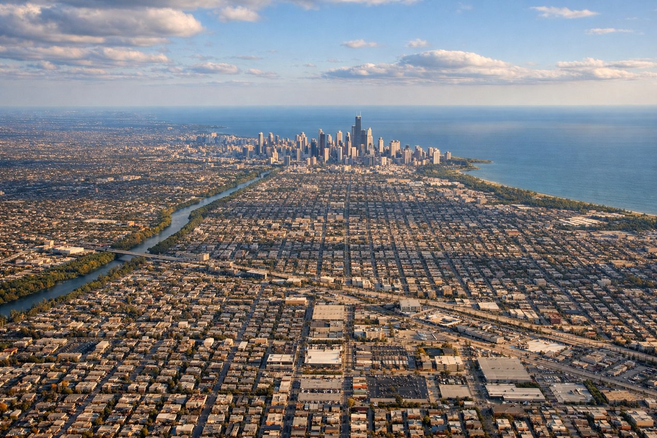
Landing at ORD
LEFTO'Hare predominantly uses runways oriented east-west and northwest-southeast; approaches from the southwest put Lake Michigan and the Chicago lakefront on the left side. You get a sweeping view of the downtown skyline, Grant Park, and the lake as the aircraft descends over the western suburbs.
Landmarks on this routeAll landmarks →
Will your flight be in sunlight?
Pick a date and time in the Sun Map to watch the sun move across your whole flight.
About This Route
Which side of the plane should I sit on flying from El Paso International (ELP) to Chicago Ohare International (ORD)?
Sit on the Left side of the plane for the best views on flights from El Paso to Chicago. Left side wins both ends of the flight. The Franklin Mountains and Juárez border panorama at departure and the Chicago lakefront skyline on approach make the left side consistently more rewarding. Mid-flight over the Great Plains the views are similar on both sides, so the decisive moments favor left.
What can I see during takeoff from El Paso International in El Paso?
During takeoff from El Paso International (ELP), sit on the Left side for the best views. El Paso typically departs northeast on runway 04, putting the Franklin Mountains and the Rio Grande valley on the left side. You get a clear look at the Franklin Mountains rising sharply from the city and the dense urban grid of Juárez, Mexico just across the river. Notable sights include: Franklin Mountains State Park, Rio Grande/Ciudad Juárez border, downtown El Paso urban grid, Hueco Tanks area to the east.
What can I see when landing at Chicago Ohare International in Chicago?
When landing at Chicago Ohare International (ORD), sit on the Left side for the best views. O'Hare predominantly uses runways oriented east-west and northwest-southeast; approaches from the southwest put Lake Michigan and the Chicago lakefront on the left side. You get a sweeping view of the downtown skyline, Grant Park, and the lake as the aircraft descends over the western suburbs. Notable sights include: Chicago downtown skyline (Willis Tower, John Hancock), Lake Michigan shoreline, Grant Park and Museum Campus, suburban grid of the western Chicago metro.
How long is the flight from El Paso to Chicago?
The flight from El Paso International (ELP) to Chicago Ohare International (ORD) takes about 2 hours 55 minutes. The shortest flight path between them is 1,235 miles (1,987 km); winds and air traffic control usually add a few percent.
What does the El Paso to Chicago flight path pass over?
The route crosses the Chihuahuan Desert into New Mexico, then tracks northeast over the Texas Panhandle and into Kansas and Missouri. Visible features include the flat agricultural patchwork of the High Plains with center-pivot irrigation circles clearly visible, the Arkansas River valley in Kansas, and eventually the Missouri River before entering Illinois. The terrain is predominantly flat and featureless at altitude through this central section, with the geometric grid of farmland being the dominant visual.