Right side scores higher due to superior scenery on both legs: dramatic Andean peaks during Medellín departure and the visually striking Caribbean coastline and turquoise waters during Montego Bay arrival. Left side faces the valley wall at takeoff and open ocean at landing, offering minimal scenic variety.
Flight Path
Caribbean Sea crossing with no significant landmarks; flight path traverses open water between Colombia's Caribbean coast and Jamaica, passing over the Yucatán Channel region with no visible islands or notable geographic features at cruise altitude
Great circle distance and headings ›Phase by phase
Takeoff from EOH
RIGHTRight side captures Medellín's urban sprawl in the valley floor and the dramatic surrounding Andes peaks during climb-out. Left side faces the narrow valley walls with limited city visibility.
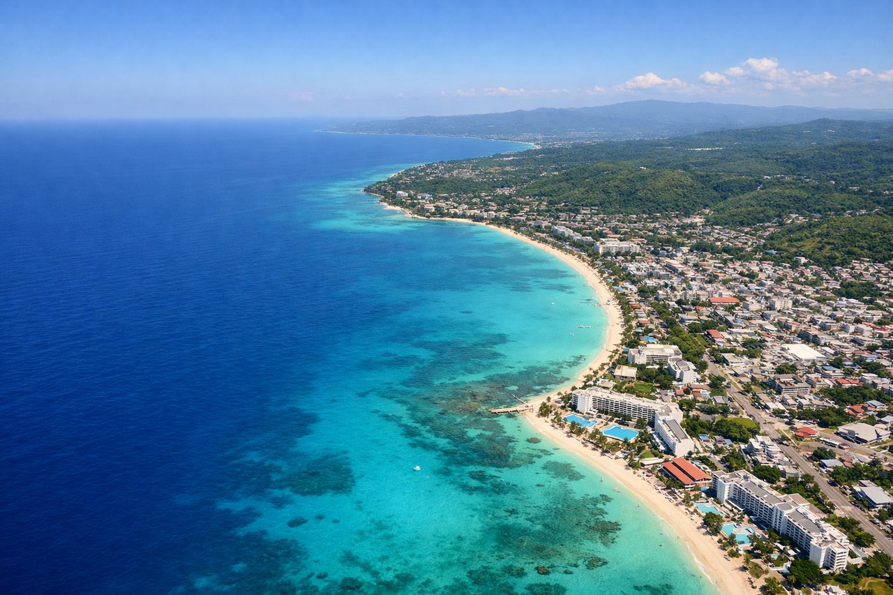
Landing at MBJ
RIGHTRight side offers the Caribbean coastline approach into Montego Bay, with the turquoise shallow waters, white sand beaches, and the bay's distinctive crescent shape visible during descent. Left side sees only open ocean and lacks the coastal detail.
Will your flight be in sunlight?
See exactly which side of the plane gets sun and shade at your departure time.
About This Route
Which side of the plane should I sit on flying from Olaya Herrera (EOH) to Sangster International (MBJ)?
Sit on the Right side of the plane for the best views on flights from Medellin to Montego Bay. Right side scores higher due to superior scenery on both legs: dramatic Andean peaks during Medellín departure and the visually striking Caribbean coastline and turquoise waters during Montego Bay arrival. Left side faces the valley wall at takeoff and open ocean at landing, offering minimal scenic variety.
What can I see during takeoff from Olaya Herrera in Medellin?
During takeoff from Olaya Herrera (EOH), sit on the Right side for the best views. Right side captures Medellín's urban sprawl in the valley floor and the dramatic surrounding Andes peaks during climb-out. Left side faces the narrow valley walls with limited city visibility. Notable sights include: Medellín city center in the Aburrá Valley, Arví Peak (4,680 ft) to the east, surrounding Cordillera Central ridgelines.
What can I see when landing at Sangster International in Montego Bay?
When landing at Sangster International (MBJ), sit on the Right side for the best views. Right side offers the Caribbean coastline approach into Montego Bay, with the turquoise shallow waters, white sand beaches, and the bay's distinctive crescent shape visible during descent. Left side sees only open ocean and lacks the coastal detail. Notable sights include: Montego Bay's crescent coastline, turquoise Caribbean waters and reef systems, Sangster International Airport runway on the coastal plain, Doctor's Cave Beach area.
How long is the flight from Medellin to Montego Bay?
The flight from Olaya Herrera (EOH) to Sangster International (MBJ) takes 1h 25m.
What does the Medellin to Montego Bay flight path pass over?
Caribbean Sea crossing with no significant landmarks; flight path traverses open water between Colombia's Caribbean coast and Jamaica, passing over the Yucatán Channel region with no visible islands or notable geographic features at cruise altitude