The right side captures the most dramatic geography: the Central Cordillera's western escarpment during climb-out and the descent into the Central Valley with the Cordillera Central peaks. Left side offers the delta and wetlands on approach, but right-side views span more of the flight's scenic arc.
Flown EOH to SJO? Did we get it right?
Flight Path
Medellin to San Jose is 645 miles (1,037 km), a flight of about 2 hours.
Río Cauca valley and Caribbean lowlands of northwestern Colombia, transition zone between Andean foothills and Central American isthmus, scattered cumulus clouds over the Caribbean coast near the Colombia-Panama border region, descent into Costa Rican Central Valley with Cordillera Central peaks becoming prominent
Great circle distance and headings ›Phase by phase
Takeoff from EOH
RIGHTRight-side seats capture the Aburrá Valley and Medellin's urban grid immediately after departure, then the western slopes of the Central Cordillera as the aircraft climbs northwest toward the Caribbean coast.
Landing at SJO
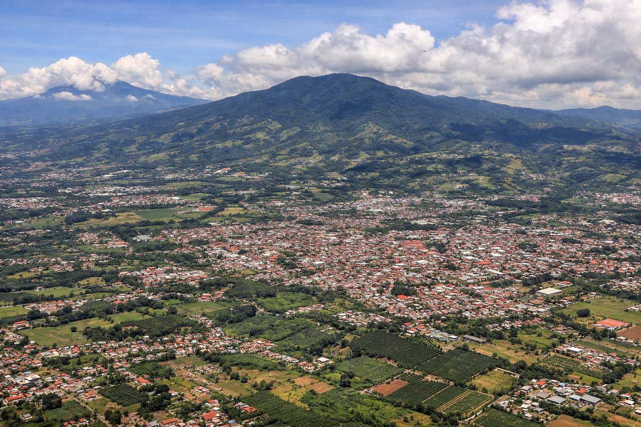
LEFTLeft-side seats offer views of the Tárcoles River delta and Pacific coastal wetlands during descent into San José, plus the Central Valley's agricultural landscape and the Cordillera Central peaks that frame the approach.
Will your flight be in sunlight?
Pick a date and time in the Sun Map to watch the sun move across your whole flight.
About This Route
Which side of the plane should I sit on flying from Olaya Herrera (EOH) to Juan Santamaria International (SJO)?
Sit on the Right side of the plane for the best views on flights from Medellin to San Jose. The right side captures the most dramatic geography: the Central Cordillera's western escarpment during climb-out and the descent into the Central Valley with the Cordillera Central peaks. Left side offers the delta and wetlands on approach, but right-side views span more of the flight's scenic arc.
What can I see during takeoff from Olaya Herrera in Medellin?
During takeoff from Olaya Herrera (EOH), sit on the Right side for the best views. Right-side seats capture the Aburrá Valley and Medellin's urban grid immediately after departure, then the western slopes of the Central Cordillera as the aircraft climbs northwest toward the Caribbean coast. Notable sights include: Aburrá Valley urban sprawl, Central Cordillera (western ridge), Río Cauca valley to the west, Caribbean coastal plains emerging at cruise altitude.
What can I see when landing at Juan Santamaria International in San Jose?
When landing at Juan Santamaria International (SJO), sit on the Left side for the best views. Left-side seats offer views of the Tárcoles River delta and Pacific coastal wetlands during descent into San José, plus the Central Valley's agricultural landscape and the Cordillera Central peaks that frame the approach. Notable sights include: Tárcoles River estuary and mangrove wetlands, Central Valley agricultural grid, Cordillera Central peaks (Cerro Chirripó region to the south), Gulf of Nicoya to the southwest.
How long is the flight from Medellin to San Jose?
The flight from Olaya Herrera (EOH) to Juan Santamaria International (SJO) takes about 2 hours. The shortest flight path between them is 645 miles (1,037 km); winds and air traffic control usually add a few percent.
What does the Medellin to San Jose flight path pass over?
Río Cauca valley and Caribbean lowlands of northwestern Colombia, transition zone between Andean foothills and Central American isthmus, scattered cumulus clouds over the Caribbean coast near the Colombia-Panama border region, descent into Costa Rican Central Valley with Cordillera Central peaks becoming prominent