While the landing approach favors the left, the takeoff climb-out on the right provides superior scenic value with the Khomas Highlands and escarpment transition. The right side captures more dramatic topography during the first 20 minutes of flight, which typically offers better photo opportunities than the final descent.
Flown ERS to JNB? Did we get it right?
Flight Path
Windhoek to Johannesburg is 744 miles (1,197 km), a flight of about 2 hours 15 minutes.
The flight path crosses the Botswana border and passes over the eastern Kalahari region. Notable features include the sparse acacia and mopane woodland landscape, the gradual elevation increase as you approach the Witwatersrand plateau, and the transition from Namibia's semi-arid terrain to South Africa's highveld grassland. The Limpopo River valley lies to the north of the direct flight path. No major mountain ranges are directly on the typical flight corridor, but the Magaliesburg Mountains become visible on the horizon as you approach Johannesburg from the west.
Great circle distance and headings ›Phase by phase
Takeoff from ERS
RIGHTClimbing out eastbound from Windhoek, the right side offers views of the Khomas Highlands and the transition from Namibia's central plateau toward the escarpment. The left side faces westward toward the Namib Desert interior, which is visually flatter and less distinctive during initial climb.
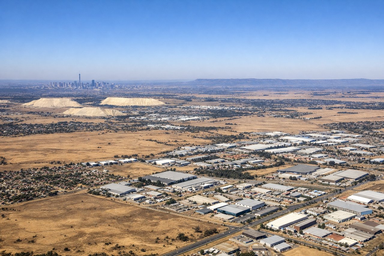
Landing at JNB
LEFTOn final approach to Johannesburg from the west, the left side provides views of the Witwatersrand ridge system and the urban sprawl of greater Johannesburg as you descend. The right side faces toward the southern suburbs and lacks the dramatic topographic features visible on the left during descent.
Will your flight be in sunlight?
Pick a date and time in the Sun Map to watch the sun move across your whole flight.
About This Route
Which side of the plane should I sit on flying from Eros Airport (ERS) to O.R. Tambo International Airport (JNB)?
Sit on the Right side of the plane for the best views on flights from Windhoek to Johannesburg. While the landing approach favors the left, the takeoff climb-out on the right provides superior scenic value with the Khomas Highlands and escarpment transition. The right side captures more dramatic topography during the first 20 minutes of flight, which typically offers better photo opportunities than the final descent.
What can I see during takeoff from Eros Airport in Windhoek?
During takeoff from Eros Airport (ERS), sit on the Right side for the best views. Climbing out eastbound from Windhoek, the right side offers views of the Khomas Highlands and the transition from Namibia's central plateau toward the escarpment. The left side faces westward toward the Namib Desert interior, which is visually flatter and less distinctive during initial climb. Notable sights include: Khomas Highlands (eastern ridge system), Windhoek city grid below, transition zone between central plateau and eastern escarpment, sparse acacia woodland patterns.
What can I see when landing at O.R. Tambo International Airport in Johannesburg?
When landing at O.R. Tambo International Airport (JNB), sit on the Left side for the best views. On final approach to Johannesburg from the west, the left side provides views of the Witwatersrand ridge system and the urban sprawl of greater Johannesburg as you descend. The right side faces toward the southern suburbs and lacks the dramatic topographic features visible on the left during descent. Notable sights include: Witwatersrand ridge (prominent north-south escarpment), Johannesburg city center and northern suburbs, the Magaliesburg Mountains (distant, on horizon), urban sprawl pattern of Gauteng province.
How long is the flight from Windhoek to Johannesburg?
The flight from Eros Airport (ERS) to O.R. Tambo International Airport (JNB) takes about 2 hours 15 minutes. The shortest flight path between them is 744 miles (1,197 km); winds and air traffic control usually add a few percent.
What does the Windhoek to Johannesburg flight path pass over?
The flight path crosses the Botswana border and passes over the eastern Kalahari region. Notable features include the sparse acacia and mopane woodland landscape, the gradual elevation increase as you approach the Witwatersrand plateau, and the transition from Namibia's semi-arid terrain to South Africa's highveld grassland. The Limpopo River valley lies to the north of the direct flight path. No major mountain ranges are directly on the typical flight corridor, but the Magaliesburg Mountains become visible on the horizon as you approach Johannesburg from the west.