Left side delivers the two most rewarding moments: Ankara and the Anatolian plateau on departure, and the Paris basin with the Seine on arrival. The right side has little to compete with either view. Mid-flight over the Balkans and central Europe both sides are broadly similar.
Flown ESB to CDG? Did we get it right?
Flight Path
Ankara to Paris is 1,606 miles (2,584 km), a flight of about 3 hours 45 minutes.
The route crosses northwestern Turkey and the Sea of Marmara (briefly visible), then tracks over Bulgaria and Serbia through the Balkan ranges, crosses Hungary and the Pannonian Plain, passes over Austria or southern Germany depending on routing, then enters France over Alsace or Burgundy before descending into the Paris basin. The Danube river may be visible crossing Hungary, and the Rhine valley marks the France-Germany border region.
Great circle distance and headings ›


Phase by phase
Takeoff from ESB
LEFTESB's primary runway is oriented roughly east-west (03/21 and 03R/21L). Departures heading west toward Europe typically use a northwesterly climb-out, putting the Ankara city center and the surrounding Anatolian plateau to the left (south). You get a clear look at the urban sprawl of Ankara and the rolling steppe terrain dropping away.
Landing at CDG
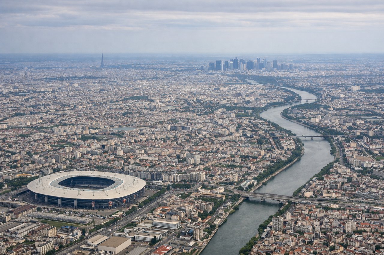
LEFTApproaching CDG from the east on runways 27L/27R, the left side faces south toward Paris. On final approach you can see the Seine river snaking westward, the dense urban fabric of northeastern Paris, and on clear days the Eiffel Tower and La Défense towers are visible in the far distance to the southwest. The right side faces north toward flat agricultural Picardy with little of interest.
Will your flight be in sunlight?
Pick a date and time in the Sun Map to watch the sun move across your whole flight.
About This Route
Which side of the plane should I sit on flying from Esenboga (ESB) to Charles De Gaulle (CDG)?
Sit on the Left side of the plane for the best views on flights from Ankara to Paris. Left side delivers the two most rewarding moments: Ankara and the Anatolian plateau on departure, and the Paris basin with the Seine on arrival. The right side has little to compete with either view. Mid-flight over the Balkans and central Europe both sides are broadly similar.
What can I see during takeoff from Esenboga in Ankara?
During takeoff from Esenboga (ESB), sit on the Left side for the best views. ESB's primary runway is oriented roughly east-west (03/21 and 03R/21L). Departures heading west toward Europe typically use a northwesterly climb-out, putting the Ankara city center and the surrounding Anatolian plateau to the left (south). You get a clear look at the urban sprawl of Ankara and the rolling steppe terrain dropping away. Notable sights include: Ankara city center and Atatürk's mausoleum (Anıtkabir) visible as a prominent hilltop complex, the broad Anatolian plateau stretching south, Çubuk reservoir to the northeast briefly visible on the right before banking.
What can I see when landing at Charles De Gaulle in Paris?
When landing at Charles De Gaulle (CDG), sit on the Left side for the best views. Approaching CDG from the east on runways 27L/27R, the left side faces south toward Paris. On final approach you can see the Seine river snaking westward, the dense urban fabric of northeastern Paris, and on clear days the Eiffel Tower and La Défense towers are visible in the far distance to the southwest. The right side faces north toward flat agricultural Picardy with little of interest. Notable sights include: Seine river valley curving west toward Paris, northeastern Paris urban grid, La Défense tower cluster on the far western horizon, Marne river confluence visible below on approach.
How long is the flight from Ankara to Paris?
The flight from Esenboga (ESB) to Charles De Gaulle (CDG) takes about 3 hours 45 minutes. The shortest flight path between them is 1,606 miles (2,584 km); winds and air traffic control usually add a few percent.
What does the Ankara to Paris flight path pass over?
The route crosses northwestern Turkey and the Sea of Marmara (briefly visible), then tracks over Bulgaria and Serbia through the Balkan ranges, crosses Hungary and the Pannonian Plain, passes over Austria or southern Germany depending on routing, then enters France over Alsace or Burgundy before descending into the Paris basin. The Danube river may be visible crossing Hungary, and the Rhine valley marks the France-Germany border region.