While the takeoff offers good Cascade views on the left, the landing approach on the right provides more dramatic and varied scenery—the Pacific coastline, Mission Bay, and San Diego's urban geography are visually distinctive and concentrated. The right side captures the most memorable portion of the flight.
Flown EUG to SAN? Did we get it right?
Flight Path
Eugene to San Diego is 851 miles (1,370 km), a flight of about 2 hours 20 minutes.
Mount Shasta (visible to the east during cruise over northern California), the Sierra Nevada range along the eastern horizon during the central portion of flight, the Central Valley of California, and the Transverse Ranges as the flight approaches Southern California
Great circle distance and headings ›


Phase by phase
Takeoff from EUG
LEFTLeft side captures the Cascade Range immediately after departure, with the distinctive volcanic peaks of the High Cascades visible to the east. The Willamette Valley spreads below in the initial climb, offering clear views of the agricultural landscape and river system.
Landing at SAN
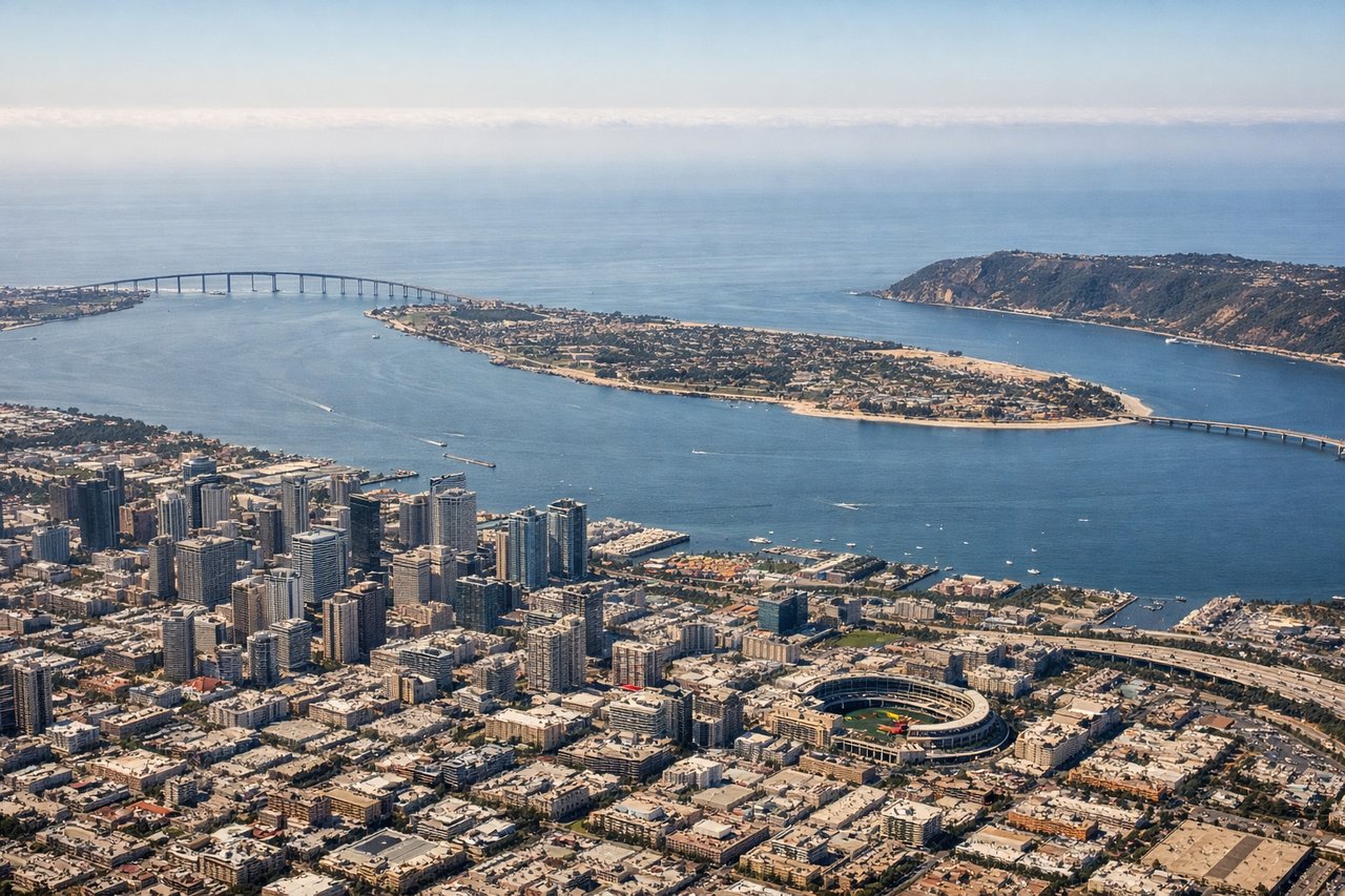
RIGHTRight side provides excellent views during the descent into San Diego, with the Pacific coastline, Mission Bay, and the San Diego urban area clearly visible. The approach path typically brings the coast into view on the right, with distinctive geographic features like Point Loma and the bay system.
Will your flight be in sunlight?
Pick a date and time in the Sun Map to watch the sun move across your whole flight.
About This Route
Which side of the plane should I sit on flying from Eugene Airport (EUG) to San Diego International Lindbergh Fld (SAN)?
Sit on the Right side of the plane for the best views on flights from Eugene to San Diego. While the takeoff offers good Cascade views on the left, the landing approach on the right provides more dramatic and varied scenery—the Pacific coastline, Mission Bay, and San Diego's urban geography are visually distinctive and concentrated. The right side captures the most memorable portion of the flight.
What can I see during takeoff from Eugene Airport in Eugene?
During takeoff from Eugene Airport (EUG), sit on the Left side for the best views. Left side captures the Cascade Range immediately after departure, with the distinctive volcanic peaks of the High Cascades visible to the east. The Willamette Valley spreads below in the initial climb, offering clear views of the agricultural landscape and river system. Notable sights include: Cascade Range (High Cascades volcanic peaks), Willamette Valley, Willamette River, Spencer Butte.
What can I see when landing at San Diego International Lindbergh Fld in San Diego?
When landing at San Diego International Lindbergh Fld (SAN), sit on the Right side for the best views. Right side provides excellent views during the descent into San Diego, with the Pacific coastline, Mission Bay, and the San Diego urban area clearly visible. The approach path typically brings the coast into view on the right, with distinctive geographic features like Point Loma and the bay system. Notable sights include: Pacific Ocean coastline, Mission Bay, Point Loma, San Diego Bay.
How long is the flight from Eugene to San Diego?
The flight from Eugene Airport (EUG) to San Diego International Lindbergh Fld (SAN) takes about 2 hours 20 minutes. The shortest flight path between them is 851 miles (1,370 km); winds and air traffic control usually add a few percent.
What does the Eugene to San Diego flight path pass over?
Mount Shasta (visible to the east during cruise over northern California), the Sierra Nevada range along the eastern horizon during the central portion of flight, the Central Valley of California, and the Transverse Ranges as the flight approaches Southern California