Newark to Savannah is 709 miles (1,140 km), a flight of about 2 hours 15 minutes.
Left side wins both ends of this flight. The departure delivers the iconic New York Harbor panorama, and the arrival gives you the Savannah River, tidal marshes, and the historic city grid. During cruise over the Carolinas, the left side also faces slightly more inland toward the Piedmont and coastal plain geography.
Flight Path
The flight tracks roughly south-southwest over New Jersey, Delaware, the Delmarva Peninsula or inland over Maryland and Virginia, then across North Carolina's coastal plain and the Pee Dee River basin in South Carolina. Passengers may see the Delaware Bay, the broad flat agricultural patchwork of the Carolina coastal plain, the Neuse and Cape Fear river systems in North Carolina, and the Pee Dee and Santee river drainages in South Carolina — all relatively flat terrain with no significant mountain ranges on this route.
Great circle distance and headings ›.jpeg?width=600)
.jpg?width=600)

Phase by phase
Takeoff from EWR
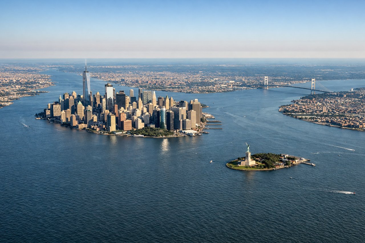
LEFTEWR typically departs south on runway 22L/22R or northeast on 04R/04L. On a southbound departure toward SAV, the left side gives you Manhattan's skyline across Newark Bay, the Statue of Liberty, and the full sweep of Upper New York Bay before the aircraft turns south over New Jersey. This is one of the most iconic urban departure views in aviation.
Landing at SAV
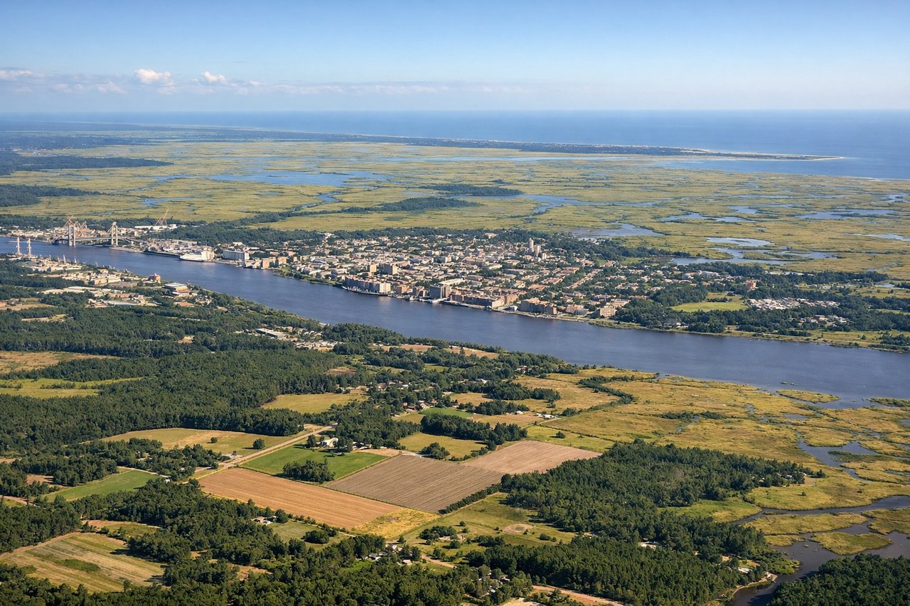
LEFTSAV typically lands on runway 10 (eastbound) or runway 28 (westbound). On a runway 10 approach from the west, the left side looks south over the Savannah River marshlands, the city of Savannah's historic grid, and the broad tidal estuaries of coastal Georgia. On runway 28, the left side still captures the Savannah River and port facilities on final approach.
Landmarks on this routeAll landmarks →
Will your flight be in sunlight?
Pick a date and time in the Sun Map to watch the sun move across your whole flight.
About This Route
Which side of the plane should I sit on flying from Newark Liberty International (EWR) to Savannah Hilton Head International (SAV)?
Sit on the Left side of the plane for the best views on flights from Newark to Savannah. Left side wins both ends of this flight. The departure delivers the iconic New York Harbor panorama, and the arrival gives you the Savannah River, tidal marshes, and the historic city grid. During cruise over the Carolinas, the left side also faces slightly more inland toward the Piedmont and coastal plain geography.
What can I see during takeoff from Newark Liberty International in Newark?
During takeoff from Newark Liberty International (EWR), sit on the Left side for the best views. EWR typically departs south on runway 22L/22R or northeast on 04R/04L. On a southbound departure toward SAV, the left side gives you Manhattan's skyline across Newark Bay, the Statue of Liberty, and the full sweep of Upper New York Bay before the aircraft turns south over New Jersey. This is one of the most iconic urban departure views in aviation. Notable sights include: Manhattan skyline, Statue of Liberty in Upper New York Bay, Verrazano-Narrows Bridge, Newark Bay.
What can I see when landing at Savannah Hilton Head International in Savannah?
When landing at Savannah Hilton Head International (SAV), sit on the Left side for the best views. SAV typically lands on runway 10 (eastbound) or runway 28 (westbound). On a runway 10 approach from the west, the left side looks south over the Savannah River marshlands, the city of Savannah's historic grid, and the broad tidal estuaries of coastal Georgia. On runway 28, the left side still captures the Savannah River and port facilities on final approach. Notable sights include: Savannah River, Savannah historic district grid, coastal Georgia tidal marshes, Port of Savannah container terminal.
How long is the flight from Newark to Savannah?
The flight from Newark Liberty International (EWR) to Savannah Hilton Head International (SAV) takes about 2 hours 15 minutes. The shortest flight path between them is 709 miles (1,140 km); winds and air traffic control usually add a few percent.
What does the Newark to Savannah flight path pass over?
The flight tracks roughly south-southwest over New Jersey, Delaware, the Delmarva Peninsula or inland over Maryland and Virginia, then across North Carolina's coastal plain and the Pee Dee River basin in South Carolina. Passengers may see the Delaware Bay, the broad flat agricultural patchwork of the Carolina coastal plain, the Neuse and Cape Fear river systems in North Carolina, and the Pee Dee and Santee river drainages in South Carolina — all relatively flat terrain with no significant mountain ranges on this route.