Savannah to Newark is 709 miles (1,140 km), a flight of about 2 hours 5 minutes.
While takeoff from Savannah offers coastal marsh scenery, the landing approach into Newark provides more dramatic and visually distinctive urban and geographic features. The Hudson River, Manhattan skyline, and surrounding geography create a more compelling final descent view.
Flight Path
The flight path northeastward crosses the Outer Banks of North Carolina (visible as a thin sandy barrier island chain if flying at lower altitudes during climb), then proceeds over the Atlantic coastal plain and Chesapeake Bay region. The Appalachian foothills appear as subtle elevation changes in Pennsylvania and Maryland. Major cities visible along the route include Raleigh-Durham, Washington D.C. area, and Philadelphia before final approach to Newark.
Great circle distance and headings ›
.jpg?width=600)
.jpeg?width=600)
Phase by phase
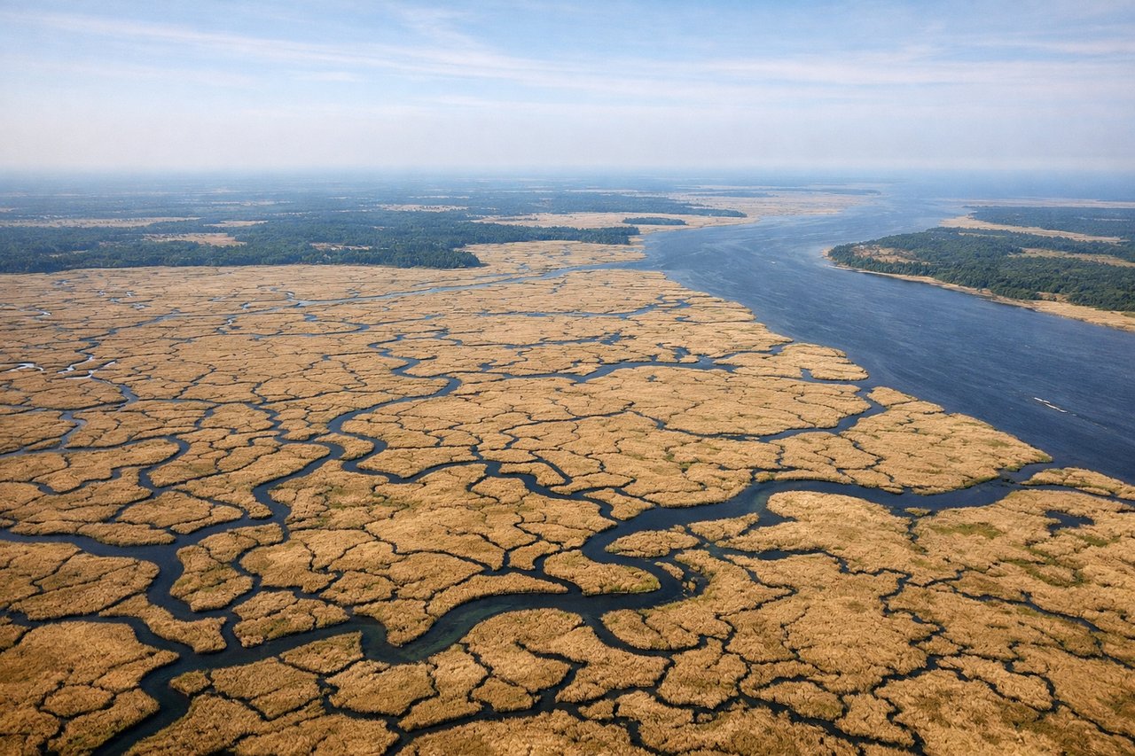
Takeoff from SAV
RIGHTRight side offers views of the Savannah River and Atlantic coastal marshlands as the aircraft climbs northeastward. You'll see the river's distinctive meanders and the salt marsh grid patterns that characterize the Low Country.
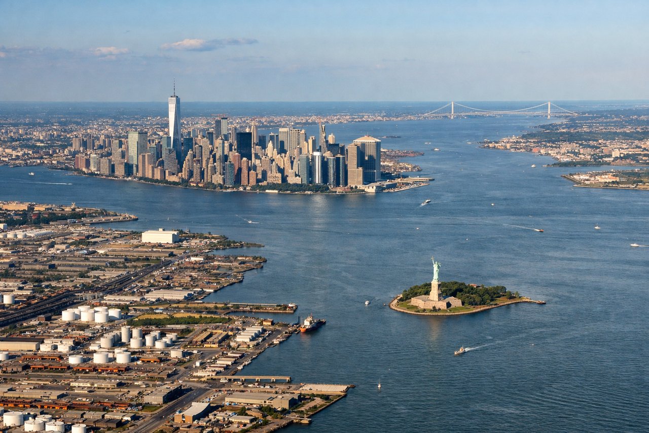
Landing at EWR
LEFTLeft side provides excellent views during descent into Newark. You'll see the Hudson River, Manhattan's skyline, and the New Jersey urban corridor as the aircraft approaches from the southwest. The river and city landmarks are unmistakable.
Landmarks on this routeAll landmarks →
Will your flight be in sunlight?
Pick a date and time in the Sun Map to watch the sun move across your whole flight.
About This Route
Which side of the plane should I sit on flying from Savannah Hilton Head International (SAV) to Newark Liberty International (EWR)?
Sit on the Left side of the plane for the best views on flights from Savannah to Newark. While takeoff from Savannah offers coastal marsh scenery, the landing approach into Newark provides more dramatic and visually distinctive urban and geographic features. The Hudson River, Manhattan skyline, and surrounding geography create a more compelling final descent view.
What can I see during takeoff from Savannah Hilton Head International in Savannah?
During takeoff from Savannah Hilton Head International (SAV), sit on the Right side for the best views. Right side offers views of the Savannah River and Atlantic coastal marshlands as the aircraft climbs northeastward. You'll see the river's distinctive meanders and the salt marsh grid patterns that characterize the Low Country. Notable sights include: Savannah River, Tybee Island, Atlantic coastal marshes, Wilmington River.
What can I see when landing at Newark Liberty International in Newark?
When landing at Newark Liberty International (EWR), sit on the Left side for the best views. Left side provides excellent views during descent into Newark. You'll see the Hudson River, Manhattan's skyline, and the New Jersey urban corridor as the aircraft approaches from the southwest. The river and city landmarks are unmistakable. Notable sights include: Hudson River, Manhattan skyline, New Jersey Palisades, Newark Bay.
How long is the flight from Savannah to Newark?
The flight from Savannah Hilton Head International (SAV) to Newark Liberty International (EWR) takes about 2 hours 5 minutes. The shortest flight path between them is 709 miles (1,140 km); winds and air traffic control usually add a few percent.
What does the Savannah to Newark flight path pass over?
The flight path northeastward crosses the Outer Banks of North Carolina (visible as a thin sandy barrier island chain if flying at lower altitudes during climb), then proceeds over the Atlantic coastal plain and Chesapeake Bay region. The Appalachian foothills appear as subtle elevation changes in Pennsylvania and Maryland. Major cities visible along the route include Raleigh-Durham, Washington D.C. area, and Philadelphia before final approach to Newark.