Savannah to Dallas-Fort Worth is 923 miles (1,486 km), a flight of about 2 hours 30 minutes.
While takeoff offers coastal marsh scenery, the landing approach provides more dramatic and varied visual interest with the Trinity River system, major metropolitan infrastructure, and the impressive scale of DFW's runway complex. The approach descent also offers longer viewing duration at lower altitudes where details are clearer.
Flight Path
The flight path westbound crosses central Georgia (Piedmont region with rolling terrain and pine forests), then transitions into Alabama and Mississippi with river systems including the Chattahoochee River valley and Mississippi River floodplain visible around the 90-minute mark. Eastern Louisiana shows the Mississippi Delta's distinctive dendritic drainage patterns. By the 2-hour mark, the landscape flattens into the Texas coastal plain with scattered lakes and agricultural fields. The flight remains over relatively flat terrain for most of the journey with no major mountain ranges visible; the primary visual interest comes from river systems, reservoirs, and the gradual transition from eastern deciduous forests to western prairie grasslands.
Great circle distance and headings ›.jpeg?width=600)

Phase by phase
Takeoff from SAV
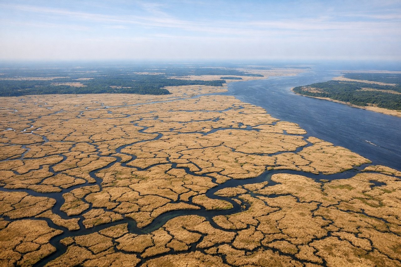
RIGHTRight-side seats offer views of the Savannah River estuary and coastal marshlands during the initial climb-out westward. The river's distinctive meandering pattern and salt marsh grid are clearly visible from 3,000-8,000 feet.

Landing at DFW
LEFTLeft-side seats provide excellent views of the Trinity River system and Dallas-Fort Worth urban sprawl during the descent approach from the east. The river's braided channels and the distinctive geometry of DFW's runway complex become visible at 8,000-3,000 feet.
Landmarks on this routeAll landmarks →
Will your flight be in sunlight?
Pick a date and time in the Sun Map to watch the sun move across your whole flight.
About This Route
Which side of the plane should I sit on flying from Savannah Hilton Head International (SAV) to Dallas Fort Worth International (DFW)?
Sit on the Left side of the plane for the best views on flights from Savannah to Dallas-Fort Worth. While takeoff offers coastal marsh scenery, the landing approach provides more dramatic and varied visual interest with the Trinity River system, major metropolitan infrastructure, and the impressive scale of DFW's runway complex. The approach descent also offers longer viewing duration at lower altitudes where details are clearer.
What can I see during takeoff from Savannah Hilton Head International in Savannah?
During takeoff from Savannah Hilton Head International (SAV), sit on the Right side for the best views. Right-side seats offer views of the Savannah River estuary and coastal marshlands during the initial climb-out westward. The river's distinctive meandering pattern and salt marsh grid are clearly visible from 3,000-8,000 feet. Notable sights include: Savannah River estuary, Atlantic coastal marshlands, Tybee Island (barrier island to the east), Savannah city grid.
What can I see when landing at Dallas Fort Worth International in Dallas-Fort Worth?
When landing at Dallas Fort Worth International (DFW), sit on the Left side for the best views. Left-side seats provide excellent views of the Trinity River system and Dallas-Fort Worth urban sprawl during the descent approach from the east. The river's braided channels and the distinctive geometry of DFW's runway complex become visible at 8,000-3,000 feet. Notable sights include: Trinity River and its reservoirs (Lake Ray Hubbard to the southeast), Dallas-Fort Worth metropolitan grid, DFW International Airport runways, Arlington urban development.
How long is the flight from Savannah to Dallas-Fort Worth?
The flight from Savannah Hilton Head International (SAV) to Dallas Fort Worth International (DFW) takes about 2 hours 30 minutes. The shortest flight path between them is 923 miles (1,486 km); winds and air traffic control usually add a few percent.
What does the Savannah to Dallas-Fort Worth flight path pass over?
The flight path westbound crosses central Georgia (Piedmont region with rolling terrain and pine forests), then transitions into Alabama and Mississippi with river systems including the Chattahoochee River valley and Mississippi River floodplain visible around the 90-minute mark. Eastern Louisiana shows the Mississippi Delta's distinctive dendritic drainage patterns. By the 2-hour mark, the landscape flattens into the Texas coastal plain with scattered lakes and agricultural fields. The flight remains over relatively flat terrain for most of the journey with no major mountain ranges visible; the primary visual interest comes from river systems, reservoirs, and the gradual transition from eastern deciduous forests to western prairie grasslands.