Savannah to Minneapolis is 1,092 miles (1,758 km), a flight of about 3 hours 15 minutes.
While takeoff offers interesting coastal marsh views, the landing approach provides more dramatic and recognizable geography—the Mississippi River, downtown Minneapolis, and the Chain of Lakes system are visually striking and geographically significant. Left side captures these features best during standard eastbound approaches.
Flight Path
The flight path crosses the Appalachian foothills of Tennessee and Kentucky (visible as rolling terrain with ridge lines running northeast-southwest around 25,000-30,000 feet), then transitions into the flatter Ohio River valley. The Ohio River itself may be visible during descent into the Midwest, appearing as a dark meandering line through forested terrain. The Great Lakes region begins to show as you approach Minnesota, with the landscape becoming progressively flatter and more agricultural.
Great circle distance and headings ›.jpeg?width=600)

Phase by phase
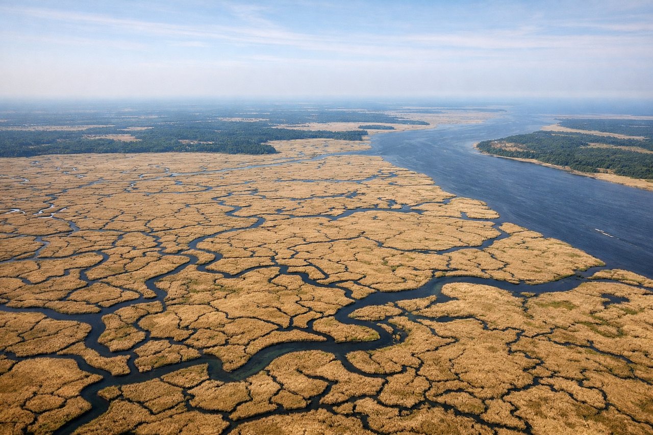
Takeoff from SAV
RIGHTRight side seats capture the Savannah River estuary and coastal marshlands immediately after departure. SAV typically departs runway 09 or 27; runway 09 departures (northwestbound) give right-side views of the tidal creeks and salt marshes that define the Low Country landscape.

Landing at MSP
LEFTLeft side seats on approach to MSP offer views of the Minnesota River valley and the Twin Cities urban area. Typical landing runways at MSP are 04L/04R or 22L/22R; eastbound approaches (runway 04) give left-side views of downtown Minneapolis and the Mississippi River corridor as you descend through 5,000-8,000 feet.
Landmarks on this routeAll landmarks →
Will your flight be in sunlight?
Pick a date and time in the Sun Map to watch the sun move across your whole flight.
About This Route
Which side of the plane should I sit on flying from Savannah Hilton Head International (SAV) to Minneapolis St Paul International (MSP)?
Sit on the Left side of the plane for the best views on flights from Savannah to Minneapolis. While takeoff offers interesting coastal marsh views, the landing approach provides more dramatic and recognizable geography—the Mississippi River, downtown Minneapolis, and the Chain of Lakes system are visually striking and geographically significant. Left side captures these features best during standard eastbound approaches.
What can I see during takeoff from Savannah Hilton Head International in Savannah?
During takeoff from Savannah Hilton Head International (SAV), sit on the Right side for the best views. Right side seats capture the Savannah River estuary and coastal marshlands immediately after departure. SAV typically departs runway 09 or 27; runway 09 departures (northwestbound) give right-side views of the tidal creeks and salt marshes that define the Low Country landscape. Notable sights include: Savannah River estuary with branching tidal creeks, Atlantic coastal salt marshes, Tybee Island (barrier island to the east), Calibogue Sound.
What can I see when landing at Minneapolis St Paul International in Minneapolis?
When landing at Minneapolis St Paul International (MSP), sit on the Left side for the best views. Left side seats on approach to MSP offer views of the Minnesota River valley and the Twin Cities urban area. Typical landing runways at MSP are 04L/04R or 22L/22R; eastbound approaches (runway 04) give left-side views of downtown Minneapolis and the Mississippi River corridor as you descend through 5,000-8,000 feet. Notable sights include: Mississippi River with visible bends through Minneapolis, downtown Minneapolis skyline, Minnesota River confluence, Chain of Lakes (visible as distinct water bodies west of downtown).
How long is the flight from Savannah to Minneapolis?
The flight from Savannah Hilton Head International (SAV) to Minneapolis St Paul International (MSP) takes about 3 hours 15 minutes. The shortest flight path between them is 1,092 miles (1,758 km); winds and air traffic control usually add a few percent.
What does the Savannah to Minneapolis flight path pass over?
The flight path crosses the Appalachian foothills of Tennessee and Kentucky (visible as rolling terrain with ridge lines running northeast-southwest around 25,000-30,000 feet), then transitions into the flatter Ohio River valley. The Ohio River itself may be visible during descent into the Midwest, appearing as a dark meandering line through forested terrain. The Great Lakes region begins to show as you approach Minnesota, with the landscape becoming progressively flatter and more agricultural.