The takeoff experience from Buenos Aires is visually superior, offering dynamic estuary and urban views. While the landing into Cairo provides the iconic Nile Delta perspective, the long transatlantic and African overland segments offer limited scenic value—mostly open ocean and Sahara. Left seats capture the most distinctive moments at both ends.
Flight Path
The flight path crosses the South Atlantic (featureless ocean for ~8 hours), then approaches the African continent near the West African coast. Notable features include the Sahara Desert (vast, tan-colored expanse with subtle dune patterns visible at altitude), the Atlas Mountains (if the route passes near Morocco/Algeria), and the Nile Valley (narrow green corridor through desert, visible during the final approach phase into Egypt). Most of the midpoint crossing offers minimal scenic interest—primarily open ocean and desert monotony.
Great circle distance and headings ›_(cropped).jpg?width=600)


.jpg?width=600)
.JPG?width=600)
Phase by phase

Takeoff from EZE
LEFTLeft side offers views of the Río de la Plata estuary and the Buenos Aires metropolitan area as the aircraft climbs northeast. Right side faces inland toward flat pampas with minimal visual interest.
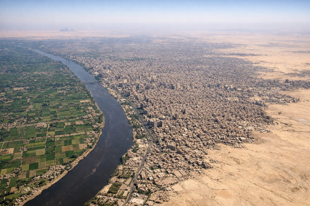
Landing at CAI
RIGHTRight side provides views of the Nile Delta's distinctive fan-shaped irrigation pattern and the Nile River itself during descent into Cairo. Left side faces the Western Desert, which is visually monotonous at altitude.
Landmarks on this routeAll landmarks →
Will your flight be in sunlight?
See exactly which side of the plane gets sun and shade at your departure time.
About This Route
Which side of the plane should I sit on flying from Ezeiza Ministro Pistarini (EZE) to Cairo International (CAI)?
Sit on the Left side of the plane for the best views on flights from Buenos Aires to Cairo. The takeoff experience from Buenos Aires is visually superior, offering dynamic estuary and urban views. While the landing into Cairo provides the iconic Nile Delta perspective, the long transatlantic and African overland segments offer limited scenic value—mostly open ocean and Sahara. Left seats capture the most distinctive moments at both ends.
What can I see during takeoff from Ezeiza Ministro Pistarini in Buenos Aires?
During takeoff from Ezeiza Ministro Pistarini (EZE), sit on the Left side for the best views. Left side offers views of the Río de la Plata estuary and the Buenos Aires metropolitan area as the aircraft climbs northeast. Right side faces inland toward flat pampas with minimal visual interest. Notable sights include: Río de la Plata (wide brown estuary), Buenos Aires city grid and port facilities, Aeroparque Jorge Newbery (smaller airport visible on the estuary's north shore).
What can I see when landing at Cairo International in Cairo?
When landing at Cairo International (CAI), sit on the Right side for the best views. Right side provides views of the Nile Delta's distinctive fan-shaped irrigation pattern and the Nile River itself during descent into Cairo. Left side faces the Western Desert, which is visually monotonous at altitude. Notable sights include: Nile Delta (geometric green agricultural fields in stark contrast to desert), Nile River (thin brown line visible upstream), Cairo metropolitan area and sprawl, Eastern Desert plateau (rocky, tan-colored terrain).
How long is the flight from Buenos Aires to Cairo?
The flight from Ezeiza Ministro Pistarini (EZE) to Cairo International (CAI) takes Approximately 13.5 to 14.5 hours (depending on winds and routing).
What does the Buenos Aires to Cairo flight path pass over?
The flight path crosses the South Atlantic (featureless ocean for ~8 hours), then approaches the African continent near the West African coast. Notable features include the Sahara Desert (vast, tan-colored expanse with subtle dune patterns visible at altitude), the Atlas Mountains (if the route passes near Morocco/Algeria), and the Nile Valley (narrow green corridor through desert, visible during the final approach phase into Egypt). Most of the midpoint crossing offers minimal scenic interest—primarily open ocean and desert monotony.