Right side wins at both ends of the flight. Over the Rio de la Plata on departure and the Southern California coast on arrival, the right seat delivers the most geographically interesting views. The long overwater cruise through the night offers little difference between sides.
Flown EZE to LAX? Did we get it right?
Flight Path
Buenos Aires to Los Angeles is 6,127 miles (9,861 km), a flight of about 14 hours 30 minutes.
After departing Buenos Aires the route climbs northwest over the Pampas, crosses the Andes somewhere over northern Chile or southern Peru at cruising altitude (the high peaks including Aconcagua may be visible far to the south early in the flight on the left side). The route then tracks northwest over the Pacific Ocean for the majority of the flight, passing west of Central America and Mexico's Pacific coast. The Baja California Peninsula may be visible on descent into Southern California, appearing as a long narrow strip of brown desert terrain to the right of the aircraft.
Great circle distance and headings ›


Phase by phase
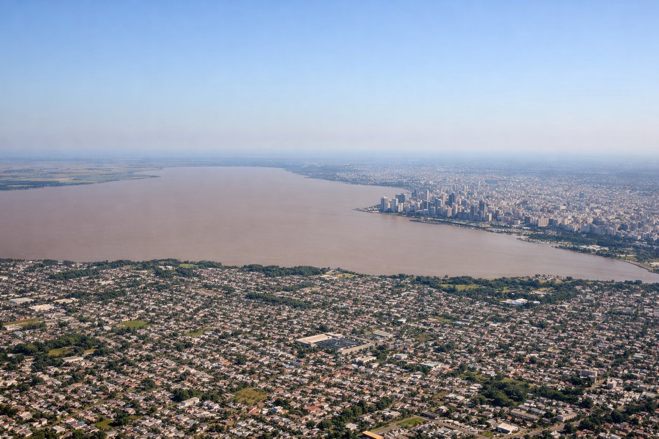
Takeoff from EZE
RIGHTEZE's primary runways (11/29) mean northbound departures toward LAX typically involve a right turn climbing out over the Rio de la Plata estuary. The right side gives you the broad brown expanse of the Plata and the Buenos Aires city skyline to the northeast. The left side faces inland toward flat pampas with little visual interest.
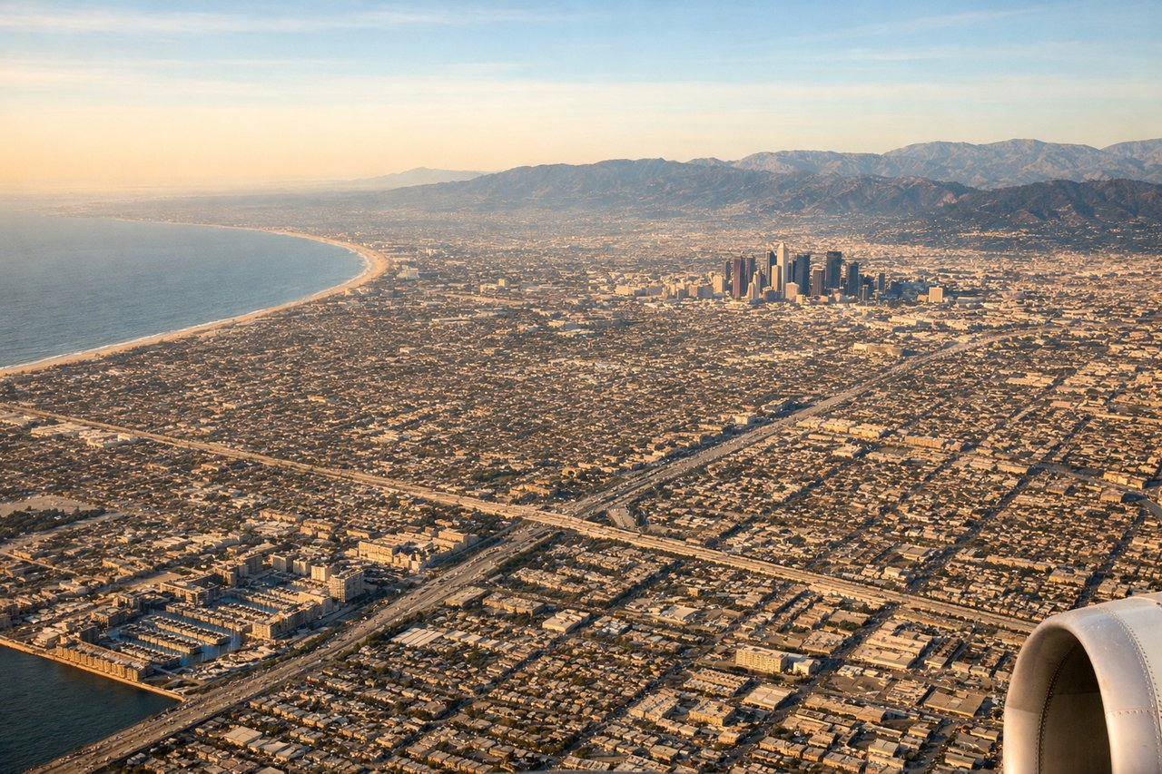
Landing at LAX
RIGHTLAX approaches from the east on runway 24L/24R mean the aircraft flies over the Los Angeles Basin before touching down. The right side faces south toward the South Bay, Long Beach harbor, and the Pacific coastline curving toward Palos Verdes Peninsula. The left side looks north over the urban sprawl toward downtown LA and the Santa Monica Mountains, which is also good, but the coastline and ocean on the right are more visually striking on final approach.
Will your flight be in sunlight?
Pick a date and time in the Sun Map to watch the sun move across your whole flight.
About This Route
Which side of the plane should I sit on flying from Ezeiza Ministro Pistarini (EZE) to Los Angeles International (LAX)?
Sit on the Right side of the plane for the best views on flights from Buenos Aires to Los Angeles. Right side wins at both ends of the flight. Over the Rio de la Plata on departure and the Southern California coast on arrival, the right seat delivers the most geographically interesting views. The long overwater cruise through the night offers little difference between sides.
What can I see during takeoff from Ezeiza Ministro Pistarini in Buenos Aires?
During takeoff from Ezeiza Ministro Pistarini (EZE), sit on the Right side for the best views. EZE's primary runways (11/29) mean northbound departures toward LAX typically involve a right turn climbing out over the Rio de la Plata estuary. The right side gives you the broad brown expanse of the Plata and the Buenos Aires city skyline to the northeast. The left side faces inland toward flat pampas with little visual interest. Notable sights include: Rio de la Plata estuary, Buenos Aires city grid and port district (Puerto Madero), Montevideo across the water on clear days, flat Pampas grasslands receding to the west.
What can I see when landing at Los Angeles International in Los Angeles?
When landing at Los Angeles International (LAX), sit on the Right side for the best views. LAX approaches from the east on runway 24L/24R mean the aircraft flies over the Los Angeles Basin before touching down. The right side faces south toward the South Bay, Long Beach harbor, and the Pacific coastline curving toward Palos Verdes Peninsula. The left side looks north over the urban sprawl toward downtown LA and the Santa Monica Mountains, which is also good, but the coastline and ocean on the right are more visually striking on final approach. Notable sights include: Palos Verdes Peninsula and cliffs above the Pacific, Long Beach harbor and container port, Santa Catalina Island on the horizon (on clear days), South Bay coastline and beach communities.
How long is the flight from Buenos Aires to Los Angeles?
The flight from Ezeiza Ministro Pistarini (EZE) to Los Angeles International (LAX) takes about 14 hours 30 minutes. The shortest flight path between them is 6,127 miles (9,861 km); winds and air traffic control usually add a few percent.
What does the Buenos Aires to Los Angeles flight path pass over?
After departing Buenos Aires the route climbs northwest over the Pampas, crosses the Andes somewhere over northern Chile or southern Peru at cruising altitude (the high peaks including Aconcagua may be visible far to the south early in the flight on the left side). The route then tracks northwest over the Pacific Ocean for the majority of the flight, passing west of Central America and Mexico's Pacific coast. The Baja California Peninsula may be visible on descent into Southern California, appearing as a long narrow strip of brown desert terrain to the right of the aircraft.