Fargo to Minneapolis is 223 miles (359 km), a flight of about 1 hour.
Right-side seats offer superior scenery on takeoff with clear views of the Red River valley and agricultural landscape. While left-side seats improve during landing with MSP metro views, the takeoff experience is more visually distinctive, making right the better overall choice for this short flight.
Flight Path
The flight path crosses central Minnesota, passing over the transition zone between the Red River valley's flat agricultural land and the slightly more rolling terrain approaching the Twin Cities. The Minnesota River valley becomes increasingly visible as the aircraft descends toward MSP, with scattered lakes and wetlands visible throughout the route. No major mountain ranges or dramatic geological features are present on this route—the landscape is characterized by agricultural fields, small towns, river valleys, and increasing suburban development as the aircraft approaches Minneapolis-St. Paul.
Great circle distance and headings ›Phase by phase
Takeoff from FAR
RIGHTRight-side seats offer views of the Red River valley and agricultural patchwork immediately west and south of Fargo during climb-out. The left side faces north toward relatively flat terrain with fewer distinctive features.
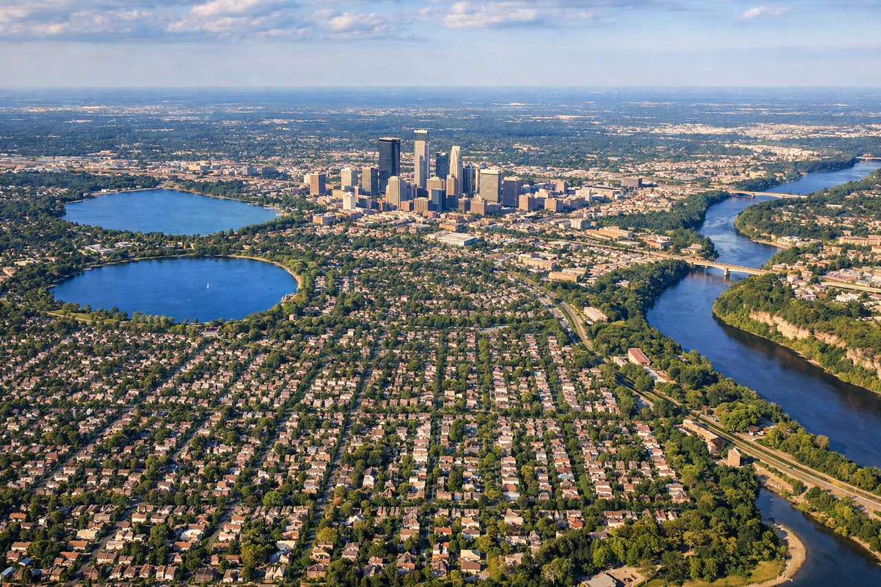
Landing at MSP
LEFTLeft-side seats provide views of the Minnesota River valley and Minneapolis-St. Paul metropolitan area during descent into MSP. The right side faces open farmland with fewer urban features.
Landmarks on this routeAll landmarks →
Will your flight be in sunlight?
Pick a date and time in the Sun Map to watch the sun move across your whole flight.
About This Route
Which side of the plane should I sit on flying from Hector International Airport (FAR) to Minneapolis St Paul International (MSP)?
Sit on the Right side of the plane for the best views on flights from Fargo to Minneapolis. Right-side seats offer superior scenery on takeoff with clear views of the Red River valley and agricultural landscape. While left-side seats improve during landing with MSP metro views, the takeoff experience is more visually distinctive, making right the better overall choice for this short flight.
What can I see during takeoff from Hector International Airport in Fargo?
During takeoff from Hector International Airport (FAR), sit on the Right side for the best views. Right-side seats offer views of the Red River valley and agricultural patchwork immediately west and south of Fargo during climb-out. The left side faces north toward relatively flat terrain with fewer distinctive features. Notable sights include: Red River (western boundary), Fargo urban area, agricultural grid pattern of eastern North Dakota, distant tree lines marking river corridors.
What can I see when landing at Minneapolis St Paul International in Minneapolis?
When landing at Minneapolis St Paul International (MSP), sit on the Left side for the best views. Left-side seats provide views of the Minnesota River valley and Minneapolis-St. Paul metropolitan area during descent into MSP. The right side faces open farmland with fewer urban features. Notable sights include: Minnesota River valley, Minneapolis-St. Paul skyline and urban sprawl, Mississippi River (visible near downtown Minneapolis), suburban development pattern.
How long is the flight from Fargo to Minneapolis?
The flight from Hector International Airport (FAR) to Minneapolis St Paul International (MSP) takes about 1 hour. The shortest flight path between them is 223 miles (359 km); winds and air traffic control usually add a few percent.
What does the Fargo to Minneapolis flight path pass over?
The flight path crosses central Minnesota, passing over the transition zone between the Red River valley's flat agricultural land and the slightly more rolling terrain approaching the Twin Cities. The Minnesota River valley becomes increasingly visible as the aircraft descends toward MSP, with scattered lakes and wetlands visible throughout the route. No major mountain ranges or dramatic geological features are present on this route—the landscape is characterized by agricultural fields, small towns, river valleys, and increasing suburban development as the aircraft approaches Minneapolis-St. Paul.