The right side offers glimpses of Rome's cityscape and the Apennines on departure and forested Appalachian foothills on arrival, giving it slightly more topographic interest than the left side's flatter coastal and farmland views, though the long Atlantic crossing limits both sides to modest scores.
Flight Path
Extended Atlantic Ocean crossing with no visible landmarks for several hours; possible distant coastal glimpse of Newfoundland or Atlantic Canada depending on routing before descent into the southeastern United States.
Great circle distance and headings ›


.jpeg?width=600)
Phase by phase
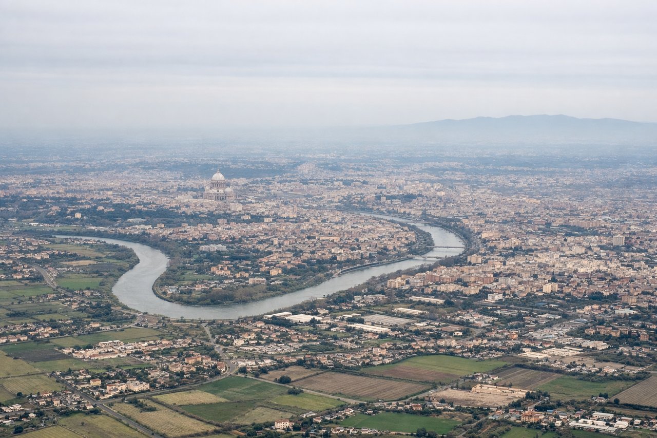
Takeoff from FCO
RIGHTDeparting FCO northbound, the right side faces inland toward Rome's skyline and the Apennine foothills, while the climb continues toward the Alps visible in the distance on clear days. The left side mostly shows the flatter coastal plain and Tyrrhenian Sea.

Landing at ATL
RIGHTOn approach into ATL from the east under typical west-flow operations, the right side faces north toward the rolling foothills of the Appalachians and forested Georgia terrain, offering more textured scenery than the flatter farmland to the south.
Landmarks on this routeAll landmarks →
Will your flight be in sunlight?
See exactly which side of the plane gets sun and shade at your departure time.
About This Route
Which side of the plane should I sit on flying from Fiumicino (FCO) to The William B Hartsfield Atlanta International (ATL)?
Sit on the Right side of the plane for the best views on flights from Rome to Atlanta. The right side offers glimpses of Rome's cityscape and the Apennines on departure and forested Appalachian foothills on arrival, giving it slightly more topographic interest than the left side's flatter coastal and farmland views, though the long Atlantic crossing limits both sides to modest scores.
What can I see during takeoff from Fiumicino in Rome?
During takeoff from Fiumicino (FCO), sit on the Right side for the best views. Departing FCO northbound, the right side faces inland toward Rome's skyline and the Apennine foothills, while the climb continues toward the Alps visible in the distance on clear days. The left side mostly shows the flatter coastal plain and Tyrrhenian Sea. Notable sights include: Rome city skyline, Apennine Mountains, Tyrrhenian coastline, distant Alps on climb-out.
What can I see when landing at The William B Hartsfield Atlanta International in Atlanta?
When landing at The William B Hartsfield Atlanta International (ATL), sit on the Right side for the best views. On approach into ATL from the east under typical west-flow operations, the right side faces north toward the rolling foothills of the Appalachians and forested Georgia terrain, offering more textured scenery than the flatter farmland to the south. Notable sights include: Appalachian foothills, Chattahoochee River, forested North Georgia ridgelines, Atlanta suburbs.
How long is the flight from Rome to Atlanta?
The flight from Fiumicino (FCO) to The William B Hartsfield Atlanta International (ATL) takes 10h 45m.
What does the Rome to Atlanta flight path pass over?
Extended Atlantic Ocean crossing with no visible landmarks for several hours; possible distant coastal glimpse of Newfoundland or Atlantic Canada depending on routing before descent into the southeastern United States.