While Fernando de Noronha's volcanic departure is visually striking, the landing approach into São Paulo offers greater scenic variety and landmark density. The combination of a dramatic volcanic takeoff (2.5) and a rich urban-plateau landing (3.0) with the Cantareira Mountains and São Paulo's sprawling cityscape gives the right side a slight edge overall. The flight path crosses the Atlantic and Brazilian interior, but most of the cruise segment is open ocean with limited visual interest.
Flown FEN to GRU? Did we get it right?
Flight Path
Fernando Do Noronha to Sao Paulo is 1,646 miles (2,649 km), a flight of about 3 hours 15 minutes.
Open Atlantic Ocean for approximately 2 hours; transition to Brazilian mainland coast near Pernambuco state; interior plateau terrain with sparse vegetation and occasional river valleys; approach to São Paulo plateau region with increasing urban development density
Great circle distance and headings ›

Phase by phase
Takeoff from FEN
LEFTFernando de Noronha is a volcanic archipelago with dramatic rocky peaks and deep blue Atlantic waters. The left side captures the island's rugged terrain, surrounding reefs, and open ocean immediately after departure.
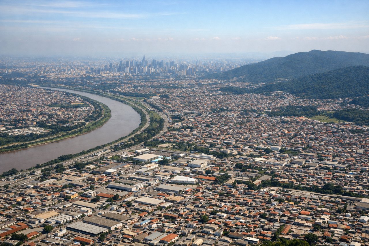
Landing at GRU
RIGHTThe approach to Guarulhos passes over the São Paulo metropolitan area and surrounding plateau terrain. The right side offers views of the city's urban sprawl, industrial zones, and the transition from interior plateau to the airport's location in the northern suburbs.
Will your flight be in sunlight?
Pick a date and time in the Sun Map to watch the sun move across your whole flight.
About This Route
Which side of the plane should I sit on flying from Fernando De Noronha (FEN) to Guarulhos (GRU)?
Sit on the Right side of the plane for the best views on flights from Fernando Do Noronha to Sao Paulo. While Fernando de Noronha's volcanic departure is visually striking, the landing approach into São Paulo offers greater scenic variety and landmark density. The combination of a dramatic volcanic takeoff (2.5) and a rich urban-plateau landing (3.0) with the Cantareira Mountains and São Paulo's sprawling cityscape gives the right side a slight edge overall. The flight path crosses the Atlantic and Brazilian interior, but most of the cruise segment is open ocean with limited visual interest.
What can I see during takeoff from Fernando De Noronha in Fernando Do Noronha?
During takeoff from Fernando De Noronha (FEN), sit on the Left side for the best views. Fernando de Noronha is a volcanic archipelago with dramatic rocky peaks and deep blue Atlantic waters. The left side captures the island's rugged terrain, surrounding reefs, and open ocean immediately after departure. Notable sights include: Morro do Pico (321m volcanic peak), surrounding Atlantic reef formations, neighboring islands of the archipelago, deep blue water contrasting with shallow reef zones.
What can I see when landing at Guarulhos in Sao Paulo?
When landing at Guarulhos (GRU), sit on the Right side for the best views. The approach to Guarulhos passes over the São Paulo metropolitan area and surrounding plateau terrain. The right side offers views of the city's urban sprawl, industrial zones, and the transition from interior plateau to the airport's location in the northern suburbs. Notable sights include: São Paulo city skyline and high-rise districts, Cantareira Mountains to the north, Guarulhos airport and surrounding suburban development, Tietê River valley.
How long is the flight from Fernando Do Noronha to Sao Paulo?
The flight from Fernando De Noronha (FEN) to Guarulhos (GRU) takes about 3 hours 15 minutes. The shortest flight path between them is 1,646 miles (2,649 km); winds and air traffic control usually add a few percent.
What does the Fernando Do Noronha to Sao Paulo flight path pass over?
Open Atlantic Ocean for approximately 2 hours; transition to Brazilian mainland coast near Pernambuco state; interior plateau terrain with sparse vegetation and occasional river valleys; approach to São Paulo plateau region with increasing urban development density