While takeoff offers good Atlantic views, the landing approach into Cartagena provides more dramatic and visually distinctive scenery—the Caribbean's turquoise waters, the Rosario Islands, and Cartagena's historic peninsula are far more striking than Florida's developed coastline. Left-side seats capture the best of the journey's finale.
Flown FLL to CTG? Did we get it right?
Flight Path
Fort Lauderdale to Cartagena is 1,122 miles (1,805 km), a flight of about 3 hours 15 minutes.
The flight path crosses the Bahamas (visible as shallow turquoise banks and islands if at lower cruise altitude), then the open Caribbean Sea. The Yucatan Channel lies to the west of the direct route. No major mountain ranges are visible during cruise—the flight passes over open water for the majority of the journey. The Colombian coast becomes visible about 30 minutes before landing, with the Sierra Nevada de Santa Marta mountains appearing on the horizon as you approach from the northwest, though they remain distant and subtle at cruise altitude.
Great circle distance and headings ›

Phase by phase
Takeoff from FLL
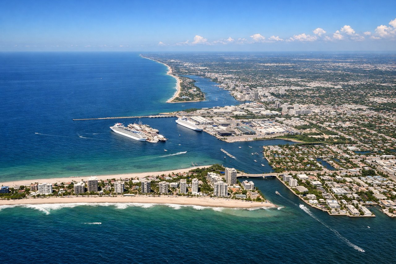
RIGHTRight-side seats capture the Atlantic coastline and the barrier islands of southeastern Florida during the initial climb-out. You'll see Port Everglades and the Fort Lauderdale beachfront receding beneath you, with the Intracoastal Waterway visible as a thin line separating the mainland from the islands.
Landing at CTG
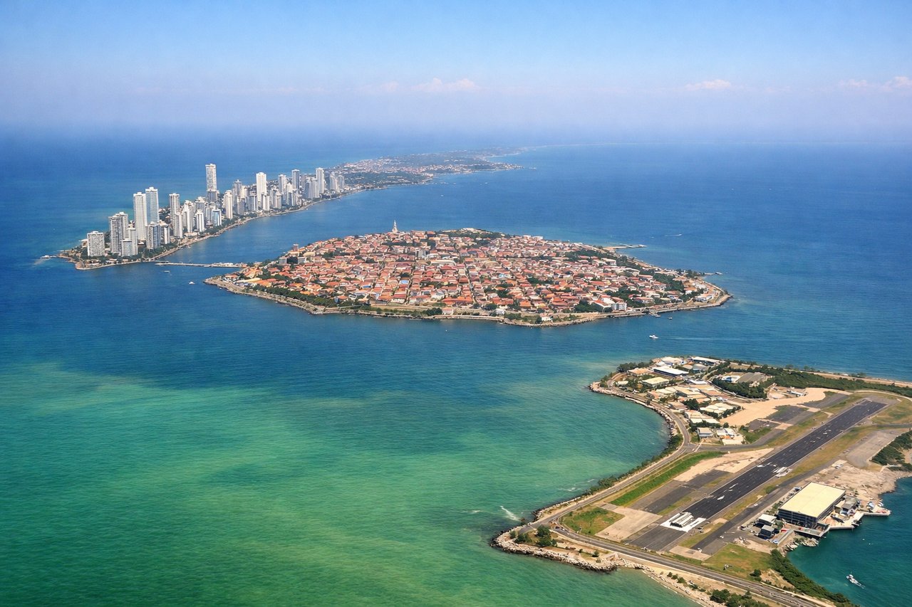
LEFTLeft-side seats provide the best views during descent into Cartagena. You'll see the Caribbean coastline, the Rosario Islands archipelago, and Cartagena's old walled city on the peninsula as you approach from the northwest. The turquoise waters of the Caribbean and the contrast between the developed city and surrounding islands create striking visuals.
Will your flight be in sunlight?
Pick a date and time in the Sun Map to watch the sun move across your whole flight.
About This Route
Which side of the plane should I sit on flying from Fort Lauderdale Hollywood International (FLL) to Rafael Nunez (CTG)?
Sit on the Left side of the plane for the best views on flights from Fort Lauderdale to Cartagena. While takeoff offers good Atlantic views, the landing approach into Cartagena provides more dramatic and visually distinctive scenery—the Caribbean's turquoise waters, the Rosario Islands, and Cartagena's historic peninsula are far more striking than Florida's developed coastline. Left-side seats capture the best of the journey's finale.
What can I see during takeoff from Fort Lauderdale Hollywood International in Fort Lauderdale?
During takeoff from Fort Lauderdale Hollywood International (FLL), sit on the Right side for the best views. Right-side seats capture the Atlantic coastline and the barrier islands of southeastern Florida during the initial climb-out. You'll see Port Everglades and the Fort Lauderdale beachfront receding beneath you, with the Intracoastal Waterway visible as a thin line separating the mainland from the islands. Notable sights include: Atlantic Ocean, Port Everglades shipping channel, Fort Lauderdale Beach and barrier islands, Intracoastal Waterway.
What can I see when landing at Rafael Nunez in Cartagena?
When landing at Rafael Nunez (CTG), sit on the Left side for the best views. Left-side seats provide the best views during descent into Cartagena. You'll see the Caribbean coastline, the Rosario Islands archipelago, and Cartagena's old walled city on the peninsula as you approach from the northwest. The turquoise waters of the Caribbean and the contrast between the developed city and surrounding islands create striking visuals. Notable sights include: Caribbean Sea, Rosario Islands (Islas del Rosario), Cartagena's walled old city on the peninsula, Cartagena Bay.
How long is the flight from Fort Lauderdale to Cartagena?
The flight from Fort Lauderdale Hollywood International (FLL) to Rafael Nunez (CTG) takes about 3 hours 15 minutes. The shortest flight path between them is 1,122 miles (1,805 km); winds and air traffic control usually add a few percent.
What does the Fort Lauderdale to Cartagena flight path pass over?
The flight path crosses the Bahamas (visible as shallow turquoise banks and islands if at lower cruise altitude), then the open Caribbean Sea. The Yucatan Channel lies to the west of the direct route. No major mountain ranges are visible during cruise—the flight passes over open water for the majority of the journey. The Colombian coast becomes visible about 30 minutes before landing, with the Sierra Nevada de Santa Marta mountains appearing on the horizon as you approach from the northwest, though they remain distant and subtle at cruise altitude.