Fort Lauderdale to Freeport is 96 miles (155 km), a flight of about 50 minutes.
Right-side seats offer superior views for both takeoff and landing on this route. The eastbound departure and approach headings mean right seats face the Atlantic, the Bahama Bank transition, Port Everglades, and the Fort Lauderdale coastline throughout the flight.
Flight Path
The flight crosses the Bahama Bank, a shallow limestone platform with distinctive turquoise coloration visible from altitude. The water transitions from deep Atlantic blue (west of the bank) to light turquoise (over the bank itself). Small islands and cays of the Bahamas archipelago may be visible to the north and south depending on exact routing. The Gulf Stream current boundary may create subtle color variations in the water. No significant terrain features—the route is entirely over water and flat coastal terrain.
Great circle distance and headings ›Phase by phase
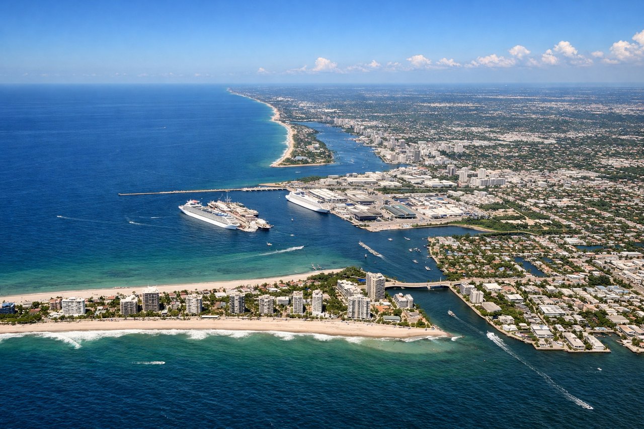
Takeoff from FLL
RIGHTFLL typically departs eastbound (runways 08L/08R or 09L/09R). Right-side seats face north across the Atlantic, giving views of the Fort Lauderdale coastline, Port Everglades, and the initial climb over the Intracoastal Waterway before heading toward the Bahamas.
Landing at FPO
RIGHTApproaching FLL from the east (typical landing on runways 08L/08R or 09L/09R), right-side seats face north during descent. You'll see the Bahamas Bank transition to shallow turquoise water, then the Florida coastline, Port Everglades, and the final approach over the beach and coastal hotels.
Will your flight be in sunlight?
Pick a date and time in the Sun Map to watch the sun move across your whole flight.
About This Route
Which side of the plane should I sit on flying from Fort Lauderdale Hollywood International (FLL) to Grand Bahama International (FPO)?
Sit on the Right side of the plane for the best views on flights from Fort Lauderdale to Freeport. Right-side seats offer superior views for both takeoff and landing on this route. The eastbound departure and approach headings mean right seats face the Atlantic, the Bahama Bank transition, Port Everglades, and the Fort Lauderdale coastline throughout the flight.
What can I see during takeoff from Fort Lauderdale Hollywood International in Fort Lauderdale?
During takeoff from Fort Lauderdale Hollywood International (FLL), sit on the Right side for the best views. FLL typically departs eastbound (runways 08L/08R or 09L/09R). Right-side seats face north across the Atlantic, giving views of the Fort Lauderdale coastline, Port Everglades, and the initial climb over the Intracoastal Waterway before heading toward the Bahamas. Notable sights include: Port Everglades (major shipping port immediately north of runway), Fort Lauderdale Beach and beachfront hotels, Intracoastal Waterway (parallel waterway system), Atlantic Ocean horizon.
What can I see when landing at Grand Bahama International in Freeport?
When landing at Grand Bahama International (FPO), sit on the Right side for the best views. Approaching FLL from the east (typical landing on runways 08L/08R or 09L/09R), right-side seats face north during descent. You'll see the Bahamas Bank transition to shallow turquoise water, then the Florida coastline, Port Everglades, and the final approach over the beach and coastal hotels. Notable sights include: Bahama Bank (shallow turquoise waters), Atlantic Ocean deep blue water transition, Port Everglades and shipping infrastructure, Fort Lauderdale beachfront hotels and beach.
How long is the flight from Fort Lauderdale to Freeport?
The flight from Fort Lauderdale Hollywood International (FLL) to Grand Bahama International (FPO) takes about 50 minutes. The shortest flight path between them is 96 miles (155 km); winds and air traffic control usually add a few percent.
What does the Fort Lauderdale to Freeport flight path pass over?
The flight crosses the Bahama Bank, a shallow limestone platform with distinctive turquoise coloration visible from altitude. The water transitions from deep Atlantic blue (west of the bank) to light turquoise (over the bank itself). Small islands and cays of the Bahamas archipelago may be visible to the north and south depending on exact routing. The Gulf Stream current boundary may create subtle color variations in the water. No significant terrain features—the route is entirely over water and flat coastal terrain.